Island, Kentucky

Last updated
Island, Kentucky
Adams north of Hiland in Island.jpg
Adams Avenue on the city's south side
McLean County Kentucky Incorporated and Unincorporated areas Island Highlighted 2139700.svg
Location in McLean County, Kentucky
Coordinates: 37°26′33″N87°8′48″W / 37.44250°N 87.14667°W / 37.44250; -87.14667 Coordinates: 37°26′33″N87°8′48″W / 37.44250°N 87.14667°W / 37.44250; -87.14667
Country United States
State Kentucky
County McLean
IncorporatedBefore 1908 [1]
Named for a local farm
Area
[2]
  Total0.34 sq mi (0.87 km2)
  Land0.34 sq mi (0.87 km2)
  Water0.00 sq mi (0.00 km2)
Elevation
449 ft (137 m)
Population
 (2020) [3]
  Total429
  Density1,273.00/sq mi (492.19/km2)
Time zone UTC-6 (Central (CST))
  Summer (DST) UTC-5 (CDT)
ZIP code
42350
Area code 270
FIPS code 21-39700
GNIS feature ID0495040

Island is a home rule-class city in McLean County, Kentucky, in the United States. The population was 429 at the 2020 census. [3] It is included in the Owensboro metropolitan area.

Contents

History

The city is named for Judge William Worthington's early 19th-century 8-square-mile (21 km2) estate, known as "The Island" from the way high water on the Green and other nearby rivers would maroon it from adjacent land. Between 1829 and 1860, the local post office operated as "Worthington". The Owensboro and Nashville Railroad connected the area in 1872; the station and new post office were known as "Island Station". Both were shortened to "Island" in 1882. [4]

Geography

Island is located at 37°26′33″N87°8′48″W / 37.44250°N 87.14667°W / 37.44250; -87.14667 (37.442444, -87.146633). [5] It is in the southeastern portion of McLean County along U.S. Route 431 at its junction with Kentucky Route 85. Also traversing the city is Kentucky Route 2110. US 431 leads north 3 miles (5 km) to Livermore and 23 miles (37 km) to Owensboro, while to the south it leads 11 miles (18 km) to Central City. KY 85 leads east 10 miles (16 km) to Centertown and west 7 miles (11 km) to Sacramento.

According to the United States Census Bureau, Island has a total area of 0.34 square miles (0.88 km2), of which 0.001 square miles (0.003 km2), or 0.30%, are water. [2]

Demographics

Historical population
CensusPop.Note
1910 647
1920 623−3.7%
1930 69411.4%
1940 626−9.8%
1950 566−9.6%
1960 462−18.4%
1970 410−11.3%
1980 53229.8%
1990 446−16.2%
2000 435−2.5%
2010 4585.3%
2020 429−6.3%
U.S. Decennial Census [6]

As of the census [7] of 2000, there were 435 people, 182 households, and 123 families residing in the city. The population density was 1,237.8 inhabitants per square mile (477.9/km2). There were 210 housing units at an average density of 597.6 per square mile (230.7/km2). The racial makeup of the city was 99.31% White, 0.23% Native American, 0.46% from other races.

There were 182 households, out of which 34.6% had children under the age of 18 living with them, 54.9% were married couples living together, 10.4% had a female householder with no husband present, and 32.4% were non-families. 29.1% of all households were made up of individuals, and 13.7% had someone living alone who was 65 years of age or older. The average household size was 2.39 and the average family size was 2.98.

In the city, the population was spread out, with 26.9% under the age of 18, 8.7% from 18 to 24, 26.2% from 25 to 44, 25.3% from 45 to 64, and 12.9% who were 65 years of age or older. The median age was 36 years. For every 100 females, there were 90.8 males. For every 100 females age 18 and over, there were 83.8 males.

The median income for a household in the city was $23,750, and the median income for a family was $31,875. Males had a median income of $33,333 versus $15,313 for females. The per capita income for the city was $15,284. About 9.5% of families and 12.5% of the population were below the poverty line, including 16.0% of those under age 18 and 21.3% of those age 65 or over.

Notable people

Related Research Articles

<span class="mw-page-title-main">Webster County, Kentucky</span> County in Kentucky, United States

Webster County is a county located in the U.S. state of Kentucky. As of the 2020 census, the population was 13,017. Its county seat is Dixon and its largest city is Providence. It is the southernmost county in the Evansville, IN–KY Metropolitan Statistical Area. The county was formed in 1860 from parts of Henderson, Hopkins, and Union Counties and named for American statesman Daniel Webster (1782-1852). It was mainly pro-Confederate during the American Civil War and was the site of several skirmishes and some guerrilla warfare. Since 2018 it has been a moist county, with Providence and Sebree voting to allow alcohol sales, and Clay doing so in 2022.

<span class="mw-page-title-main">McLean County, Kentucky</span> County in Kentucky, United States

McLean County is a county located in the U.S. state of Kentucky. As of the 2020 census, the population was 9,152. Its county seat is Calhoun and its largest city is Livermore. McLean is a prohibition or dry county. McLean County is part of the Owensboro, KY Metropolitan Statistical Area, which has a population of some 114,752.

<span class="mw-page-title-main">Daviess County, Kentucky</span> County in Kentucky, United States

Daviess County ( "Davis"), is a county in Kentucky. As of the 2020 census, the population was 103,312. Its county seat is Owensboro. The county was formed from part of Ohio County on January 14, 1815.

<span class="mw-page-title-main">McCausland, Iowa</span> City in Iowa, USA

McCausland is a city in Butler Township, Scott County, Iowa, United States. The population was 313 at the time of the 2020 census.

<span class="mw-page-title-main">Crofton, Kentucky</span> City in Kentucky, United States

Crofton is a home rule-class city in Christian County, Kentucky, in the United States. The population was 749 at the 2010 census.

<span class="mw-page-title-main">Masonville, Kentucky</span> Census-designated place in Kentucky, United States

Masonville is an unincorporated community and census-designated place (CDP) in Daviess County, Kentucky, United States. The population was 1,014 at the 2010 census. It is included in the Owensboro Metropolitan Statistical Area.

<span class="mw-page-title-main">Whitesville, Kentucky</span> City in Kentucky, United States

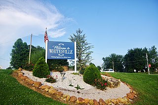
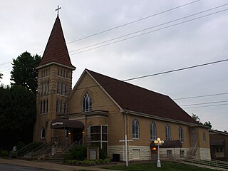
Whitesville is a home rule-class city in Daviess County, Kentucky, United States. The population was 552 at the 2010 census, down from 632 at the 2000 census. It is included in the Owensboro, Kentucky Metropolitan Statistical Area. The city was founded in 1844 by Dr. William White, and named for him. The current mayor of Whitesville is Patsy Mayfield.

<span class="mw-page-title-main">Raceland, Kentucky</span> City in Kentucky, United States

Raceland is a home rule-class city in Greenup County, Kentucky, United States, in the Ohio River valley. As of the 2010 census, the population was 2,424. It is part of the Huntington–Ashland metropolitan area.

<span class="mw-page-title-main">Hawesville, Kentucky</span> City in Kentucky, United States

Hawesville is a home rule-class city on the south bank of the Ohio River in Hancock County, Kentucky, in the United States. It is the seat of its county. The population was 945 at the 2010 census. It is included in the Owensboro metropolitan area.

<span class="mw-page-title-main">Lewisport, Kentucky</span> City in Kentucky, United States

Lewisport is a home rule-class city in the floodplain of the Ohio River in Hancock County, Kentucky, in the United States. The population was 1,670 at the 2010 census, and is also the most populous community in the county. It is included in the Owensboro metropolitan area.

<span class="mw-page-title-main">Worthington Hills, Kentucky</span> City in Kentucky, United States

City of Worthington Hills is a home rule-class city in Jefferson County, Kentucky, United States. The population was 1,446 at the 2010 census, down from 1,594 at the 2000 census.

<span class="mw-page-title-main">Calhoun, Kentucky</span> City in Kentucky, United States

Calhoun is a home rule-class city in McLean County, Kentucky, United States. The population was 725 at the 2020 census. It is the county seat of McLean County. It is included in the Owensboro, Kentucky Metropolitan Statistical Area.

<span class="mw-page-title-main">Livermore, Kentucky</span> City in Kentucky, United States

Livermore is a home rule-class city located at the confluence of the Green and Rough rivers in McLean County in the U.S. state of Kentucky. The population was 1,365 at the 2010 census. It is included in the Owensboro metropolitan area.

<span class="mw-page-title-main">Sacramento, Kentucky</span> City in Kentucky, United States

Sacramento is a home rule-class city in McLean County, Kentucky, in the United States. The population was 468 during the 2010 U.S. Census. It is included in the Owensboro metropolitan area.

<span class="mw-page-title-main">Central City, Kentucky</span> City in Kentucky, United States

Central City is a home rule-class city in Muhlenberg County, Kentucky, in the United States. The population was 5,978 at the 2010 census. It is also the largest city in the county and the principal community in the Central City Micropolitan Statistical Area, which includes all of Muhlenberg County.

<span class="mw-page-title-main">Greenville, Kentucky</span> City in Kentucky, United States

Greenville is a home rule-class city in Muhlenberg County, Kentucky, in the United States. It is the seat of its county. The population was 4,312 at the 2010 census.

<span class="mw-page-title-main">South Carrollton, Kentucky</span> City in Kentucky, United States

South Carrollton is a home rule-class city in Muhlenberg County, Kentucky, United States. The population was 184 at the 2000 census. Founded as Randolph Old Farm in 1838, an early pioneer changed the name of the city to honor his son, Carroll. The name was prefixed with south in order to disambiguate the city from Carrollton, Kentucky.

<span class="mw-page-title-main">Wheatcroft, Kentucky</span> City in Kentucky, United States

Wheatcroft is a home rule-class city in Webster County, Kentucky, United States. The population was 173 at the 2000 census.

<span class="mw-page-title-main">Eubank, Kentucky</span> City in Kentucky, United States

Eubank is a home rule-class city in Pulaski and Lincoln counties in southern Kentucky. The population was 319 at the 2010 census.

<span class="mw-page-title-main">Owensboro metropolitan area</span> Metropolitan statistical area in Kentucky, United States

The Owensboro Metropolitan Statistical Area, as defined by the United States Census Bureau, is an area consisting of three counties in Kentucky, anchored by the city of Owensboro. As of the 2000 census, the MSA had a population of 109,875. In the 2010 Census the population was 114,752. Owensboro is part of the Illinois–Indiana–Kentucky tri-state area and sometimes, albeit seldom, referred to as Kentuckiana.

References

  1. Commonwealth of Kentucky. Office of the Secretary of State. Land Office. "Island, Kentucky". Accessed 29 July 2013.
  2. 1 2 "2022 U.S. Gazetteer Files: Kentucky". United States Census Bureau. Retrieved May 10, 2023.
  3. 1 2 "P1. Race – Island city, Kentucky: 2020 DEC Redistricting Data (PL 94-171)". U.S. Census Bureau. Retrieved May 10, 2023.
  4. Rennick, Robert. Kentucky Place Names, p. 150. University Press of Kentucky (Lexington), 1987. Accessed 30 July 2013.
  5. "US Gazetteer files: 2010, 2000, and 1990". United States Census Bureau. 2011-02-12. Retrieved 2011-04-23.
  6. "Census of Population and Housing". Census.gov. Retrieved June 4, 2015.
  7. "U.S. Census website". United States Census Bureau . Retrieved 2008-01-31.