
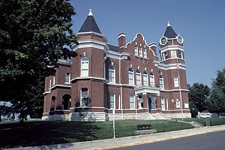
Clay County is a county located in the U.S. state of Kentucky. As of the 2020 census, the county population was 20,345. Its county seat is Manchester. The county was formed in 1807 and named in honor of Green Clay (1757–1826). Clay was a member of the Virginia and Kentucky State legislatures, first cousin once removed of Henry Clay, U.S. Senator from Kentucky and Secretary of State in the 19th century.

Poverty is a state or condition in which one lacks the financial resources and essentials for a certain standard of living. Poverty can have diverse social, economic, and political causes and effects. When evaluating poverty in statistics or economics there are two main measures: absolute poverty compares income against the amount needed to meet basic personal needs, such as food, clothing, and shelter; relative poverty measures when a person cannot meet a minimum level of living standards, compared to others in the same time and place. The definition of relative poverty varies from one country to another, or from one society to another.
Fulton County is the westernmost county in the U.S. state of Kentucky, with the Mississippi River forming its western boundary. As of the 2020 census, the population was 6,515. Its county seat is Hickman and its largest city is Fulton. The county was formed in 1845 from Hickman County, Kentucky and named for Robert Fulton, the inventor of the steamboat.

Fleming County is a county located in the U.S. state of Kentucky. As of the 2020 census, the population was 15,082. Its county seat is Flemingsburg. The county was formed in 1798 and named for Colonel John Fleming, an Indian fighter and early settler. It is a moist county. In 1998, the Kentucky General Assembly designated Fleming County as the Covered Bridge Capital of Kentucky.
Burlington is a census-designated place (CDP) in and the county seat of Boone County, Kentucky, United States. The population was 17,318 at the 2020 census.

Russell is a home rule-class city on the south bank of the Ohio River in Greenup County, Kentucky, United States. The population was 3,380 as of the 2010 census, down from 3,645 in 2000. Russell is a suburb of Ashland and part of the Huntington-Ashland-Ironton metropolitan area. It has close economic affiliations with its neighbors, Ashland and Flatwoods in Kentucky and Ironton, Ohio.

Erlanger is a home rule-class city in Kenton County, Kentucky, United States. It had a 2010 census population of 18,368. Erlanger is part of the Cincinnati-Middletown, OH-KY-IN Metropolitan Statistical Area.

Inez is a home rule-class city in and the county seat of Martin County, Kentucky, United States. The population was 546 at the 2020 census.

Frenchburg is a home rule-class city in Menifee County, Kentucky, in the United States. The population was 486 at the 2010 census. It is the seat and only incorporated city in its rural county. It is located at the junction of U.S. Route 460 and Kentucky Route 36. Logging is the primary industry.

Hazard is a home rule-class city in, and the county seat of, Perry County, Kentucky, United States. The population was 5,263 at the 2020 Census.

Appalachia is a cultural region in the Eastern United States that stretches from the Southern Tier of New York State to northern Alabama and Georgia. While the Appalachian Mountains stretch from Belle Isle in Newfoundland and Labrador, Canada, to Cheaha Mountain in Alabama, Appalachia typically refers only to the cultural region of the central and southern portions of the range, from the Catskill Mountains of New York southwest to the Blue Ridge Mountains which run southwest from southern Pennsylvania to northern Georgia, and the Great Smoky Mountains of Tennessee and North Carolina. In 2020, the region was home to an estimated 26.1 million people, of whom roughly 80% are white.

Whitney Moore Young Jr. was an American civil rights leader. Trained as a social worker, he spent most of his career working to end employment discrimination in the United States and turning the National Urban League from a relatively passive civil rights organization into one that aggressively worked for equitable access to socioeconomic opportunity for the historically disenfranchised. Young was influential in the United States federal government's War on Poverty in the 1960s.

The Congregation of the Sisters of Charity of Nazareth (SCN) is a Roman Catholic order of nuns. It was founded in 1812 near Bardstown, Kentucky, when three young women responded to Bishop John Baptist Mary David's call for assistance in ministering to the needs of the people of the area.

Progress and Poverty: An Inquiry into the Cause of Industrial Depressions and of Increase of Want with Increase of Wealth: The Remedy is an 1879 book by social theorist and economist Henry George. It is a treatise on the questions of why poverty accompanies economic and technological progress and why economies exhibit a tendency toward cyclical boom and bust. George uses history and deductive logic to argue for a radical solution focusing on the capture of economic rent from natural resource and land titles.
Community economic development (CED) is a field of study that actively elicits community involvement when working with government, and private sectors to build strong communities, industries, and markets. It includes collaborative and participatory involvement of community dwellers in every area of development that affects their standard of living.
Monkey's Eyebrow is a rural unincorporated community in Ballard County, Kentucky, United States. It is generally the northwesternmost community in the Jackson Purchase area of western Kentucky that is identified on the highway maps distributed by the Kentucky Transportation Cabinet. The community is part of the Paducah, KY-IL Micropolitan Statistical Area. A few different theories exist regarding the origin of the community's unique name.

The Eastern Kentucky Coalfield is part of the Central Appalachian bituminous coalfield, including all or parts of 30 Kentucky counties and adjoining areas in Ohio, West Virginia, Virginia, and Tennessee. It covers an area from the Allegheny Mountains in the east across the Cumberland Plateau to the Pottsville Escarpment in the west. The region is known for its coal mining; most family farms in the region have disappeared since the introduction of surface mining in the 1940s and 1950s.

Appalachian Volunteers (AV) was a non-profit organization engaged in community development projects in central Appalachia that evolved into a controversial community organizing network, with a reputation that went "from self-help to sedition" as its staff developed from "reformers to radicals," teaching things from Marx, Lenin and Mao, in the words of one historian, in the brief period between 1964 and 1970 during the War on Poverty.
Glenville is an unincorporated community in McLean County, Kentucky, United States.
Wright Modlin or Wright Maudlin (1797–1866) helped enslaved people escape slavery, whether transporting them between Underground Railroad stations or traveling south to find people that he could deliver directly to Michigan. Modlin and his Underground Railroad partner, William Holden Jones, traveled to the Ohio River and into Kentucky to assist enslave people on their journey north. Due to their success, angry slaveholders instigated the Kentucky raid on Cass County of 1847. Two years later, he helped free his neighbors, the David and Lucy Powell family, who had been captured by their former slaveholder. Tried in South Bend, Indiana, the case was called The South Bend Fugitive Slave Case.


