
Muhlenberg County is a county in the U.S. Commonwealth of Kentucky. As of the 2020 census, the population was 30,928. Its county seat is Greenville and its largest city is Central City.

McLean County is a county located in the U.S. state of Kentucky. As of the 2020 census, the population was 9,152. Its county seat is Calhoun and its largest city is Livermore. McLean is a prohibition or dry county. McLean County is part of the Owensboro, KY Metropolitan Statistical Area, which has a population of some 114,752.

Cave-In-Rock is a village in Hardin County, Illinois, United States. Its principal feature and tourist attraction is nearby Cave-In-Rock, on the banks of the Ohio River. In 1816, the earliest known permanent white settlers arrived and started building a town near the cave. The town was originally known as Rock and Cave, Illinois, with a post office under this name. On October 24, 1849, the town was officially renamed Cave-In-Rock. Cave-In-Rock was incorporated as a village in 1901. The population was 318 at the 2010 census.
Calhoun is a home rule-class city in McLean County, Kentucky, United States. The population was 725 at the 2020 census. It is the county seat of McLean County. It is included in the Owensboro, Kentucky Metropolitan Statistical Area.

Livermore is a home rule-class city located at the confluence of the Green and Rough rivers in McLean County in the U.S. state of Kentucky. The population was 1,230 as of the 2020 census, down from 1,365 in 2010. It is included in the Owensboro metropolitan area.
Greenville is a home rule-class city in Muhlenberg County, Kentucky, in the United States. It is the seat of its county. The population was 4,492 as of the 2020 census.
Wolf Island is an unincorporated community in eastern Mississippi County, Missouri, United States. It is located on Route 77, approximately nine miles east of East Prairie.

The Rough River is a 136-mile-long (219 km) tributary of the Green River in west-central Kentucky in the United States. It's located about 70 miles southwest of Louisville, and flows through Breckinridge, Hardin, Grayson, and Ohio counties. Via the Green and Ohio rivers, it is part of the watershed of the Mississippi River. According to the Geographic Names Information System, it has also been known historically as "Rough Creek". In the 1950s it was dammed, creating Rough River Lake.
The Pond River is a 90.8-mile-long (146.1 km) tributary of the Green River in western Kentucky in the United States. Via the Green and Ohio rivers, it is part of the watershed of the Mississippi River.
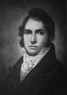
Alney McLean was a United States representative from Kentucky. McLean County, Kentucky, is named in his honor.

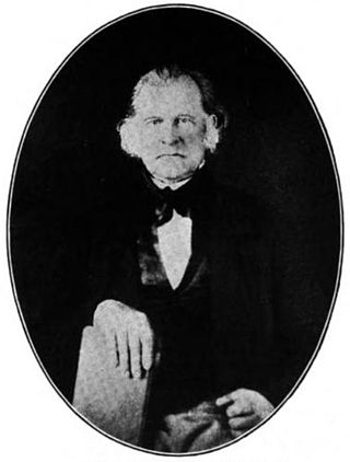
Edward Rumsey was a United States representative from Kentucky.

Kentucky Route 70 (KY 70) is a long east-east state highway that originates at a junction with U.S. Route 60 (US 60) in Smithland in Livingston County, just east of the Ohio River. The route continues through the counties of Crittenden, Caldwell, Hopkins, Muhlenberg, Butler, Edmonson, Barren, Barren, Metcalfe, Green, Taylor, Casey, Pulaski, Lincoln and back into Pulaski again to terminate at a junction with US 150 near Maretburg in Rockcastle.
Diamond Island is an island in the Ohio River ten miles west of Henderson in Henderson County, Kentucky, United States. It has an area of about half a square mile.

U.S. Route 431 in Kentucky runs 86.93 miles (139.90 km) from the Tennessee state line south of Adairville to US 60 at Owensboro. It crosses the state in mainly west-central portions of the state, passing through or near towns such as Russellville, Lewisburg, Central City and Livermore. The route goes through Logan, Muhlenberg, McLean, and Daviess counties.
Ephraim McLean Brank was a Kentucky soldier in the War of 1812, noted for his exceptional marksmanship which played a decisive role in the American victory at the Battle of New Orleans.
Rhoda is an unincorporated community located in Edmonson County, Kentucky, United States.
Roundhill is an unincorporated community in Butler County, Kentucky, United States, situated on Butler County's eastern boundary with Edmonson County.
Jetson is an unincorporated community in Butler County, Kentucky, United States.
Reedyville is an Unincorporated community in Butler County, Kentucky, United States. The town is supposedly named for the nearby Big Reedy Creek, a tributary of the Green River.


