Johnson County, Kentucky

Last updated

Johnson County
Johnson County Judicial Center (Kentucky).jpg
Johnson County Judicial Center in Paintsville
Map of Kentucky highlighting Johnson County.svg
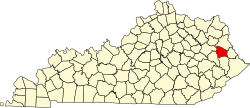
Location within the U.S. state of Kentucky
Kentucky in United States.svg
Kentucky's location within the U.S.
Coordinates: 37°50′N82°50′W / 37.84°N 82.83°W / 37.84; -82.83
CountryFlag of the United States.svg United States
StateFlag of Kentucky.svg  Kentucky
FoundedFebruary 24, 1843
Named for Richard Mentor Johnson
Seat Paintsville
Largest cityPaintsville
Area
  Total264 sq mi (680 km2)
  Land262 sq mi (680 km2)
  Water2.2 sq mi (6 km2)  0.8%
Population
 (2020)
  Total22,680
  Estimate 
(2023)
22,116 Decrease2.svg
  Density86/sq mi (33/km2)
Time zone UTC−5 (Eastern)
  Summer (DST) UTC−4 (EDT)
Congressional district 5th
Website www.johnsoncoky.com

Johnson County is a county located in the U.S. state of Kentucky. As of the 2020 census, the population was 22,680. [1] Its county seat is Paintsville. [2] The county was formed in 1843 and named for Richard Mentor Johnson, a colonel of the War of 1812, United States Representative, Senator, and Vice President of the United States. [3]

Contents

Johnson County is classified as a moist county, which is a county in which alcohol sales are not allowed (a dry county), but containing a "wet" city, in this case Paintsville, where alcoholic beverage sales are allowed.

History

Eastern Kentucky around 1820. Future Johnson County is marked in red. Eastern KY around 1820.png
Eastern Kentucky around 1820. Future Johnson County is marked in red.

Formation

Johnson County was formed on February 24, 1843, by the Kentucky General Assembly from land given by Floyd, Lawrence, and Morgan counties. [4] [5] At that time, its county seat of Paintsville had already been a chartered city for nine years. Homes had been built in Paintsville as early as the 1810s. [6]

Many of the families at the beginning of Johnson County's formation were of Scottish, Irish, English, or German descent. Also, a fact lost to most historians is the large population of French Huguenots who were confused as English because they fled via England en route to the United States. Many of these settlers migrated from North Carolina, Pennsylvania, and Virginia following their participation in the Revolutionary War.

For about its first twenty-five years, Johnson County and Paintsville struggled along. Roads and highways were nonexistent. Mail and supplies reached Johnson County from the Bluegrass region by horseback and steamboat. Years later, stage coaches began to connect eastern Kentucky and Johnson County to the bluegrass region and the rest of civilization. [7]

Civil War era

As Johnson County and its county seat had begun to thrive, in 1860 the Civil War became a disrupter. Like other border areas, brothers fought against brothers, tearing families apart. Johnson County was not only part of a border state during the Civil War, but it was a border county as well.

Sometime between 1860 and 1862, the county enacted an ordinance that neither the Union or Confederate flags were to be flown within the county. This was repealed quickly after Colonel James Garfield's Union brigade marched through Paintsville, (with the United States Flag being raised above the town courthouse) on its way to defeat the Confederate cavalry at the Battle of Middle Creek in Floyd County. [7]

John C. C. Mayo

Following the Civil War, Thomas Jefferson Mayo moved to Paintsville to fulfill a role as a gifted and talented teacher. He fathered John C. C. Mayo, an important figure in the development of eastern Kentucky. The county citizenry is divided on their loyalty to his memory. Some[ who? ] would say he was a benefactor who assisted in the development of Paintsville, and as a result, Johnson County. That he helped develop banks, churches, streets, public utilities and railroad transportation. Others[ who? ] would say he was directly responsible for the huge influence coal companies had over the county's vast coal resources and the reason the region remains so economically depressed to this day.

The funeral procession of John C.C. Mayo through Paintsville in Johnson County, 1914. John C C Mayo procession.JPG
The funeral procession of John C.C. Mayo through Paintsville in Johnson County, 1914.

Coal was important for Johnson County and the rest of eastern Kentucky even before the Civil War, but its development halted at the start of the war. Financing was slow to return to the coal industry in eastern Kentucky and this inhibited development in Johnson County. The people were suspicious of outsiders and Mayo, a school teacher, was a known quantity and one of their own. So he was invaluable in helping the coal industry to gain a firm foothold in the coal fields of eastern Kentucky and to the industrialized north which spurred the development of railroads in the area. Carpetbaggers from the North became a common sight in the area. It was during this time that many of the citizens of Johnson County were given misleading information and sold all mineral rights to their property for pennies on the dollar of what the rights were worth. In some cases, for a new shotgun. It was also during this time that many people lost their property due to a strange rash of fires in several county seats, destroying deeds and records of ownership, which paved the way for land-grabbers to take what the owners did not want to relinquish.

The Chesapeake and Ohio Railway first opened its Paintsville depot on September 1, 1904, following 25 years of work connecting it to Lawrence County. The rails were paid for by donations, stocks and bonds, and the hard work of local citizens.[ citation needed ] History shows that the rail companies leaked information and frequently changed planned routes to create bidding wars and to finance the rails. Following the development of the railroad, tens of thousands of tons of coal were being transported out of eastern Kentucky by 1910.

Mayo went on to be a political lobbyist, and eastern Kentucky's only member of the Democratic National Committee. He had influence in electing Kentucky's governors, members of Congress and the election of President Woodrow Wilson.

He died on May 11, 1914, after becoming ill following a trip to Europe. During his life, he built a historic mansion in Paintsville which has become known as Mayo Mansion. [7] [8]

Geography

A typical mountain vista. Johnson County, Kentucky scenery.jpg
A typical mountain vista.

According to the United States Census Bureau, the county has a total area of 264 square miles (680 km2), of which 262 square miles (680 km2) is land and 2.2 square miles (5.7 km2) (0.8%) is water. [9]

The county's highest point is Stuffley Knob, with an elevation of 1,496 feet (456 m). [10] Its lowest point is the Levisa Fork on the Lawrence County border, with an elevation of about 550 feet (170 m). [11]

Adjacent counties

Transportation

Major highways

Air

Big Sandy Regional Airport, located in adjacent Martin County, is the nearest airport. It is used as a general aviation airport.

The nearest airport that provides commercial aviation services is Tri-State Airport, which is located 55 miles (89 km) northeast in Ceredo, West Virginia.

Demographics

Historical population
CensusPop.Note
1850 3,873
1860 5,30637.0%
1870 7,49441.2%
1880 9,15522.2%
1890 11,02720.4%
1900 13,73024.5%
1910 17,48227.3%
1920 19,62212.2%
1930 22,96817.1%
1940 25,77112.2%
1950 23,846−7.5%
1960 19,748−17.2%
1970 17,539−11.2%
1980 24,43239.3%
1990 23,248−4.8%
2000 23,4450.8%
2010 23,356−0.4%
2020 22,680−2.9%
2023 (est.)22,116 [12] −2.5%
U.S. Decennial Census [13]
1790–1960 [14] 1900–1990 [15]
1990–2000 [16] 2010–2020 [1]

As of the census of 2000, there were 23,445 people, 9,103 households, and 6,863 families residing in the county. The population density was 90 per square mile (35/km2). There were 10,236 housing units at an average density of 39 per square mile (15/km2). The racial makeup of the county was 98.64% White, 0.25% Black or African American, 0.13% Native American, 0.29% Asian, 0.02% Pacific Islander, 0.09% from other races, and 0.58% from two or more races. 0.61% of the population were Hispanic or Latino of any race.

There were 9,103 households, out of which 34.10% had children under the age of 18 living with them, 60.50% were married couples living together, 11.30% had a female householder with no husband present, and 24.60% were non-families. 22.30% of all households were made up of individuals, and 9.00% had someone living alone who was 65 years of age or older. The average household size was 2.52 and the average family size was 2.93.

In the county, the population was spread out, with 24.00% under the age of 18, 8.80% from 18 to 24, 28.90% from 25 to 44, 25.70% from 45 to 64, and 12.60% who were 65 years of age or older. The median age was 37 years. For every 100 females there were 93.10 males. For every 100 females age 18 and over, there were 90.70 males.

The median income for a household in the county was $24,911, and the median income for a family was $29,142. Males had a median income of $29,762 versus $20,136 for females. The per capita income for the county was $14,051. About 21.70% of families and 26.60% of the population were below the poverty line, including 35.50% of those under age 18 and 19.30% of those age 65 or over.

Government

Politics

Johnson County is at present and historically a powerfully Republican county. No Democrat has ever won a majority of the county's vote since at least 1880, [17] though Bill Clinton did gain narrow pluralities in 1992 and 1996, and Lyndon Johnson lost to Barry Goldwater by a mere twenty-two votes in 1964.

United States presidential election results for Johnson County, Kentucky [18]
Year Republican Democratic Third party
No.%No.%No.%
2020 8,45082.91%1,60815.78%1341.31%
2016 8,04384.03%1,25013.06%2792.91%
2012 7,09578.53%1,72319.07%2172.40%
2008 5,94869.84%2,40728.26%1621.90%
2004 5,94063.84%3,28835.34%760.82%
2000 4,78358.47%3,25139.74%1461.78%
1996 3,26242.56%3,34843.68%1,05413.75%
1992 3,61442.84%3,66943.49%1,15313.67%
1988 4,61956.25%3,53843.09%540.66%
1984 5,22562.58%3,07836.87%460.55%
1980 5,03960.50%3,14237.72%1481.78%
1976 4,89156.64%3,68342.65%610.71%
1972 4,90772.25%1,84027.09%450.66%
1968 4,04661.90%2,14232.77%3485.32%
1964 3,07549.94%3,05349.59%290.47%
1960 5,31766.97%2,62233.03%00.00%
1956 5,80271.06%2,35628.85%70.09%
1952 5,19966.18%2,65433.78%30.04%
1948 3,99362.26%2,37837.08%420.65%
1944 4,64267.53%2,22232.32%100.15%
1940 5,04262.29%3,04237.58%100.12%
1936 4,30557.94%3,10641.80%190.26%
1932 4,87160.69%3,13439.05%210.26%
1928 5,33973.98%1,86925.90%90.12%
1924 3,07861.67%1,48029.65%4338.68%
1920 4,37371.26%1,71427.93%500.81%
1916 2,50065.51%1,25332.84%631.65%
1912 99829.40%1,03430.47%1,36240.13%

Education

Public

Johnson County is home to two public school districts.

Johnson County Schools

Johnson Central High School Johnson Central HS.jpg
Johnson Central High School

The Johnson County School District, which operates schools throughout the county, including the city of Paintsville, operates the following schools:

Porter Elementary, W.R. Castle Elementary, Highland Elementary, Flat Gap Elementary, Central Elementary, Johnson County Middle School, and Johnson Central High School.

Central Elementary was ranked top-performing elementary school in 5-6 statewide CTBS/CATS testing. Central Elementary was also the top-performing elementary school (based on national CTBS testing) in the Southeastern US.

Johnson County Middle School's academic team has won the most State Governor's Cups. It has won the Cup in 1999, 2000, 2004, 2006, 2007, 2008, 2009, 2010, 2012, 2013, and 2014. It has won numerous state Quick Recall awards and its Future Problem Solving team has won state and international awards and acclaim.

Johnson Central High School performs well in various areas and is well known statewide for their academic, football, and basketball teams. The high school was recently[ when? ] named a U.S. News & World Report Top American High School, being given a bronze award. Johnson Central offers many clubs including STLP, FBLA, DECA, Beta, FFA, HOSA, SkillsUSA and FCCLA. Johnson Central is also home to a new Career Technology Center.

Paintsville Independent Schools

Paintsville High School Paintsville High School HR.jpg
Paintsville High School

The Paintsville Independent School District also operates two schools: Paintsville Elementary School, a K-6 facility, and the 7-12 Paintsville High School. Paintsville High also has earned numerous sport titles. The school has won boys' state championships in football, basketball, baseball and golf. Note that in Kentucky, the only sports in which schools are divided into enrollment classes are football, cross-country and track.

Both the Johnson County and Paintsville Independent districts met all of the No Child Left Behind standards set by the national government. [19] [20]

Private

Big Sandy Community and Technical College BSCTC Mayo Campus.jpg
Big Sandy Community and Technical College

Two private schools also operate in the county: Our Lady of the Mountain School (K-8) and Johnson County Christian School.

Colleges

Attractions

Kentucky Apple Festival

In the same year as Mayo's death (1914), the first county fair was held in Paintsville, where the first Apple King was also crowned.

In 1962, Johnson County hosted the first Kentucky Apple Festival, [7] which has been held annually in Paintsville since. The streets of downtown Paintsville are closed to vehicular traffic and festivities to include live music and entertainment, along with various competitions.

Parks and recreation

Paintsville Lake State Park
Paintsville Lake and marina Paintsville Lake.jpg
Paintsville Lake and marina

This scenic state park contains a 1,140 acres (4.6 km2) lake, a 12,404-acre (50.20 km2) wildlife management area, a marina, a 4 lane boat dock, a restaurant, a convenience store, boat rentals, multiple picnic shelters, playgrounds, and both developed and primitive camp sites. It is located on route 2275 at Staffordsville, just a few miles out of Paintsville.

Paintsville Recreation Center

The Paintsville Recreation Center contains a basketball court, a playground, and a volleyball court. Located on Preston Street in Paintsville.

Paintsville Country Club & Golf Course

This 18-hole golf course was established on September 27, 1929, making it one of the oldest golf courses in Eastern Kentucky. [21] The country club was built in 1930 by the WPA and is on the National Register of Historic Places. [22] Located on Kentucky Route 1107 in Paintsville.

Museums

Mayo Mansion MayoMansion.jpg
Mayo Mansion
U.S. 23 Country Music Highway Museum

This museum has many exhibits that tell the stories of the country music stars that grew up near U.S. Route 23 in Eastern Kentucky. Located at 120 Staves Branch in Paintsville.

The Coal Miners' Museum

This museum tells the history of the local area's coal mining industry. Located on Millers Creek Road in Van Lear.

Historical sites

Mayo Mansion
Jenny Wiley Gravesite Jenny Wiley Grave.jpg
Jenny Wiley Gravesite

This 43-room mansion was built by John C. C. Mayo between 1905 and 1912 and now serves as Our Lady of the Mountains School. Located on Third Street in Paintsville.

Mayo Memorial United Methodist Church

The church was also constructed by John C. C. Mayo, who hired 100 Masons from Italy to construct it. The church has an organ donated by Andrew Carnegie and has several large stained glass windows. The church opened in the fall of 1909. Located on Third Street in Paintsville, beside Mayo Mansion.

Jenny Wiley Gravesite

Jenny Wiley is a historical figure who was captured by Native Americans in Virginia. After she escaped captivity, she reunited with her husband and lived in Johnson County until her death in 1831. Her grave is located just off Highway 581 at River.

Points of interest

Loretta Lynn Homeplace
Loretta Lynn Birthplace Loretta Lynn Homeplace.jpg
Loretta Lynn Birthplace

Childhood home of country music superstar, Loretta Lynn Located at Butcher Hollow in Van Lear.

Forrest and Maxie Preston Memorial Bridge

This 420-foot (130 m) pedestrian only swinging bridge is the world's longest plastic bridge. The deck of the bridge is made of glass fiber-reinforced polymer. It crosses the Levisa Fork of the Big Sandy River and connects the communities of River and Offutt. Located on Kentucky Route 581 at River.

Mountain Homeplace

The Mountain Homeplace gives a unique look at a replica of an Eastern Kentucky farming community from the mid-nineteenth century. It contains a one-room schoolhouse, a church, a blacksmith shop, a cabin, a barn, and farm grounds. There are also demonstrations of old time skills and crafts. It is located near the dam at Paintsville Lake State Park.

Miscellaneous

Johnson County is also the former home of the Enterprise Association of Regular Baptists, which was organized on October 26, 1894, at Enterprise (now known as Redbush), Kentucky. The association now resides at 1560 Nibert Road, Gallipolis, Ohio, 45631. [23]

Communities

City

Unincorporated communities

Notable residents

See also

Related Research Articles

<span class="mw-page-title-main">Whitley County, Kentucky</span> County in Kentucky, United States

Whitley County is a county located in the southeastern part of the U.S. state of Kentucky. As of the 2020 census, the population was 36,712. Its county seat is at Williamsburg, though the largest city is Corbin, and the county's District Court sits in both cities. Whitley County is included in the London, KY Micropolitan Statistical Area.

<span class="mw-page-title-main">Pike County, Kentucky</span> County in Kentucky, United States

Pike County is a county in the U.S. state of Kentucky. As of the 2020 Census, the population was 58,669. Its county seat is Pikeville. The county was founded in 1821. With regard to the sale of alcohol, it is classified as a moist county–– a county in which alcohol sales are prohibited, but containing a "wet" city. There are three cities in the county, Pikeville, Elkhorn City, and Coal Run Village, where package alcohol sales are legal.

<span class="mw-page-title-main">Nelson County, Kentucky</span> County in Kentucky, United States

Nelson County is a county located in the U.S. state of Kentucky. As of the 2020 census, the population was 48,065. Its county seat is Bardstown. Nelson County comprises the Bardstown, KY Micropolitan Statistical Area, which is also included in the Louisville/Jefferson County-Elizabethtown-Madison, KY-IN Combined Statistical Area.

<span class="mw-page-title-main">Martin County, Kentucky</span> County in Kentucky, United States

Martin County is a county located in the U.S. state of Kentucky. As of the 2020 census, the population was 11,287. Its county seat is Inez. The county was founded in 1870 and is named for Congressman John Preston Martin. Warfield, Kentucky, is the only non-dry city in the county.

<span class="mw-page-title-main">Hopkins County, Kentucky</span> County in Kentucky, United States

Hopkins County is a county located in the western part of the U.S. state of Kentucky. As of the 2020 census, the population was 45,423. Its county seat is Madisonville. Hopkins County was created December 9, 1806 from Henderson County. It was named for General Samuel Hopkins, an officer in both the American Revolutionary War and War of 1812, and later a Kentucky legislator and U.S. Congressman.

<span class="mw-page-title-main">Johnson County, Illinois</span> County in Illinois, United States

Johnson County is a county in the U.S. state of Illinois. According to the 2020 census, it has a population of 13,308. Its county seat is Vienna. It is located in the southern portion of Illinois known locally as "Little Egypt".

<span class="mw-page-title-main">Prestonsburg, Kentucky</span> City in Kentucky, United States

Prestonsburg is a small home rule-class city in and the county seat of Floyd County, Kentucky, United States. It is in the eastern part of the state in the valley of the Big Sandy River. The population was 3,255 at the time of the 2010 census, down from 3,612 at the 2000 census.

<span class="mw-page-title-main">Ashland, Kentucky</span> City in Kentucky, United States

Ashland is a home rule-class city in Boyd County, Kentucky, United States. The largest city in Boyd County, Ashland is located upon a southern bank of the Ohio River at the state border with Ohio and near West Virginia. The population was 21,625 at the 2020 census. Ashland is a principal city of the Huntington–Ashland metropolitan area, referred to locally as the "Tri-State area", home to 376,155 residents as of 2020. Ashland serves as an important economic and medical center for northeastern Kentucky.

<span class="mw-page-title-main">Madisonville, Kentucky</span> City in Kentucky, United States

Madisonville is a home rule-class city in and the county seat of Hopkins County, Kentucky, United States, located along Interstate 69 in the state's Western Coal Fields region. The population was 19,591 at the 2010 census. Madisonville is a commercial center of the region and is home to Madisonville Community College.

<span class="mw-page-title-main">Paintsville, Kentucky</span> City in Kentucky, United States

Paintsville is a home rule-class city along Paint Creek in Johnson County, Kentucky, in the United States. It is the seat of its county. The population was 3,459 during the 2010 U.S. Census.

<span class="mw-page-title-main">Jenkins, Kentucky</span> City in Kentucky, United States

Jenkins is a home rule-class city in Letcher County, Kentucky, United States. The population was 2,203 as of the 2010 census.

<span class="mw-page-title-main">Salyersville, Kentucky</span> City in Kentucky, United States

Salyersville is a home rule-class city on the Licking River in Magoffin County, Kentucky, in the United States. It is the seat of its county. As of the 2020 census, the population was 1,591, down from 1,883 in 2010.

<span class="mw-page-title-main">Butcher Hollow, Kentucky</span> Unincorporated community in Kentucky, United States

Butcher Hollow is a coal-mining community located in Johnson County, Kentucky, United States.

<span class="mw-page-title-main">Eastern Kentucky Coalfield</span> Coalfield in Kentucky, United States

The Eastern Kentucky Coalfield is part of the Central Appalachian bituminous coalfield, including all or parts of 30 Kentucky counties and adjoining areas in Ohio, West Virginia, Virginia, and Tennessee. It covers an area from the Allegheny Mountains in the east across the Cumberland Plateau to the Pottsville Escarpment in the west. The region is known for its coal mining; most family farms in the region have disappeared since the introduction of surface mining in the 1940s and 1950s.

<span class="mw-page-title-main">Paintsville Lake State Park</span> State park in Kentucky, United States

Paintsville Lake State Park is a park located just west of Paintsville, Kentucky in Johnson County. The park itself encompasses 242 acres (98 ha), while Paintsville Lake, its major feature, covers approximately 1,139 acres (461 ha) extending into parts of Morgan County.

Van Lear is an unincorporated community and coal town in Johnson County, Kentucky, United States.

<span class="mw-page-title-main">John C. C. Mayo</span> American politician and businessman

John Caldwell Calhoun Mayo was an American entrepreneur, educator, and politician. He is known for attracting corporate interest in the coal deposits of Eastern Kentucky and Southwestern Virginia, leading to the development of commercial coal mining in the region. The creation of the broad form deed is also attributed to Mayo in the early 1900s.

<span class="mw-page-title-main">Knox County, Kentucky</span> County in Kentucky, United States

Knox County is a county located in Appalachia near the southeastern corner of the U.S. state of Kentucky. As of the 2020 census, the population was 30,193. Its county seat is Barbourville. The county is named for General Henry Knox. It is one of the few coal-producing counties in Kentucky that has not suffered massive population loss. Knox County is included in the London, KY Micropolitan Statistical Area.

Staffordsville is an unincorporated community in Johnson County, Kentucky, United States. The community was originally named Frew and the first post office was established on July 14, 1882, with Millard F. Rule as postmaster but in 1893, postmistress Jessie Stafford changed the post office's name to "Staffordsville" in order to honor her family. Staffordsville's ZIP code is 41256.

<span class="mw-page-title-main">Thealka, Kentucky</span> Unincorporated community in Kentucky, United States

Thealka is an unincorporated community in Johnson County, Kentucky, United States. It was created by the North East Coal Company in 1906.and was originally called Muddy Branch. In 1911, it was renamed "Thealka" after the steamboat known by the same name. Both the community and the steamboat were named after John C.C. Mayo's wife, Alice Jane Mayo, who was given the nickname "Alka". Thealka is in the 41240 ZIP Code Tabulation Area, which includes the nearby city of Paintsville.

References

  1. 1 2 "State & County QuickFacts". United States Census Bureau. Retrieved September 8, 2022.
  2. "Find a County". National Association of Counties. Archived from the original on May 31, 2011. Retrieved June 7, 2011.
  3. The Register of the Kentucky State Historical Society, Volume 1. Kentucky State Historical Society. 1903. p. 35.
  4. Collins, Lewis (1877). History of Kentucky. p. 399. ISBN   9780722249208.
  5. Johnson Country Historical and Genealogical Society (August 21, 2001). Johnson County, Kentucky: History and Families. Paducah, KY: Turner Publishing. p. 8. ISBN   978-1563117565. OCLC   57514858. OL   8642451M.
  6. Wells, J.K. (1992). The Gathering of the Trades People: The Early and Pre-History of Paintsville and Johnson County, Kentucky (Hardcover). pp. 98 pages. ASIN   B0006EZ726.
  7. 1 2 3 4 Johnson County Historical Society. "Overview of Paintsville and Johnson County History" . Retrieved June 5, 2007.
  8. Johnson County Historical Society. "John C. C. Mayo" . Retrieved June 5, 2007.
  9. "2010 Census Gazetteer Files". United States Census Bureau. August 22, 2012. Archived from the original on August 12, 2014. Retrieved August 16, 2014.
  10. U.S. Geological Survey Geographic Names Information System: Stuffley Knob Retrieved on January 7, 2010
  11. Topography of Johnson County, Kentucky Retrieved on January 7, 2010
  12. "Annual Estimates of the Resident Population for Counties: April 1, 2020 to July 1, 2023". United States Census Bureau. Retrieved March 14, 2024.
  13. "U.S. Decennial Census". United States Census Bureau. Retrieved August 16, 2014.
  14. "Historical Census Browser". University of Virginia Library. Retrieved August 16, 2014.
  15. "Population of Counties by Decennial Census: 1900 to 1990". United States Census Bureau. Retrieved August 16, 2014.
  16. "Census 2000 PHC-T-4. Ranking Tables for Counties: 1990 and 2000" (PDF). United States Census Bureau. Archived (PDF) from the original on March 27, 2010. Retrieved August 16, 2014.
  17. The Political Graveyard; Johnson County, Kentucky
  18. Leip, David. "Dave Leip's Atlas of U.S. Presidential Elections". uselectionatlas.org. Retrieved July 3, 2018.
  19. SchoolMatters (2006). "Paintsville High School, Kentucky Public School – Overview". Archived from the original on September 30, 2007. Retrieved June 6, 2007.
  20. SchoolMatters (2006). "Johnson Central High School, Kentucky Public School – Overview". Archived from the original on September 27, 2007. Retrieved June 6, 2007.
  21. Johnson County History:1900–1950 Retrieved on February 26, 2010 Archived July 7, 2009, at the Wayback Machine
  22. Powell, Helen National Register of Historic Places Nomination Form for Paintsville Country Club January 26, 1989. Retrieved on February 26, 2010
  23. Enterprise Association of Regular Baptists Archived January 16, 2013, at the Wayback Machine Retrieved on February 27, 2010

37°50′N82°50′W / 37.84°N 82.83°W / 37.84; -82.83