Thealka, Kentucky | |
|---|---|
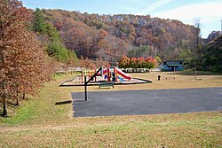 Thealka Park | |
 Thealka  Thealka | |
| Coordinates: 37°49′19″N82°47′20″W / 37.82194°N 82.78889°W | |
| Country | United States |
| State | Kentucky |
| County | Johnson |
| Elevation | 620 ft (190 m) |
| Time zone | UTC-5 (Eastern (EST)) |
| • Summer (DST) | UTC-4 (EDT) |
| ZIP code | 41240 |
| GNIS feature ID | 509201 |
Thealka is an unincorporated community in Johnson County, Kentucky, United States. It was created by the North East Coal Company in 1906.and was originally called Muddy Branch. In 1911, it was renamed "Thealka" after the steamboat known by the same name. Both the community and the steamboat were named after John C.C. Mayo's wife, Alice Jane Mayo, who was given the nickname "Alka". [1] Thealka is in the 41240 ZIP Code Tabulation Area, which includes the nearby city of Paintsville.