
A ZIP Code is a system of postal codes used by the United States Postal Service (USPS). The term ZIP was chosen to suggest that the mail travels more efficiently and quickly when senders use the code in the postal address.
Varney is an unincorporated community in Pike County, Kentucky, United States. Its ZIP Code is 41571; the population of the 41571 ZIP Code Tabulation Area (ZCTA) was 543 at the 2000 census.
Oil Springs is an unincorporated community in Johnson County, Kentucky, United States. It lies along Route 40 west of the city of Paintsville, the county seat of Johnson County. It has a post office with the ZIP code 41238.
Bee Spring is an unincorporated community in northern Edmonson County, Kentucky, United States. The population of the community's ZCTA was 1,335 at the 2000 census.
Sweeden is an unincorporated community in north-central Edmonson County, Kentucky, United States. The population of Sweeden's ZCTA was 171 at the 2000 census. It is part of the Bowling Green, Kentucky Metropolitan Statistical Area. The ZIP Code for Sweeden is 42285.
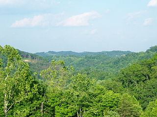
Tutor Key is an unincorporated community in Johnson County, Kentucky, United States about 4.5 miles northeast of Paintsville. Tutor Key was originally known as Mingo.
Stambaugh, Kentucky is a residential community with US Post Office located in Johnson County, Kentucky, United States. The community received its name when Stambaugh's post office was established on February 28, 1905, in honor of Bessie L. Stambaugh, Postmaster. Bessie Stambaugh's relatives Samuel and Philip Stambaugh were two of the area's first settlers. Its ZIP Code is 41257.
Nippa is an unincorporated community in Johnson County, Kentucky, United States. It is located at an elevation of 636 feet. Nippa is located in the ZIP Code Tabulation Area for ZIP code 41240.
Winifred is an unincorporated community in Johnson County, Kentucky, United States. It is located at an elevation of 840 feet. Winifred is located in the ZIP Code Tabulation Area for ZIP code 41219, which includes the nearby community of Flat Gap.
Elna is an unincorporated community in Johnson County, Kentucky, United States. It is located at an elevation of 876 feet. Elna is located in the ZIP Code Tabulation Area for ZIP code 41219.
Nero is an unincorporated community in Johnson County, Kentucky, United States. It is located at an elevation of 628 feet. Nero is located in the ZIP Code Tabulation Area for ZIP code 41265.
Burnaugh, Kentucky is an unincorporated community located in Boyd County, Kentucky along U.S. Route 23. Being located between the Burgess Station, a former C&O Freight and passenger terminal and Kavanaugh, it takes its name from the combination of the two communities. It is located on both the former Mayo Trail and present-day U.S. Route 23. Burnaugh is located within the ZIP Code Tabulation Area for zip code 41129, which includes the nearby city of Catlettsburg.
Durbin, Kentucky is an unincorporated community situated along Kentucky Route 752 and Durbin Creek in southern Boyd County, Kentucky. The post office was established on March 5, 1900, with Robert Struther as postmaster, and was named for Amos Durbin, an early explorer. It is located within the ZIP Code Tabulation Area for zip code 41129, which includes the city of Catlettsburg.
Boaz is an unincorporated community in Graves County, Kentucky, United States.
Huff is an unincorporated community located in Edmonson County, Kentucky, United States.
Kenvir is a census-designated place and unincorporated community in Harlan County, Kentucky, United States. Its population was 297 as of the 2010 census. It is located 8 miles east of Harlan, the county seat of Harlan County. The area is known locally as Black Mountain.
Jetson is an unincorporated community in Butler County, Kentucky, United States.
Cromwell is an unincorporated community in Ohio County, Kentucky, United States.
Reedyville is an Unincorporated community in Butler County, Kentucky, United States. The town is supposedly named for the nearby Big Reedy Creek, a tributary of the Green River.


