West Van Lear, Kentucky | |
|---|---|
 West Van Lear  West Van Lear | |
| Coordinates: 37°47′10″N82°46′50″W / 37.78611°N 82.78056°W | |
| Country | United States |
| State | Kentucky |
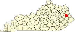
| County | Johnson |
| Area | |
• Total | 1.12 sq mi (2.90 km2) |
| • Land | 1.09 sq mi (2.82 km2) |
| • Water | 0.035 sq mi (0.09 km2) |
| Population (2020) | |
• Total | 768 |
| • Density | 706.2/sq mi (272.65/km2) |
| Time zone | UTC-5 (Eastern (EST)) |
| • Summer (DST) | UTC-4 (EDT) |
| FIPS code | 21-82056 |
West Van Lear is an unincorporated community in Johnson County, Kentucky, United States. As of the 2020 census, West Van Lear had a population of 768. [2] Even though it is unincorporated, it has a post office and its own ZIP code (41268). [3] It has a small grocery store, a volunteer fire department, and a community center.
West Van Lear's post office was established on April 29, 1912, with James H. Price as postmaster. [4]