London, Kentucky

Last updated

London, Kentucky
Downtown London KY.jpg
Downtown London
Flag of London, Kentucky.svg
Laurel County Kentucky Incorporated and Unincorporated areas London Highlighted 2147476.svg
Location in Laurel County, Kentucky
Coordinates: 37°08′10″N84°05′10″W / 37.13611°N 84.08611°W / 37.13611; -84.08611
CountryUnited States
State Kentucky
County Laurel
IncorporatedFebruary 11, 1836
Named for London, England
Government
  Type Mayor-Council
   Mayor Randall Weddle
Area
[1]
   City 11.61 sq mi (30.07 km2)
  Land11.57 sq mi (29.96 km2)
  Water0.04 sq mi (0.12 km2)
Elevation
[2]
1,178 ft (359 m)
Population
 (2020)
   City 8,053
  Estimate 
(2022) [3]
7,578
  Density654.62/sq mi (252.76/km2)
   Metro
126,565
Time zone UTC−5 (Eastern (EST))
  Summer (DST) UTC−4 (EDT)
ZIP codes
40741-40745
Area code 606
FIPS code 21-47476
GNIS feature ID2404950 [2]
Website www.londonky.gov

London is a home rule-class city [4] in Laurel County, Kentucky, in the United States. It is the seat of its county. [5] The population was 8,053 at the time of the 2020 census. [6] It is the second-largest city named "London" in the United States and the fourth-largest in the world.[ citation needed ] It is part of the London, Kentucky micropolitan area. Of the seventeen micropolitan areas in Kentucky, London is the largest; the London micropolitan area's 2010 Census population was 126,368. London is also home to the annual World Chicken Festival that celebrates the life of Colonel Sanders and features the world's largest skillet.

Contents

History

Upon the establishment of Laurel County in 1825, a vote was held to provide for the new area's seat of government. The land offered by John Jackson and his son Jarvis Jackson was selected, along with their suggested name of London, honoring their English heritage. [7] [8] The town was founded the next year, its post office established in 1831, [7] and its city rights granted in 1836. [9]

One of John Jackson's sons was Hancock Lee Jackson, 13th governor of Missouri. His second cousin was Claiborne Fox Jackson, 15th governor of Missouri.

During the late 1930s and early 1940s, London served as a central collection agency for books donated to the Pack Horse Library Project. [10] It also had a pack horse library which delivered books to rural residents in the mountains. [11]

Geography

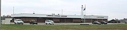
London is located in central Laurel County. U.S. Route 25 passes through London as its Main Street. Route 25 leads northwest 25 miles (40 km) to Mount Vernon and south 13 miles (21 km) to Corbin. Interstate 75, running parallel to US 25, passes along the western edge of London, with access from Exits 38 and 41. I-75 leads north 76 miles (122 km) to Lexington and south 97 miles (156 km) to Knoxville, Tennessee. The Hal Rogers Parkway runs along the northern edge of London, leading east 21 miles (34 km) to Garrard and west 32 miles (51 km) to Somerset.

According to the United States Census Bureau, London has a total area of 11.6 square miles (30.1 km2), of which 0.04 square miles (0.1 km2), or 0.39%, are water. [12] Between the 2000 and 2010 censuses, the city annexed a significant portion of land. [13]

Climate

London has a humid subtropical climate (Köppen Cfa) with continental influences. Summers are hot and humid with frequent storms. July is the warmest month, with an average high of 86 °F (30 °C) and an average low of 66 °F (19 °C). Winters are cold with a few mild periods. January is the coldest month with an average high of 44 °F (7 °C) and an average low of 26 °F (−3 °C). The highest recorded temperature was 105 °F (41 °C) on June 29, 2012, and the lowest recorded temperature was −25 °F (−32 °C) on January 19, 1994. [14] May has the highest average rainfall of 4.92 inches (125 mm) and October has the lowest average rainfall of 3.01 inches (76 mm). [14]

Climate data for London, Kentucky (London-Corbin Airport), 1991–2020 normals, extremes 1954–present
MonthJanFebMarAprMayJunJulAugSepOctNovDecYear
Record high °F (°C)74
(23)
81
(27)
87
(31)
90
(32)
91
(33)
105
(41)
101
(38)
102
(39)
97
(36)
94
(34)
83
(28)
78
(26)
105
(41)
Mean maximum °F (°C)65.6
(18.7)
69.1
(20.6)
77.4
(25.2)
84.1
(28.9)
87.0
(30.6)
91.7
(33.2)
93.2
(34.0)
92.5
(33.6)
90.1
(32.3)
83.4
(28.6)
74.7
(23.7)
67.0
(19.4)
94.5
(34.7)
Mean daily maximum °F (°C)45.2
(7.3)
49.7
(9.8)
58.4
(14.7)
69.3
(20.7)
76.7
(24.8)
83.5
(28.6)
86.3
(30.2)
85.6
(29.8)
80.0
(26.7)
69.5
(20.8)
57.9
(14.4)
48.5
(9.2)
67.5
(19.7)
Daily mean °F (°C)36.0
(2.2)
39.7
(4.3)
47.3
(8.5)
57.1
(13.9)
65.4
(18.6)
72.9
(22.7)
76.3
(24.6)
75.2
(24.0)
68.8
(20.4)
57.5
(14.2)
46.7
(8.2)
39.4
(4.1)
56.9
(13.8)
Mean daily minimum °F (°C)26.7
(−2.9)
29.7
(−1.3)
36.2
(2.3)
44.9
(7.2)
54.1
(12.3)
62.4
(16.9)
66.3
(19.1)
64.8
(18.2)
57.6
(14.2)
45.4
(7.4)
35.5
(1.9)
30.3
(−0.9)
46.2
(7.9)
Mean minimum °F (°C)5.0
(−15.0)
11.5
(−11.4)
17.9
(−7.8)
28.2
(−2.1)
37.5
(3.1)
49.4
(9.7)
57.0
(13.9)
54.8
(12.7)
43.1
(6.2)
29.7
(−1.3)
20.0
(−6.7)
13.6
(−10.2)
2.4
(−16.4)
Record low °F (°C)−25
(−32)
−17
(−27)
−12
(−24)
19
(−7)
28
(−2)
34
(1)
45
(7)
44
(7)
32
(0)
18
(−8)
2
(−17)
−17
(−27)
−25
(−32)
Average precipitation inches (mm)3.89
(99)
4.02
(102)
4.57
(116)
4.65
(118)
5.04
(128)
5.06
(129)
5.16
(131)
3.97
(101)
3.55
(90)
3.29
(84)
3.52
(89)
4.54
(115)
51.26
(1,302)
Average snowfall inches (cm)4.5
(11)
3.1
(7.9)
0.6
(1.5)
1.0
(2.5)
0.0
(0.0)
0.0
(0.0)
0.0
(0.0)
0.0
(0.0)
0.0
(0.0)
0.0
(0.0)
0.0
(0.0)
1.1
(2.8)
10.3
(26)
Average precipitation days (≥ 0.01 in)11.812.012.912.513.712.613.410.28.39.09.812.0138.2
Average snowy days (≥ 0.1 in)2.61.90.50.30.00.00.00.00.00.00.10.96.3
Source: NOAA (snow 1981–2010) [14] [15] [16]

Demographics

Historical population
CensusPop.Note
1860 235
1870 165−29.8%
1880 21530.3%
1900 1,147
1910 1,63842.8%
1920 1,7074.2%
1930 1,95014.2%
1940 2,26316.1%
1950 3,42651.4%
1960 4,03517.8%
1970 4,3377.5%
1980 4,002−7.7%
1990 5,75743.9%
2000 5,692−1.1%
2010 7,99340.4%
2020 8,0530.8%
2022 (est.)7,578 [17] −5.9%
U.S. Decennial Census [18]

As of the census [19] of 2000, there were 5,692 people, 2,400 households, and 1,461 families residing in the city. The population density was 738.1 inhabitants per square mile (285.0/km2). There were 2,676 housing units at an average density of 347.0 per square mile (134.0/km2). The racial makeup of the city was 96.03% White, 1.83% African American, 0.33% Native American, 0.69% Asian, 0.11% from other races, and 1.02% from two or more races. Hispanic or Latino of any race were 0.47% of the population.

There were 2,400 households, out of which 25.3% had children under the age of 18 living with them, 44.8% were married couples living together, 13.7% had a female householder with no husband present, and 39.1% were non-families. 35.9% of all households were made up of individuals, and 16.5% had someone living alone who was 65 years of age or older. The average household size was 2.16 and the average family size was 2.78.

In the city, the population was spread out, with 19.3% under the age of 18, 9.7% from 18 to 24, 28.1% from 25 to 44, 23.4% from 45 to 64, and 19.5% who were 65 years of age or older. The median age was 40 years. For every 100 females, there were 87.3 males. For every 100 females age 18 and over, there were 84.6 males.

The median income for a household in the city was $27,283, and the median income for a family was $34,340. Males had a median income of $32,355 versus $19,873 for females. The per capita income for the city was $15,046. About 19.4% of families and 20.7% of the population were below the poverty line, including 31.9% of those under age 18 and 18.4% of those age 65 or over.

Education

Public schools are administered by Laurel County Public Schools. [20] The district has two comprehensive high schools: North Laurel High School and South Laurel High School.

There is a private school, London Christian Academy.

Colleges

Public library

London has a lending library, the Laurel County Public Library. [21]

Economy

Major employers in London include: [22]

Transportation

Greyhound Lines provides service to London on its route serving Atlanta, Knoxville, and Detroit. [23] Rural Transit Enterprises Coordinated provides on-demand public transportation to Laurel County and surrounding counties. [24] Daniel Boone Transit and Harlan County Community Action Agency provide connecting services from other counties to Greyhound in London. [25] [26]

Notable people

See also

Related Research Articles

<span class="mw-page-title-main">Whitley County, Kentucky</span> County in Kentucky, United States

Whitley County is a county located in the southeastern part of the U.S. state of Kentucky. As of the 2020 census, the population was 36,712. Its county seat is at Williamsburg, though the largest city is Corbin, and the county's District Court sits in both cities. Whitley County is included in the London, KY Micropolitan Statistical Area.

<span class="mw-page-title-main">Rockcastle County, Kentucky</span> County in Kentucky, United States

Rockcastle County is a county located in the southeastern part of the U.S. state of Kentucky. As of the 2020 census, the population was 16,037. Its county seat is Mt. Vernon. The county was founded in 1810 and named for the Rockcastle River, which runs through it. The river, in turn, is named for its majestic rock cliffs. Rockcastle County is part of the Richmond-Berea, KY Micropolitan Statistical Area, which is also included in the Lexington-Fayette–Richmond–Frankfort, KY combined statistical area.

<span class="mw-page-title-main">Laurel County, Kentucky</span> County in Kentucky, United States

Laurel County is a county located in the southeastern portion of the U.S. state of Kentucky. As of the 2020 census, the population was 62,613. Its county seat is London. After a special election in January 2016 alcohol sales are permitted only in the city limits of London. The ordinance went into effect on March 27, 2016, 60 days after results of the election. Laurel County is included in the London, KY Micropolitan Statistical Area.

<span class="mw-page-title-main">Pineville, Kentucky</span> City in Kentucky, United States

Pineville is a home rule-class city in Bell County, Kentucky, United States. It is the seat of its county. The population was 1,732 as of the 2010 census. It is located on a small strip of land between the Cumberland River and Pine Mountain.

<span class="mw-page-title-main">Barbourville, Kentucky</span> City in Kentucky, United States

Barbourville is a home rule-class city in Knox County, Kentucky, in the United States. The population was 3,165 at the 2010 census, down from 3,589 at the 2000 census. It is the county seat of Knox County. The city was formally established by the state assembly in 1812. It was incorporated in 1854 and then reincorporated in 1856.

<span class="mw-page-title-main">Vanceburg, Kentucky</span> City in Kentucky, United States

Vanceburg is a home rule-class city in Lewis County, Kentucky, United States, along the Ohio River. The population was 1,428 at the 2020 census. It is the county seat of Lewis County.

<span class="mw-page-title-main">Stanford, Kentucky</span> City in Kentucky, United States

Stanford is a home rule-class city in Lincoln County, Kentucky, United States. It is one of the oldest settlements in Kentucky, having been founded in 1775. Its population was 3,487 at the 2010 census and an estimated 3,686 in 2018. It is the county seat of Lincoln County. Stanford is part of the Danville Micropolitan Statistical Area.

<span class="mw-page-title-main">Frenchburg, Kentucky</span> City in Kentucky, United States

Frenchburg is a home rule-class city in Menifee County, Kentucky, in the United States. The population was 601 at the 2020 census, up from 486 in 2010. It is the seat and only incorporated city in its rural county. It is located at the junction of U.S. Route 460 and Kentucky Route 36. Logging is the primary industry.

<span class="mw-page-title-main">Edmonton, Kentucky</span> City in Kentucky, United States

Edmonton is a home rule-class city in and the county seat of Metcalfe County, Kentucky, United States. It is part of the Glasgow Micropolitan Statistical Area. The population was 1,671 at the 2020 census.

<span class="mw-page-title-main">Camargo, Kentucky</span> City in Kentucky, United States

Camargo is a home rule-class city in Montgomery County, Kentucky, in the United States. The population was 1,020 at the 2020 census. It is part of the Mount Sterling Micropolitan Statistical Area.

<span class="mw-page-title-main">Jeffersonville, Kentucky</span> City in Kentucky, United States

Jeffersonville is a home rule-class city in Montgomery County, Kentucky, in the United States. The population was 1,708 as of the 2020 census, up from 1,506 in 2010. It is part of the Mount Sterling micropolitan area.

<span class="mw-page-title-main">Mount Sterling, Kentucky</span> City in Kentucky, United States

Mount Sterling, often written as Mt. Sterling, is a home rule-class city in Montgomery County, Kentucky, United States. The population was 7,558 as of the 2020 census, up from 6,895 in 2010. It is the county seat of Montgomery County and the principal city of the Mount Sterling micropolitan area.

<span class="mw-page-title-main">Mount Vernon, Kentucky</span> City in Kentucky, United States

Mount Vernon is a home rule-class city and the seat of Rockcastle County in southeastern Kentucky. The intersection of U.S. Routes 25 and 150 is located here. The population was 2,477 at the time of the 2010 U.S. census. Mount Vernon is part of the Richmond-Berea micropolitan area.

<span class="mw-page-title-main">Corbin, Kentucky</span> City in Kentucky, United States

Corbin is a home rule-class city in Whitley, Knox and Laurel counties in the southeastern portion of the U.S. state of Kentucky. As of the 2020 census, the city population was 7,856.

<span class="mw-page-title-main">North Corbin, Kentucky</span> Census-designated place in Kentucky, United States

North Corbin is a census-designated place (CDP) in Laurel and Knox counties in the U.S. state of Kentucky. The population was 1,727 at the 2020 census down from 1,773 at the 2010 census. The census bureau also lists the Laurel County portion of North Corbin as a CCD with a population of 10,729.

<span class="mw-page-title-main">Eubank, Kentucky</span> City in Kentucky, United States

Eubank is a home rule-class city in Pulaski and Lincoln counties in southern Kentucky. The population was 319 at the 2010 census.

<span class="mw-page-title-main">Knox County, Kentucky</span> County in Kentucky, United States

Knox County is a county located in Appalachia near the southeastern corner of the U.S. state of Kentucky. As of the 2020 census, the population was 30,193. Its county seat is Barbourville. The county is named for General Henry Knox. It is one of the few coal-producing counties in Kentucky that has not suffered massive population loss. Knox County is included in the London, KY Micropolitan Statistical Area.

<span class="mw-page-title-main">Corbin, KY Micropolitan Statistical Area</span>

The Corbin Micropolitan Statistical Area, as defined by the United States Census Bureau, is an area consisting of Whitley County, Kentucky, anchored by the Whitley County portion of the city of Corbin. As of the 2000 census, the μSA had a population of 35,865.

<span class="mw-page-title-main">London, KY Micropolitan Statistical Area</span>

The London, KY Micropolitan Statistical Area is a United States Census Bureau defined Micropolitan Statistical Area located in the vicinity of London, Kentucky. The London Micropolitan Statistical Area encompasses Laurel County entirely. The Micropolitan Statistical Area had a population of 52,715 at the 2000 Census. A July 1, 2009 U.S. Census Bureau estimate placed the population at 57,749.

<span class="mw-page-title-main">Corbin, Kentucky micropolitan area</span> Micropolitan area in Eastern Kentucky

The Corbin, Kentucky Micropolitan Area Micropolitan Area is made up of four counties in the Eastern Coalfield region of Kentucky. Before 2013, the area was officially known as the Corbin–London, KY Combined Statistical Area, and consisted of the Corbin Micropolitan Statistical Area and the London Micropolitan Statistical Area. The Corbin micropolitan area consisted of Whitley County, and the London micropolitan area consisted of Laurel County.

References

  1. "2020 U.S. Gazetteer Files". United States Census Bureau. Retrieved March 18, 2022.
  2. 1 2 U.S. Geological Survey Geographic Names Information System: London, Kentucky
  3. "Annual Estimates of the Resident Population for Incorporated Places in Kentucky: April 1, 2020 to July 1, 2022". United States Census Bureau. Retrieved May 26, 2023.
  4. "Summary and Reference Guide to House Bill 331 City Classification Reform" (PDF). Kentucky League of Cities. Retrieved December 30, 2014.
  5. "Find a County". National Association of Counties. Retrieved June 7, 2011.
  6. "Total Population: 2020 Census DEC Summary File 1 (P1), London city, Kentucky". data.census.gov. U.S. Census Bureau. Retrieved February 6, 2020.
  7. 1 2 Rennick, Robert. Kentucky Place Names, p. 178. University Press of Kentucky (Lexington), 1987. Accessed August 1, 2013.
  8. "London, Kentucky". City Town Info. Retrieved April 5, 2013.
  9. Commonwealth of Kentucky. Office of the Secretary of State. Land Office. "London, Kentucky". Accessed August 1, 2013.
  10. Ayers, Ruth (October 26, 1936). "Pittsburgh Woman Heads Pack Horse Library Service to Mountain Homes". The Pittsburgh Press. Retrieved September 3, 2017 via Newspapers.com.
  11. "Mountain Trails Used By WPA Employees to Distribute Books". The Cincinnati Enquirer. March 18, 1937. Retrieved September 3, 2017 via Newspapers.com.
  12. "U.S. Gazetteer Files: 2019: Places: Kentucky". U.S. Census Bureau Geography Division. Retrieved February 6, 2020.
  13. "Kentucky Cities and Counties: London, Kentucky". Land Office, Kentucky Secretary of State. Retrieved July 28, 2007.
  14. 1 2 3 "NowData – NOAA Online Weather Data". National Oceanic and Atmospheric Administration. Retrieved June 22, 2021.
  15. "Station: London Corbin AP, Ky". U.S. Climate Normals 2020: U.S. Monthly Climate Normals (1991–2020). National Oceanic and Atmospheric Administration. Retrieved June 22, 2021.
  16. "Station: London Corbin Airport, Ky". U.S. Monthly Climate Normals (1981–2010). National Oceanic and Atmospheric Administration. Retrieved June 22, 2021.
  17. "Annual Estimates of the Resident Population for Incorporated Places in Kentucky: April 1, 2020 to July 1, 2022". United States Census Bureau. Retrieved May 26, 2023.
  18. "Census of Population and Housing". Census.gov. Retrieved June 4, 2015.
  19. "U.S. Census website". United States Census Bureau . Retrieved January 31, 2008.
  20. "Laurel County Public Schools". Laurel KY Schools. Digital School Network. Retrieved April 8, 2013.
  21. "Kentucky Public Library Directory". Kentucky Department for Libraries and Archives. Archived from the original on January 11, 2019. Retrieved June 5, 2019.
  22. London Laurel County Community Profile
  23. https://www.transit.land/routes/r-dn-greyhoundus0110
  24. https://www.ridertec.org/public-transportation
  25. https://danielboonecaa.org/programs/transportation
  26. https://harlancountycaa.com/all-project-list/transportation/
  27. Duan, Crystal (November 13, 2013). "Deaton departs". The Maneater. Retrieved August 9, 2017.
  28. "Derek Lewis (Kentucky)". Ballotpedia. Retrieved November 17, 2023.