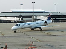
Kenton County is a county located in the northern part of the Commonwealth of Kentucky. As of the 2020 census, the population was 169,064, making it the third most populous county in Kentucky. Its county seats are Covington and Independence. It was, until November 24, 2010, the only county in Kentucky to have two legally recognized county seats. The county was formed in 1840 and is named for Simon Kenton, a frontiersman notable in the early history of the state.
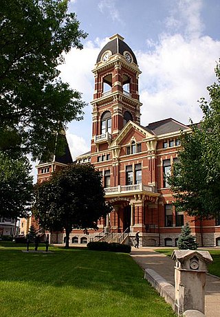
Campbell County is a county located in the northern part of the U.S. state of Kentucky. As of the 2020 census, the population was 93,076. Its county seats are Alexandria and Newport. The county was formed on December 17, 1794, from sections of Scott, Harrison, and Mason Counties and was named for Colonel John Campbell (1735–1799), a Revolutionary War soldier and Kentucky legislator. Campbell County, with Boone and Kenton Counties, is part of the Northern Kentucky metro community, and the Cincinnati-Middletown, OH-KY-IN Metropolitan Statistical Area.

Boone County is a county located on the Ohio River in the northernmost part of the Commonwealth of Kentucky. As of the 2020 census, the population was 135,968, making it the fourth-most populous county in Kentucky. Its county seat is Burlington. The county was formed in 1798 from a portion of Campbell County. and was named for frontiersman Daniel Boone. Boone County, with Kenton and Campbell Counties, is of the Northern Kentucky metro area, and the Cincinnati-Middletown, OH-KY-IN Metropolitan Statistical Area. It is the location of the Cincinnati/Northern Kentucky International Airport, which serves Cincinnati and the tri-state area.
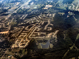
Burlington is a census-designated place (CDP) in and the county seat of Boone County, Kentucky, United States. The population was 17,318 at the 2020 census.

Alexandria is a home rule-class city in Campbell County, Kentucky, in the United States. Along with Newport, it is one of the dual seats of the county. The population was 10,341 at the 2020 census.
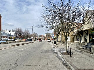
Fort Thomas is a home rule-class city in Campbell County, Kentucky, United States, on the southern bank of the Ohio River and the site of an 1890 US Army post. The population was 17,483 at the 2020 census, making it the largest city in Campbell County. It is part of the Cincinnati – Northern Kentucky metropolitan area.

Newport is a home rule-class city at the confluence of the Ohio and Licking rivers in Campbell County, Kentucky, United States. The population was 14,150 at the 2020 census. Historically, it was one of four county seats of Campbell County. Newport is a major urban center of Northern Kentucky and is part of the Cincinnati metropolitan area.

Covington is a home rule-class city in Kenton County, Kentucky, United States. Located at the confluence of the Ohio and Licking rivers, it lies south of Cincinnati, Ohio, across the Ohio and west of Newport, Kentucky, across the Licking. It had a population of 40,691 at the 2020 census, making it the largest city in Northern Kentucky and the fifth-most populous city in the state. A part of the Cincinnati metropolitan area, it is one of Kenton County's two seats, along with Independence.

Independence is a home rule-class city in Kenton County, Kentucky, United States. It is one of its county's two seats of government. The population was 28,676 at the time of the 2020 census. It is the third largest city in Northern Kentucky after Covington and Florence, and is part of the Cincinnati metropolitan area.
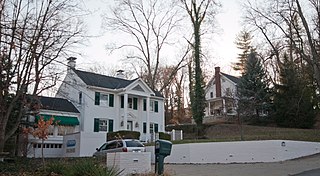
Park Hills is a home rule-class city in Kenton County, Kentucky, United States. The population was 3,162 at the 2020 census. It is a suburb of the Cincinnati metropolitan area. Much of the city was listed on the National Register of Historic Places in 2008 as the Park Hills Historic District.

Cincinnati/Northern Kentucky International Airport is a public international airport located in Boone County, Kentucky, United States, around the community of Hebron. The airport serves the Cincinnati tri-state area. The airport's code, CVG, is derived from the nearest city at the time of the airport's opening, Covington, KY. The airport covers an area of 7,700 acres (3,100 ha). It is included in the Federal Aviation Administration (FAA) National Plan of Integrated Airport Systems for 2023–2027, in which it is categorized as a medium-hub primary commercial service facility.

Hebron is an unincorporated community and census-designated place (CDP) in Boone County, Kentucky, United States. It is named after the biblical city of Hebron. As of the 2020 census, it had a population of 6,195. The wider Hebron area is home to the Cincinnati/Northern Kentucky International Airport, which serves Cincinnati and the Tri-State (Ohio-Kentucky-Indiana) area.

Kentucky's 4th congressional district is a congressional district in the U.S. state of Kentucky. Located in the northeastern portion of the state, it is a long district that follows the Ohio River. However, the district is dominated by its far western portion, comprising the eastern suburbs of Louisville and Northern Kentucky, the Kentucky side of the Cincinnati area.

Area code 859 is a telephone area code in the North American Numbering Plan (NANP) for the city of Lexington and the central portion of the Commonwealth of Kentucky. It was created in a split from area code 606 in 1999.

Interstate 75 (I-75) runs from near Williamsburg to Covington by way of Lexington in the US state of Kentucky. I-75 enters the Cumberland Plateau region from Tennessee, then descends into the Bluegrass region through the Pottsville Escarpment before crossing the Ohio River into Ohio. I-75 follows along the U.S. Route 25 (US 25) corridor for the entire length of Kentucky.

Kentucky is situated in the Upland South region of the United States. A significant portion of eastern Kentucky is part of Appalachia.

James Simpson Jr (1928–1999) was the first African American to win a city commission election in the history of Covington, Kentucky. Simpson was one of nearly 30 people who filed to run for the City Commission in 1971. He finished third, winning one of four seats and making political history. Simpson served the full two-year term. He later finished an un-expired term on the commission in 1991. Simpson was active in many other civic groups. He served on the following boards: Kenton County Airport Board, People's Liberty Bank Board of Directors, Booth Hospital in Covington, St. Elizabeth Hospital in Covington and the Kenton County TB Sanatorium. Simpson was also one of the founders of the Northern Kentucky Community Center in the Eastside Neighborhood of Covington. James Edward Simpson Jr is father to State Representative Arnold Ray Simpson who serves the 65th district of Kentucky, the first African American to hold this seat at the Kentucky State Assembly.
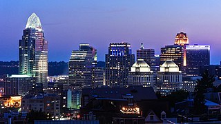
Transportation in Cincinnati includes sidewalks, roads, public transit, bicycle paths, and regional and international airports. Most trips are made by car, with transit and bicycles having a relatively low share of total trips; in a region of just over 2 million people, less than 80,000 trips are made with transit on an average day. The city is sliced by three major interstate highways, I-71, I-74 and I-75, and circled by a beltway several miles out from the city limits. The region is served by two separate transit systems, one on each side of the river. SORTA, on the Ohio side is about six times larger than TANK on the Kentucky side.

Francisville is a census-designated place (CDP) in Boone County, Kentucky, United States, and a suburb of Greater Cincinnati. Its population was 9,952 as of the 2020 census. Francisville shares ZIP code 41048 with the neighboring CDP of Hebron. It is the northernmost community in the state.

The Cincinnati metropolitan area is a metropolitan area with its core in Ohio and Kentucky. Its largest city is Cincinnati and includes surrounding counties in the U.S. states of Ohio, Kentucky, and Indiana.


