Nicholasville, Kentucky

Last updated

Nicholasville, Kentucky
Main Street in Nicholasville.jpg
Main Street in Nicholasville, Kentucky
Jessamine County Kentucky Incorporated and Unincorporated areas Nicholasville Highlighted 2156136.svg
Location of Nicholasville in Jessamine County, Kentucky
Coordinates: 37°53′26″N84°34′02″W / 37.89056°N 84.56722°W / 37.89056; -84.56722
Country United States
State Kentucky
County Jessamine
IncorporatedFebruary 13, 1837 [1]
Government
[2]
  Type City commission
  MayorAlex Carter [3]
  CommissionersDoug Blackford
Betty Black
Alex Carter, Mayor Pro Tempore
Patty Teater
Area
[4]
  Total14.85 sq mi (38.45 km2)
  Land14.78 sq mi (38.27 km2)
  Water0.07 sq mi (0.18 km2)
Elevation
[5]
994 ft (303 m)
Population
 (2020)
  Total31,093
  Estimate 
(2022) [6]
31,955
  Density2,104.29/sq mi (812.47/km2)
Time zone UTC-5 (Eastern (EST))
  Summer (DST) UTC-4 (EDT)
ZIP Codes
40340, 40356
Area code 859
FIPS code 21-56136
GNIS feature ID2404379 [5]
Website www.nicholasville.org

Nicholasville is a home rule city [7] in and the county seat of Jessamine County, Kentucky. [8] The population was 31,490 during the 2020 U.S. census, making Nicholasville the 10th-largest settlement in the state.

Contents

Since the late 20th century, Nicholasville has undergone rapid growth; the population increased 440.23% between 1970 and 2020. The city serves as both a residential area for Lexington-area commuters and as an employment and shopping center for central Kentucky. [9]

History

Nicholasville was founded by European Americans in 1798, after the American Revolutionary War, and incorporated in 1837. [10] [1] The town was named in honor of Colonel George Nicholas, a father of the Kentucky Constitution in 1792. [11] The Young House in Nicholasville is listed on the National Register of Historic Places.

The city has grown rapidly since the late 20th century and is working to accommodate new highways and transportation needs. Many residents commute to Lexington for work. Others are part of building Nicholasville as a center of retail services for the county.

Geography

Downtown Nicholasville is approximately 6 miles (9.7 km) south of Fayette County. The city serves as a logistics and commuter hub between Lexington and Nicholasville's neighboring counties, especially Garrard County. According to the U.S. Census Bureau, the city has a total area of 13.08 square miles (33.9 km2), of which 13.01 square miles (33.7 km2) is land and 0.07 square miles (0.18 km2), or 0.52%, is water. Some artificial ponds, including Lake Mingo (named after the Native American Mingo people), are present in the city. [12] Town Fork, a partially channelized stream, runs south and passes underneath downtown, eventually draining into Jessamine Creek. [13]

Climate

Nicholasville is in the northern periphery of the humid subtropical climate zone, [14] with hot and humid summers, cool winters, and occasional mild periods, especially in autumn. The city and the surrounding Bluegrass region have four distinct seasons that include cool plateau breezes, moderate nights in the summer, and no prolonged periods of rain, snow, or other severe weather.

Demographics

Historical population
CensusPop.Note
1810 158
1830 408
1840 63254.9%
1860 800
1870 1,08936.1%
1880 2,303111.5%
1890 2,157−6.3%
1900 2,39310.9%
1910 2,93522.6%
1920 2,786−5.1%
1930 3,12812.3%
1940 3,1922.0%
1950 3,4066.7%
1960 4,27525.5%
1970 5,82936.4%
1980 10,40078.4%
1990 13,60330.8%
2000 19,68044.7%
2010 28,01542.4%
2020 31,09311.0%
2022 (est.)31,955 [15] 2.8%
U.S. Decennial Census [16]

As of the 2020 census, [17] there were 31,490 people, 11,244 households, and 7,503 families residing in the city. The population density was 2,141.9 per square mile (827.0/km2). There were 11,405 housing units at an average density of 872.0 per square mile (336.7/km2). The racial makeup of the city was 90% White (87.5% non-Hispanic), 5.2% African American, 0.1% Native American, 1.4% Asian, 0.0% Pacific Islander, 1.2% from other races, and 2.6% from two or more races. Hispanics or Latinos of any race were 3.5% of the population.

There were 11,244 households, out of which 25.6% had children under the age of 18 living with them, 49.2% were married couples living together, 16.7% had a female householder with no husband present, 5.6% had a male householder with no wife present, and 26.5% were non-families. 22.3% of all households were made up of individuals, and 7.4% had someone living alone who was 65 years of age or older. The average household size was 2.64 and the average family size was 3.07.

The age distribution was 27.9% under the age of 18, 8.8% from 18 to 24, 30.7% from 25 to 44, 22.8% from 45 to 64, and 9.8% who were 65 years of age or older. The median age was 33.1 years. For every 100 females, there were 91.1 males. For every 100 females age 18 and over, there were 86.9 males.

According to Census Bureau data for 2011 from the American Community Survey's five-year estimates, the median income for a household in the city was $43,453, and the median income for a family was $52,419. Full-time male workers had a median income of $37,954 versus $33,330 for females. The per capita income for the city was $19,526. About 14.5% of families and 17.1% of the population were below the poverty line, including 22.7% of those under age 18 and 6.5% of those age 65 or over.

Arts and culture

The city is home to the Kentucky Wine and Vine Fest. [18] The annual festival showcases wines from commercial vineyards and amateur winemakers from across Kentucky and the surrounding region. In 2014, it was named as the "Official Wine Festival of Kentucky" by the Kentucky General Assembly. [19] [20] Nicholasville is near Camp Nelson Heritage National Monument and Camp Nelson National Cemetery.

Government

Jessamine County Courthouse Jessamine County Kentucky Courthouse.jpg
Jessamine County Courthouse

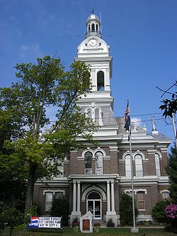
The Nicholasville government operates under a non-partisan city commission, which exercises both executive and legislative powers. The commission is composed of a mayor and four commissioners; all are elected at-large, requiring each candidate to gain the support of the majority of the electorate. In addition, the four commissioners are elected to manage particular city departments. They serve two-year terms; the mayor is elected to a four-year term. [2] The commission wields all executive, legislative, and administrative powers.

In 2012, there was a proposal on the ballot to change the form of city government to that of a mayor–council government, in order to separate the legislative and executive functions, but the proposal was defeated. [21] [22]

Commissioners draft and pass laws and, by managing their respective departments, ensure the laws are carried out efficiently. The mayor administers oaths, signs documents on the city's behalf, and conducts commission meetings. As a member of the commission, the mayor has legislative powers equal to that of the commissioners. Commission meetings take place twice monthly. [2]

Education

Jessamine County Schools provides public education. [23] Nicholasville Elementary School is located in the city. [24] Students go to schools in the county for middle and high school grades.

The Hattie C. Warner Elementary School on Wilmore Road is named after local teacher Hattie Catherine Warner (1886–1963) who taught for 46 years in Jessamine County. She graduated from Eastern Kentucky University in 1913 and is buried in the Maple Grove cemetery. [25]

Nicholasville has a lending library, the Jessamine County Public Library. [26]

Infrastructure

Transportation

U.S. highways

  • U.S. Route 27 is a major north–south artery. A four-lane arterial highway with a center-turning lane serves drivers from the Lexington city limits to the Business US 27 intersection north of the city center. US 27 diverts to the western edge of the city center on a four-lane, controlled-access bypass and continues south of the city toward the Kentucky River.

State routes

  • Kentucky Route 29 is an east–west two-lane highway that stretches from the western fringes of the city west of the U.S. 27 bypass to Business U.S. 27 in downtown Nicholasville. It is known as Wilmore Road west of U.S. 27 and east of Maple Street.
  • Kentucky Route 39 is a north–south highway that stretches from the farms south of the city before concluding at Business U.S. 27 at downtown. It is known as Maple Street, and as Sulphur Well Road and then Lancaster Road.
  • Kentucky Route 169 is an east–west highway that cuts through the city center. It has intersections with U.S. 27 and Business U.S. 27. It is known as Keene Road northwest of the city center, then 3rd Street, Richmond Road and Union Mills Road on the east side.
  • Kentucky Route 1980 is known as Ash Grove Road and travels into Fayette County to the east. It departs from U.S. 27 just south of the Lexington city limits.
  • Kentucky Route 3375 traverses west of U.S. 27, north of the city center, and is known as Catnip Hill Road.

Notable people

Related Research Articles

<span class="mw-page-title-main">Woodford County, Kentucky</span> County in Kentucky, United States

Woodford County is a county located in the U.S. state of Kentucky. As of the 2020 census, the population was 26,871. Its county seat is Versailles. The area was home to Pisgah Academy. Woodford County is part of the Lexington-Fayette, KY Metropolitan Statistical Area. It is located in the center of the Bluegrass region of Kentucky.

<span class="mw-page-title-main">Pulaski County, Kentucky</span> County in Kentucky, United States

Pulaski County is a county in the U.S. Commonwealth of Kentucky. As of the 2020 census, the population was 65,034. Its county seat is Somerset. The county was founded in December 1798 from land given by Lincoln and Green Counties and named for Polish patriot Count Casimir Pulaski. Pulaski County comprises the Somerset, KY Micropolitan Statistical Area. Somerset's population is just over 11,000, but the Micropolitan Area for Somerset/Pulaski County is over 65,000.

<span class="mw-page-title-main">Jessamine County, Kentucky</span> County in Kentucky, United States

Jessamine County is a county located in the U.S. state of Kentucky. As of the 2020 census, the population was 52,991. Its county seat is Nicholasville. The county was founded in December 1798. Jessamine County is part of the Lexington-Fayette, KY Metropolitan Statistical Area. It is within the Inner Blue Grass region, long a center of farming and blooded stock raising, including thoroughbred horses. The legislature established a commercial wine industry here in the late 18th century.

<span class="mw-page-title-main">Fayette County, Kentucky</span> County in Kentucky, United States

Fayette County is located in the central part of the U.S. state of Kentucky and is consolidated with the city of Lexington. As of the 2020 census, the population was 322,570, making it the second-most populous county in the commonwealth. Since 1974, its territory, population and government have been shared with Lexington. Fayette County is part of the Lexington-Fayette, KY Metropolitan Statistical Area.

<span class="mw-page-title-main">Butler County, Kentucky</span> County in Kentucky, United States

Butler County is a county located in the US state of Kentucky. As of the 2020 Census, the population was 12,371. Its county seat is Morgantown. The county was formed in 1810, becoming Kentucky's 53rd county. Butler County is included in the Bowling Green, Kentucky, Metropolitan Statistical Area.

<span class="mw-page-title-main">Vevay, Indiana</span> Town in Indiana, United States

Vevay is a town located in Jefferson Township and the county seat of Switzerland County, Indiana, United States, along the Ohio River. The population was 1,683 at the 2010 census.

<span class="mw-page-title-main">Danville, Kentucky</span> City in Kentucky, United States

Danville is a home rule-class city in Boyle County, Kentucky, United States. It is the seat of its county. The population was 17,236 at the 2020 Census. Danville is the principal city of the Danville Micropolitan Statistical Area, which includes all of the Boyle and Lincoln counties. In 2001, Danville received a Great American Main Street Award from the National Trust for Historic Preservation. In 2011, Money magazine placed Danville as the fourth-best place to retire in the United States. Centre College in Danville was selected to host U.S. vice-presidential debates in 2000 and 2012.

<span class="mw-page-title-main">Grayson, Kentucky</span> City in Kentucky, United States

Grayson is a home rule-class city in and the county seat of Carter County, Kentucky, United States, on U.S. Route 60 and Interstate 64 in the state's northeastern region. It is approximately 21 miles west of Ashland. Within the city limits, the population was 4,217 at the 2010 census. Along with Carter County, the city is closely associated with the nearby Huntington-Ashland, WV-KY-OH Metropolitan Statistical Area and is often erroneously included in the MSA being just 9 miles west of the M.S.A's western boundary.

<span class="mw-page-title-main">Winchester, Kentucky</span> City in Kentucky, United States

Winchester is a home rule-class city in and the county seat of Clark County, Kentucky, United States. The population was 18,368 at the 2010 census. It is part of the Lexington-Fayette, KY Metropolitan Statistical Area. Winchester is located roughly halfway between Lexington and Mt. Sterling.

<span class="mw-page-title-main">Lancaster, Kentucky</span> City in Kentucky, United States

Lancaster is a home rule-class city in Garrard County, Kentucky, in the United States. It is the seat of its county. As of the year 2020 U.S. census, the city population was 3,901.

<span class="mw-page-title-main">Richmond, Kentucky</span> City in Kentucky, United States

Richmond is a home class city in KY and the county seat of Madison County, Kentucky, United States. It is named after Richmond, Virginia, and is home to Eastern Kentucky University. With close proximity to Lexington, Richmond is considered by many to be a great place to live. It has an average - high cost of living compared to other areas. The population was 36,826 as of 2023. Richmond is the fourth-largest city in the Bluegrass region and the state's seventh-largest city. It is the ninth largest population center in the state with a Micropolitan population of 106,864. The city serves as the center for work and shopping for south-central Kentucky, with many local and chain options alike. Richmond KY is home to numerous festivals, notably the Millstone Festival. In addition, Richmond is the principal city of the Richmond-Berea, Kentucky Micropolitan Area, which includes all of Madison and Rockcastle counties.

<span class="mw-page-title-main">Maysville, Kentucky</span> City in Kentucky, United States

Maysville is a home rule-class city in Mason County, Kentucky, United States, and is the seat of Mason County. The population was 8,873 as of the 2020 census. Maysville is on the Ohio River, 66 miles (106 km) northeast of Lexington. It is the principal city of the Maysville Micropolitan Statistical Area, which comprises Mason County. Two bridges cross the Ohio from Maysville to Aberdeen, Ohio: the Simon Kenton Memorial Bridge built in 1931 and the William H. Harsha Bridge built in 2001.

<span class="mw-page-title-main">Mount Sterling, Kentucky</span> City in Kentucky, United States

Mount Sterling, often written as Mt. Sterling, is a home rule-class city in Montgomery County, Kentucky, United States. The population was 7,558 as of the 2020 census, up from 6,895 in 2010. It is the county seat of Montgomery County and the principal city of the Mount Sterling micropolitan area.

<span class="mw-page-title-main">High Bridge, Kentucky</span> Unincorporated community in Kentucky, United States

High Bridge is an unincorporated community and census-designated place in Jessamine County, Kentucky, United States. As of the 2010 census it had a population of 242. It lies along the lower reaches of the Kentucky River across from the confluence of the Dix River with the Kentucky. The community is part of the Lexington–Fayette Metropolitan Statistical Area.

<span class="mw-page-title-main">New Circle Road</span> Highway in Lexington, Kentucky

New Circle Road, also known as Kentucky Route 4, is a Kentucky state highway that serves as an inner beltway around Lexington, which is part of the consolidated city-county government with Fayette County.

<span class="mw-page-title-main">Kentucky Route 29</span> State highway in Kentucky, United States

Kentucky Route 29 is an 11.324-mile-long (18.224 km) state highway located entirely within Jessamine County in the U.S. state of Kentucky. The highway, maintained by the Kentucky Transportation Cabinet, runs north from High Bridge, Kentucky through Wilmore before ending at Nicholasville. Within Wilmore, KY 29 intersects Kentucky Route 1268 and junctions with Kentucky Route 3433. The highway acts as the border between Asbury University and Asbury Theological Seminary. Just north of Wilmore, KY 29 merges with U.S. Route 68 for 0.590 miles (0.950 km) before leaving US 68 and turning east heading towards Nicholasville. KY 29 terminates at Kentucky Route 39 and U.S. Route 27 Business in downtown Nicholasville.

<span class="mw-page-title-main">Lexington–Fayette metropolitan area</span> Metropolitan Area in Kentucky, United States

The Lexington-Fayette metropolitan area is the 109th-largest metropolitan statistical area (MSA) in the United States. It was originally formed by the United States Census Bureau in 1950 and consisted solely of Fayette County until 1980 when surrounding counties saw increases in their population densities and the number of their residents employed within Lexington-Fayette, which led to them meeting Census criteria to be added to the MSA.

<span class="mw-page-title-main">U.S. Route 27 in Kentucky</span> Segment of American highway

U.S. Route 27 (US 27) in Kentucky runs 201.120 miles (323.671 km) from the Tennessee border to the Ohio border at Cincinnati. It crosses into the state in the Lake Cumberland area, passing near or through many small towns, including Somerset, Stanford, and Nicholasville. The road then passes straight through the heart of Lexington, including past the University of Kentucky (UK) and Transylvania University. North of Lexington, it passes through Cynthiana and Falmouth before entering Campbell County and passing through many Northern Kentucky suburbs before ending at the Ohio state line on the Taylor–Southgate Bridge in Cincinnati.

Keene is a home rule-class city located in Jessamine County, Kentucky, in the United States. It is home to the Keene Springs Hotel. The U.S. Census Bureau does not record Keene as a city and does not publish a population figure for the community.

References

  1. 1 2 Commonwealth of Kentucky. Office of the Secretary of State. Land Office. "Nicholasville, Kentucky". Accessed 15 September 2013.
  2. 1 2 3 "Government: City Commission". www.nicholasville.org. Retrieved October 12, 2014.
  3. "Government". Nicholasville.org. Retrieved March 10, 2024.
  4. "2020 U.S. Gazetteer Files". United States Census Bureau. Retrieved March 18, 2022.
  5. 1 2 U.S. Geological Survey Geographic Names Information System: Nicholasville, Kentucky
  6. "Annual Estimates of the Resident Population for Incorporated Places in Kentucky: April 1, 2020 to July 1, 2022". United States Census Bureau. Retrieved May 26, 2023.
  7. "Summary and Reference Guide to House Bill 331 City Classification Reform" (PDF). Kentucky League of Cities. Retrieved December 30, 2014.
  8. "Find a County". National Association of Counties. Retrieved June 7, 2011.
  9. "2009 Report to the community" (PDF) (Press release). City of Nicholasville. 2009. p. 5. Retrieved October 3, 2014.
  10. Columbia-Lippincott Gazetteer, p. 1320. (New York: Columbia University Press, 1952).
  11. Federal Writers' Project (1996). The WPA Guide to Kentucky. University Press of Kentucky. p. 254. ISBN   0813108659 . Retrieved November 24, 2013.
  12. "NJCPR: Parks & Pictures". Nicholasville/Jessamine County Parks & Recreation. Archived from the original on August 15, 2014. Retrieved October 13, 2014.
  13. "Kentucky River Basin Assessment Report: Jessamine Creek". Kentucky Water Research Institute - University of Kentucky. August 2000. Retrieved October 13, 2014.
  14. "Map of American climate zones". Archived from the original on December 10, 2007. Retrieved October 13, 2014.
  15. "Annual Estimates of the Resident Population for Incorporated Places in Kentucky: April 1, 2020 to July 1, 2022". United States Census Bureau. Retrieved May 26, 2023.
  16. "Census of Population and Housing". Census.gov. Retrieved June 4, 2015.
  17. "U.S. Census website". United States Census Bureau . Retrieved May 14, 2011.
  18. "Kentucky Wine and Vine homepage". www.kywineandvine.com. Archived from the original on October 6, 2014. Retrieved October 3, 2014.
  19. "2014 Press Release" (PDF) (Press release). www.kywineandvine.com. April 23, 2014. Archived from the original (PDF) on January 13, 2016. Retrieved October 3, 2014.
  20. "Nicholasville NOW!: Kentucky Wine & Vine Fest named a Top 10 Festival". www.nicholasvillenow.org. Archived from the original on October 6, 2014. Retrieved October 3, 2014.
  21. "Form of Government Change Campaigns, 2003–2012", International City/County Management Association; accessed 18 August 2016
  22. "Nicholasville City Commission: Betty Black" [ permanent dead link ], Jessamine Journal, 26 March 2014; accessed 18 August 2016
  23. "Jessamine County Schools". www.jessamine.k12.ky.us. Retrieved February 28, 2016.
  24. "Nicholasville Elementary School". Jessamine County Schools. Retrieved September 30, 2017.
  25. "School history". Warner Elementary School. Retrieved July 8, 2020.
  26. "Kentucky Public Library Directory". Kentucky Department for Libraries and Archives. Archived from the original on January 11, 2019. Retrieved June 5, 2019.
  27. "Cheryl Avioli: Ky. can gain from growing biomass energy market". kentucky. Retrieved March 7, 2017.
  28. "The ballad of Richard Jay Corman".