West Liberty, Kentucky

Last updated
West Liberty, Kentucky
Downtown West Liberty, Kentucky.jpg
Downtown West Liberty, 2007
Morgan County Kentucky Incorporated and Unincorporated areas West Liberty Highlighted 2181858.svg
Location in Morgan County, Kentucky
Coordinates: 37°54′59″N83°15′41″W / 37.91639°N 83.26139°W / 37.91639; -83.26139
Country United States
State Kentucky
County Morgan
Area
[1]
  Total4.94 sq mi (12.79 km2)
  Land4.90 sq mi (12.70 km2)
  Water0.03 sq mi (0.09 km2)
Elevation
817 ft (249 m)
Population
 (2020) [2]
  Total3,215
  Estimate 
(2022) [3]
3,434
  Density655.59/sq mi (253.12/km2)
Time zone UTC-5 (Eastern (EST))
  Summer (DST) UTC-4 (EDT)
ZIP code
41472
Area code 606
FIPS code 21-81858
GNIS feature ID0516279
Website www.cityofwestliberty.com

West Liberty is a home rule-class city in Morgan County, Kentucky, United States. It is the county seat of Morgan County. [4] As of the 2020 census, the city population was 3,215. [2] It is located along the Licking River at the junction of Kentucky Route 7 and U.S. Route 460.

Contents

History

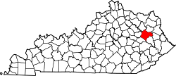
By 1816, an early settlement at the town site was called "Wells Mills". When Morgan County was founded in 1823, the settlement was incorporated to become the county seat. It chose the name "West Liberty" in the belief that Pikeville, Kentucky, would be called "Liberty" when it incorporated. West Liberty is actually 100 miles (160 km) east of Liberty, Kentucky.

Three Civil War skirmishes were fought near West Liberty, and much of the town was burned during the war, including the courthouse. It was replaced after the war, and a fourth courthouse was built in 1907.

2012 tornado

On March 2, 2012, West Liberty was hit by an EF-3 tornado which caused extensive damage to the downtown area. [5] [6] This tornado left a swath of damage over a mile wide. Many homes and businesses were heavily damaged or destroyed. Six people were killed and at least 75 people were injured. [7] Preliminary assessments from emergency officials and media indicated a path length of 60 miles (97 km)[ citation needed ], though a National Weather Service survey concluded the tornado travelled 85 miles from Menifee County to Lincoln County, West Virginia. [8] It had the longest track of any tornado in the United States in 2012. [9]

The old courthouse, built in 1907, as well as the new courthouse which was 60% completed were at first, after the tornado, both deemed as a total loss. [10] However, this determination was in error as both buildings have been restored and finished, respectively.[ citation needed ]

The tornado had also hit the city of Wellington in Menifee County and was just north of the EF3 tornado that hit Salyersville around 7:00 PM Eastern time that evening. [11] The tornadoes were the worst in the history of all three of the towns.[ citation needed ]

Restoration after tornado

Downtown prior to restoration March 02, 2012 West Liberty, KY Aerial Tornado Damage 2.jpg
Downtown prior to restoration

Since the 2012 tornado, much progress has been made in West Liberty. Many of the buildings destroyed in the disaster have been either rebuilt to prior state or have been replaced with much better structures. Planning in West Liberty has been continuous since the disaster.[ citation needed ]

Geography

West Liberty is located in central Morgan County at 37°54′59″N83°15′41″W / 37.91639°N 83.26139°W / 37.91639; -83.26139 (37.916320, -83.261386). [12] It is within the state's eastern region foothills, about 20 miles (32 km) southeast of Cave Run Lake and Daniel Boone National Forest and the same distance west of the upstream end of Paintsville Lake.

U.S. Route 460 passes through the center of West Liberty, leading west 27 miles (43 km) to Frenchburg and southeast 22 miles (35 km) to Salyersville. Kentucky Route 7 joins US 460 leading to Salyersville but turns north in the center of West Liberty and leads 18 miles (29 km) to Sandy Hook.

According to the United States Census Bureau, the city has a total area of 4.94 square miles (12.8 km2), of which 0.03 square miles (0.08 km2), or 0.67%, are water. [1] The Licking River passes through the city along the west side of the downtown, flowing northwest to join the Ohio River at Covington.

Demographics

Historical population
CensusPop.Note
1870 142
1880 22558.5%
1890 2344.0%
1900 205−12.4%
1910 442115.6%
1920 4614.3%
1930 56923.4%
1940 5730.7%
1950 93162.5%
1960 1,16525.1%
1970 1,38719.1%
1980 1,381−0.4%
1990 1,88736.6%
2000 3,27773.7%
2010 3,4354.8%
2020 3,215−6.4%
2022 (est.)3,434 [13] 6.8%
U.S. Decennial Census [14]

As of the census [15] of 2000, there were 3,277 people, 696 households, and 446 families residing in the city. The population density was 739.3 inhabitants per square mile (285.4/km2). There were 758 housing units at an average density of 171.0 per square mile (66.0/km2). The racial makeup of the city was 79.43% White, 18.19% African American, 0.40% Native American, 0.21% Asian, 0.06% Pacific Islander, 0.21% from other races, and 1.50% from two or more races. Hispanic or Latino of any race were 1.25% of the population. (Both the large increase in population after 1990 and the current demographic diversity are the result of the opening of the Eastern Kentucky Correctional Complex).

There were 696 households, out of which 27.6% had children under the age of 18 living with them, 47.7% were married couples living together, 14.1% had a female householder with no husband present, and 35.8% were non-families. 32.8% of all households were made up of individuals, and 14.7% had someone living alone who was 65 years of age or older. The average household size was 2.15 and the average family size was 2.71.

In the city, the population was spread out, with 10.1% under the age of 18, 14.8% from 18 to 24, 44.2% from 25 to 44, 19.4% from 45 to 64, and 11.5% who were 65 years of age or older. The median age was 36 years. For every 100 females, there were 264.5 males. For every 100 females age 18 and over, there were 297.4 males.

The median income for a household in the city was $21,429, and the median income for a family was $30,875. Males had a median income of $25,417 versus $19,464 for females. The per capita income for the city was $11,215. About 25.7% of families and 28.6% of the population were below the poverty line, including 41.6% of those under age 18 and 26.4% of those age 65 or over.

Economy

West Liberty is home to the Eastern Kentucky Correctional Complex. An extended campus of Morehead State University and University of Kentucky's Regional Technology Center are both located within the town.

The area is also home to Rod and Staff Publishing, a Mennonite Bible literature printing facility, located at Crockett.

Education

Morgan County has four elementary schools. These are Ezel, East Valley, Morgan Central, and Wrigley Elementary. It has one middle school, Morgan County Middle; and one high school, Morgan County High School.

West Liberty has a lending library, a branch of the Montgomery County Public Library. [16]

Arts and culture

West Liberty celebrates the annual Sorghum Festival on the last full weekend of September. The 2015 festival marked the festival's 45th year, with upwards of 50,000 visitors expected. The festival features a large variety of Appalachian crafts, folk art, food, and sundry items for sale and/or show. The entire downtown section is cordoned off with Main Street as the center of activity. The festival is host to two Civil War reenactments, which take place at the soccer field.

The Bluegrass Festival began in 1996, and showcases both local and regional bluegrass acts. It takes place at Old Mill Park, and visitors can enjoy a wide selection of food and local vendor booths. [17]

Related Research Articles

<span class="mw-page-title-main">Todd County, Kentucky</span> County in Kentucky, United States

Todd County is a county located in the U.S. state of Kentucky. As of the 2020 census, the population was 12,243. Its county seat is Elkton. The county is named for Colonel John Todd, who was killed at the Battle of Blue Licks in 1782 during the American Revolution.

<span class="mw-page-title-main">Morgan County, Kentucky</span> County in Kentucky, United States

Morgan County is a county located in the U.S. state of Kentucky. As of the 2020 census, the population was 13,726. Its county seat is West Liberty. The county is among the dry counties, which means that the sale of alcohol is restricted or prohibited.

<span class="mw-page-title-main">Menifee County, Kentucky</span> County in Kentucky, United States

Menifee County is a county located in the U.S. state of Kentucky. As of the 2020 census, the population was 6,113, making it the fifth-least populous county in Kentucky. Its county seat is Frenchburg. The county is named for Richard Hickman Menefee, U.S. Congressman, although the spelling has changed. It is a prohibition or dry county. Menifee County is part of the Mount Sterling, KY Micropolitan Statistical Area, which is also included in the Lexington-Fayette-Richmond-Frankfort, KY Combined Statistical Area. It is located in the foothills of the Cumberland Plateau.

<span class="mw-page-title-main">Magoffin County, Kentucky</span> County in Kentucky, United States

Magoffin County is a county located in the U.S. state of Kentucky. As of the 2020 census, the population was 11,637. Its county seat is Salyersville. The county was formed in 1860 from adjacent portions of Floyd, Johnson, and Morgan Counties. It was named for Beriah Magoffin who was Governor of Kentucky (1859–62).

<span class="mw-page-title-main">Lawrence County, Kentucky</span> County in Kentucky, United States

Lawrence County is a county located in the U.S. state of Kentucky. As of the 2020 census, the population was 16,293. Its county seat is Louisa. The county is named for James Lawrence, and co-founded by Isaac Bolt, who served as a Lawrence County Commissioner and Justice of the Peace. Lawrence County is the home of bluegrass music and country music star Tyler Childers. It is the birthplace of the late Chief Justice of the United States Frederick Moore Vinson and former Kentucky Governor Paul E. Patton. In regard to alcoholic beverage sales, Lawrence County is considered a "moist" county, meaning alcohol sales are only allowed within the city limits of Louisa. There are no alcohol sales within the rest of the county. Only two stores sell liquor, and most convenience stores sell beer and malted beverages.

<span class="mw-page-title-main">Estill County, Kentucky</span> County in Kentucky, United States

Estill County is a county located in the U.S. state of Kentucky. As of the 2020 census, the population was 14,163. Its county seat is Irvine The county was formed in 1808 and named for Captain James Estill, a Kentucky militia officer who was killed in the Battle of Little Mountain during the American Revolutionary War. Estill County is a moist county meaning that the county seat, the city of Irvine, allows the sale of alcohol after the October 9, 2013 vote, but not the rest of Estill County outside the Irvine city limits. Estill County has two adjacent towns, known as the twin cities, Irvine and Ravenna. Both cities sit along the Kentucky River in the central part of the county. Ravenna is home to a former CSX Transportation facility, now owned by Kentucky Steam Heritage Corporation for the restoration of Chesapeake and Ohio 2716. It conducts the Ravenna Railroad Festival annually in late summer, and the historic Fitchburg & Cottage Furnaces are located here. Irvine hosts the annual Mountain Mushroom Festival over the last weekend of April, which celebrates the abundant Morel Mushrooms found in the region.

<span class="mw-page-title-main">Casey County, Kentucky</span> County in Kentucky, United States

Casey County is a county located in the U.S. Commonwealth of Kentucky. As of the 2020 census, the population was 15,941. Its county seat is Liberty. The county was formed in 1806 from the western part of Lincoln County and named for Colonel William Casey, a pioneer settler who moved his family to Kentucky in 1779. It is the only Kentucky county entirely in the Knobs region. Casey County is home to annual Casey County Apple Festival, and is a prohibition or dry county. It is considered part of the Appalachian region of Kentucky.

<span class="mw-page-title-main">Mountain View, Arkansas</span> City in Arkansas, United States

Mountain View is the largest city in and the county seat of Stone County, Arkansas, United States, located in the Ozarks. The city's economy is largely based on tourism related to its title as the "Folk Music Capital of the World". The city is also known for outdoors recreation opportunities, including Blanchard Springs Caverns, trout fishing on the White River and the Ozark National Forest.

<span class="mw-page-title-main">Morgantown, Kentucky</span> City in Kentucky, United States

Morgantown is a home rule-class city in, and the seat of Butler County, Kentucky, United States. The population was 2,471 at the time of the 2020 Census.

<span class="mw-page-title-main">Winchester, Kentucky</span> City in Kentucky, United States

Winchester is a home rule-class city in and the county seat of Clark County, Kentucky, United States. The population was 18,368 at the 2010 census. It is part of the Lexington-Fayette, KY Metropolitan Statistical Area. Winchester is located roughly halfway between Lexington and Mt. Sterling.

<span class="mw-page-title-main">Mayfield, Kentucky</span> City in Kentucky, United States

Mayfield is a home rule–class city and the county seat of Graves County, Kentucky, United States. The population was 10,017 as of the 2020 United States Census.

Cherrywood Village is a neighborhood and former city in Jefferson County, Kentucky, United States. Cherrywood Village was annexed by the City of St. Matthews in 2001. The population was 327 at the 2000 census.

<span class="mw-page-title-main">Woodlawn Park, Kentucky</span> City in Kentucky, United States

Woodlawn Park is a home rule-class city in Jefferson County, Kentucky, United States. The population was 942 at the 2010 census, down from 1,033 at the 2000 census.

<span class="mw-page-title-main">Hindman, Kentucky</span> City in Kentucky, United States

Hindman is a home rule-class town in, and the county seat of, Knott County, Kentucky, in the United States. The population was 777 at the 2010 U.S. census.

<span class="mw-page-title-main">Stanford, Kentucky</span> City in Kentucky, United States

Stanford is a home rule-class city in Lincoln County, Kentucky, United States. It is one of the oldest settlements in Kentucky, having been founded in 1775. Its population was 3,487 at the 2010 census and an estimated 3,686 in 2018. It is the county seat of Lincoln County. Stanford is part of the Danville Micropolitan Statistical Area.

<span class="mw-page-title-main">Salyersville, Kentucky</span> City in Kentucky, United States

Salyersville is a home rule-class city on the Licking River in Magoffin County, Kentucky, in the United States. It is the seat of its county. As of the 2020 census, the population was 1,591, down from 1,883 in 2010.

<span class="mw-page-title-main">Brandenburg, Kentucky</span> City in Kentucky, United States

Brandenburg is a home rule-class city on the Ohio River in Meade County, Kentucky, in the United States. The city is 40 miles (64 km) southwest of Louisville. It is the seat of its county. The population was 2,894 at the 2020 census.

<span class="mw-page-title-main">Mount Sterling, Kentucky</span> City in Kentucky, United States

Mount Sterling, often written as Mt. Sterling, is a home rule-class city in Montgomery County, Kentucky, United States. The population was 7,558 as of the 2020 census, up from 6,895 in 2010. It is the county seat of Montgomery County and the principal city of the Mount Sterling micropolitan area.

<span class="mw-page-title-main">Bardstown, Kentucky</span> City in Kentucky, United States

Bardstown is a home rule-class city in Nelson County, Kentucky, United States. The population was 13,567 in the 2020 census. It is the county seat of Nelson County.

<span class="mw-page-title-main">Williamsburg, Kentucky</span> City in Kentucky, United States

Williamsburg is a home rule-class city in and the county seat of Whitley County, on the southeastern border of Kentucky, United States. The population was 5,245 at the 2010 census. Developed along the Cumberland River, the city was founded in 1818 and named after William Whitley.

References

  1. 1 2 "2022 U.S. Gazetteer Files: Kentucky". United States Census Bureau. Retrieved May 22, 2023.
  2. 1 2 "P1. Race – West Liberty city, Kentucky: 2020 DEC Redistricting Data (PL 94-171)". U.S. Census Bureau. Retrieved May 22, 2023.
  3. "Annual Estimates of the Resident Population for Incorporated Places in Kentucky: April 1, 2020 to July 1, 2022". United States Census Bureau. Retrieved May 26, 2023.
  4. "Find a County". National Association of Counties. Retrieved 2011-06-07.
  5. Storm smashes West Liberty into rubble
  6. Alford, Roger; Jim Suhr (2012-03-04). "Storms demolish small towns in Ind., Ky.; 38 dead". The Philadelphia Inquirer . Associated Press . Retrieved 2012-03-04.
  7. Hard hit West Liberty reacts to damage; WKYT tv; March 3, 2012.
  8. "Details on the March 2, 2012 tornadoes". NWS Jackson, KY. Retrieved 2012-03-06.
  9. United States Tornadoes for 2012 National Weather Service. Retrieved 2013-08-02
  10. Wynn, Mike. "Morgan County courthouse, judicial center lost to tornado". The Courier-Journal. Retrieved 30 March 2012.
  11. "Details on the March 2, 2012 Tornadoes". National Weather Service Weather Forecast Office Jackson, KY. Retrieved June 24, 2014.
  12. "US Gazetteer files: 2010, 2000, and 1990". United States Census Bureau. 2011-02-12. Retrieved 2011-04-23.
  13. "Annual Estimates of the Resident Population for Incorporated Places in Kentucky: April 1, 2020 to July 1, 2022". United States Census Bureau. Retrieved May 26, 2023.
  14. "Census of Population and Housing". Census.gov. Retrieved June 4, 2015.
  15. "U.S. Census website". United States Census Bureau . Retrieved 2008-01-31.
  16. "Kentucky Public Library Directory". Kentucky Department for Libraries and Archives. Archived from the original on 11 January 2019. Retrieved 7 June 2019.
  17. City of West Liberty Bluegrass Festival, Retrieved 2009-09-21.