Clay City, Kentucky

Last updated

Clay City, Kentucky
Clay City National Bank Building.jpg
The historic Clay City National Bank Building
Powell County Kentucky Incorporated and Unincorporated areas Clay City Highlighted 2115238.svg
Location of Clay City in Powell County, Kentucky.
Coordinates: 37°51′48″N83°55′42″W / 37.86333°N 83.92833°W / 37.86333; -83.92833
Country United States
State Kentucky
County Powell
IncorporatedApril 19, 1890
Government
  Type Mayor-Council
  MayorRobert Carmichael
Area
[1]
  Total1.12 sq mi (2.90 km2)
  Land1.06 sq mi (2.74 km2)
  Water0.06 sq mi (0.15 km2)
Elevation
620 ft (190 m)
Population
 (2020)
  Total1,193
  Density1,126.53/sq mi (434.88/km2)
Time zone UTC-5 (Eastern (EST))
  Summer (DST) UTC-4 (EDT)
ZIP code
40312
Area code 606
FIPS code 21-15238
GNIS feature ID0511380
Website claycity.ky.gov

Clay City is a home rule-class city [2] in Powell County, Kentucky, United States. The population was 1,077 at the 2010 census.

Contents

History

The first European settlement in the vicinity of present-day Clay City was in 1786, by Stephen Collins and his brother, after their discovery of pyrite deposits. Shortly afterwards, the brothers set up the first iron forge west of the Allegheny Mountains and established Collins Forge. [3] The Collins brother sold their forge to Clark and Smith in 1805, the forerunner company of the Red River Iron Works. For much of the 19th century, the settlement was known by the same name as the forge. By the 1880s, the post office was moved across the river and was renamed Waltersville for the local family carrying the same surname. [3]

By 1883 the settlement was named Clay City, possibly for the local clay deposits. It is believed that the name was officially changed from Waltersville on August 13, 1883, when the post office was renamed Clay City. The settlement was incorporated as a fifth-class city on April 19, 1890. [3]

Geography

Clay City is located at 37°51′48″N83°55′42″W / 37.86333°N 83.92833°W / 37.86333; -83.92833 (37.863203, -83.928281). [4]

According to the United States Census Bureau, the city has a total area of 1.1 square miles (2.8 km2), all land.

The city is located in a low-lying area in the Red River Valley. With such proximity to the Red River, it floods quite frequently when a large storm/thunderstorm moves through the area.

Demographics

Historical population
CensusPop.Note
1890 1,065
1900 585−45.1%
1910 581−0.7%
1920 6023.6%
1930 528−12.3%
1940 62718.8%
1950 6361.4%
1960 76420.1%
1970 98328.7%
1980 1,27629.8%
1990 1,258−1.4%
2000 1,3033.6%
2010 1,077−17.3%
2020 1,19310.8%
U.S. Decennial Census [5]

As of the census [6] of 2000, there were 1,303 people, 543 households, and 367 families residing in the city. The population density was 1,199.5 inhabitants per square mile (463.1/km2). There were 588 housing units at an average density of 541.3 per square mile (209.0/km2). The racial makeup of the city was 99.08% White, 0.23% African American, 0.15% Native American, and 0.54% from two or more races. Hispanic or Latino of any race were 0.84% of the population.

There were 543 households, out of which 33.0% had children under the age of 18 living with them, 42.5% were married couples living together, 18.6% had a female householder with no husband present, and 32.4% were non-families. 29.5% of all households were made up of individuals, and 10.3% had someone living alone who was 65 years of age or older. The average household size was 2.40 and the average family size was 2.95.

In the city, the population was spread out, with 27.1% under the age of 18, 8.7% from 18 to 24, 29.3% from 25 to 44, 23.6% from 45 to 64, and 11.4% who were 65 years of age or older. The median age was 34 years. For every 100 females, there were 99.5 males. For every 100 females age 18 and over, there were 91.5 males.

The median income for a household in the city was $18,750, and the median income for a family was $23,571. Males had a median income of $26,696 versus $16,964 for females. The per capita income for the city was $10,745. About 28.5% of families and 32.3% of the population were below the poverty line, including 42.4% of those under age 18 and 27.1% of those age 65 or over.

Police department

The Clay City Police Department (CCPD) is located at the Clay City Municipal Building which also houses the city government. Being under the second class city rank, Clay City is patrolled by two full-time officers and assisted by the Powell County Sheriffs Office, Stanton Police Department, and the Kentucky State Police. CCPD is a fully functioning police department that manages narcotics, roadway patrol, warrant service, and other activities.

Attractions

Climate

The climate in this area is characterized by hot, humid summers and generally mild to cool winters. According to the Köppen Climate Classification system, Clay City has a humid subtropical climate, abbreviated "Cfa" on climate maps. [7]

Related Research Articles

<span class="mw-page-title-main">Clay County, Kentucky</span> County in Kentucky, United States

Clay County is a county located in the U.S. state of Kentucky. As of the 2020 census, the county population was 20,345. Its county seat is Manchester. The county was formed in 1807 and named in honor of Green Clay (1757–1826). Clay was a member of the Virginia and Kentucky State legislatures, first cousin once removed of Henry Clay, U.S. Senator from Kentucky and Secretary of State in the 19th century.

<span class="mw-page-title-main">Bradley, California</span> Unincorporated community in California, United States

Bradley is an unincorporated community and census-designated place (CDP) in Monterey County, California, on the Salinas River 14 miles (23 km) south-southeast of San Ardo and 20 miles (32 km) north of Paso Robles. Bradley sits at an elevation of 548 feet (167 m). The population was 69 at the 2020 census, down from 93 at the 2010 census.

<span class="mw-page-title-main">Morgantown, Kentucky</span> City in Kentucky, United States

Morgantown is a home rule-class city in, and the seat of Butler County, Kentucky, United States. The population was 2,471 at the time of the 2020 Census.

<span class="mw-page-title-main">Ghent, Kentucky</span> City in Kentucky, United States

Ghent is a home rule-class city along the south bank of the Ohio River in Carroll County, Kentucky, in the United States. The population was 323 at the 2010 census.

<span class="mw-page-title-main">Irvine, Kentucky</span> City in Kentucky, United States

Irvine is a home rule-class city in Estill County, Kentucky, in the United States. It is the seat of its county. Its population was 2,715 at the time of the 2010 census.

<span class="mw-page-title-main">Ravenna, Kentucky</span> City in Kentucky, United States

Ravenna is a home rule-class city in Estill County, Kentucky, United States. The population was 605 at the 2010 census.

<span class="mw-page-title-main">Lancaster, Kentucky</span> City in Kentucky, United States

Lancaster is a home rule-class city in Garrard County, Kentucky, in the United States. It is the seat of its county. As of the year 2010 U.S. census, the city population was 3,442.

<span class="mw-page-title-main">Wurtland, Kentucky</span> City in Kentucky, United States

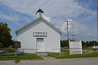
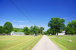
Wurtland is a home rule-class city in Greenup County, Kentucky, United States, along the Ohio River. The population was 995 at the 2010 census. Wurtland is a part of the Huntington-Ashland, WV-KY-OH, Metropolitan Statistical Area (MSA). As of the 2010 census, the MSA had a population of 287,702.

<span class="mw-page-title-main">Hyden, Kentucky</span> City in Kentucky, United States

Hyden is a home rule-class city in and the county seat of Leslie County, Kentucky, United States. The population was 365 at the 2010 census. It is located at the junction of U.S. Route 421 and Kentucky Route 80, along the Middle Fork of the Kentucky River.

<span class="mw-page-title-main">Bradfordsville, Kentucky</span> City in Kentucky, United States

Bradfordsville is a home rule-class city in Marion County, Kentucky, in the United States. The population was 270 at the time of the 2020 census.

<span class="mw-page-title-main">Calhoun, Kentucky</span> City in Kentucky, United States

Calhoun is a home rule-class city in McLean County, Kentucky, United States. The population was 725 at the 2020 census. It is the county seat of McLean County. It is included in the Owensboro, Kentucky Metropolitan Statistical Area.

<span class="mw-page-title-main">Frenchburg, Kentucky</span> City in Kentucky, United States

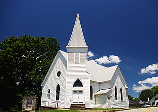
Frenchburg is a home rule-class city in Menifee County, Kentucky, in the United States. The population was 601 at the 2020 census, up from 486 in 2010. It is the seat and only incorporated city in its rural county. It is located at the junction of U.S. Route 460 and Kentucky Route 36. Logging is the primary industry.

<span class="mw-page-title-main">Edmonton, Kentucky</span> City in Kentucky, United States

Edmonton is a home rule-class city in and the county seat of Metcalfe County, Kentucky, United States. It is part of the Glasgow Micropolitan Statistical Area. The population was 1,671 at the 2020 census.

<span class="mw-page-title-main">Jeffersonville, Kentucky</span> City in Kentucky, United States

Jeffersonville is a home rule-class city in Montgomery County, Kentucky, in the United States. The population was 1,708 as of the 2020 census, up from 1,506 in 2010. It is part of the Mount Sterling micropolitan area.

<span class="mw-page-title-main">Mount Sterling, Kentucky</span> City in Kentucky, United States

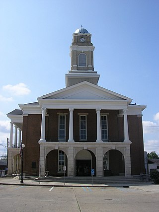
Mount Sterling, often written as Mt. Sterling, is a home rule-class city in Montgomery County, Kentucky, United States. The population was 7,558 as of the 2020 census, up from 6,895 in 2010. It is the county seat of Montgomery County and the principal city of the Mount Sterling micropolitan area.

<span class="mw-page-title-main">Buckhorn, Kentucky</span> City in Kentucky, United States

Buckhorn is a home rule-class city in Perry County, Kentucky, in the United States. The population was 162 at the 2010 census. It is centered on the Buckhorn Presbyterian Church, a log structure listed on the National Register of Historic Places. The Buckhorn Children's Center and Buckhorn Lake State Resort Park are also located here.

<span class="mw-page-title-main">Hazard, Kentucky</span> City in Kentucky, United States

Hazard is a home rule-class city in, and the county seat of, Perry County, Kentucky, United States. The population was 5,263 at the 2020 Census.

<span class="mw-page-title-main">Stanton, Kentucky</span> City in Kentucky, United States

Stanton is a home rule-class city in and the county seat of Powell County, Kentucky, United States. The population was 2,733 at the 2010 census.

<span class="mw-page-title-main">Jamestown, Kentucky</span> City in Kentucky, United States

Jamestown is a home rule-class city in Russell County, Kentucky, in the United States. It is the seat of its county. The population was 1,794 at the 2010 U.S. census.

<span class="mw-page-title-main">Wheatcroft, Kentucky</span> City in Kentucky, United States

Wheatcroft is a home rule-class city in Webster County, Kentucky, United States. The population was 173 at the 2000 census.

References

  1. "2020 U.S. Gazetteer Files". United States Census Bureau. Retrieved March 18, 2022.
  2. "Summary and Reference Guide to House Bill 331 City Classification Reform" (PDF). Kentucky League of Cities. Retrieved December 30, 2014.
  3. 1 2 3 Rennick, Robert M. (1988). "Place Names". Kentucky Place Names. Lexington, Kentucky: The University Press of Kentucky. ISBN   0-8131-0179-4. Retrieved on 2009-06-21
  4. "US Gazetteer files: 2010, 2000, and 1990". United States Census Bureau. February 12, 2011. Retrieved April 23, 2011.
  5. "Census of Population and Housing". Census.gov. Retrieved June 4, 2015.
  6. "U.S. Census website". United States Census Bureau . Retrieved January 31, 2008.
  7. Climate Summary for Clay City, Kentucky