Rockcastle County, Kentucky

Last updated

Rockcastle County
Rockcastle County Kentucky Courthouse.jpg
Rockcastle County courthouse in Mount Vernon
Map of Kentucky highlighting Rockcastle County.svg
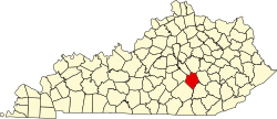
Location within the U.S. state of Kentucky
Kentucky in United States.svg
Kentucky's location within the U.S.
Coordinates: 37°22′N84°19′W / 37.36°N 84.32°W / 37.36; -84.32
CountryFlag of the United States.svg United States
StateFlag of Kentucky.svg  Kentucky
Founded1810
Named for Rockcastle River
Seat Mount Vernon
Largest cityMount Vernon
Area
  Total318 sq mi (820 km2)
  Land317 sq mi (820 km2)
  Water1.6 sq mi (4 km2)  0.5%
Population
 (2020)
  Total16,037
  Estimate 
(2023)
16,190 Increase2.svg
  Density50/sq mi (19/km2)
Time zone UTC−5 (Eastern)
  Summer (DST) UTC−4 (EDT)
Congressional district 5th
Website rockcastlecountyky.com

Rockcastle County is a county located in the southeastern part of the U.S. state of Kentucky. As of the 2020 census, the population was 16,037. [1] Its county seat is Mt. Vernon. [2] The county was founded in 1810 [3] and named for the Rockcastle River, which runs through it. The river, in turn, is named for its majestic rock cliffs. Rockcastle County is part of the Richmond-Berea, KY Micropolitan Statistical Area, which is also included in the Lexington-Fayette–Richmond–Frankfort, KY combined statistical area.

Contents

Geography

According to the United States Census Bureau, the county has a total area of 318 square miles (820 km2), of which 317 square miles (820 km2) is land and 1.6 square miles (4.1 km2) (0.5%) is water. [4]

Adjacent counties

National protected area

Demographics

Historical population
CensusPop.Note
1820 2,249
1830 2,86527.4%
1840 3,40919.0%
1850 4,69737.8%
1860 5,34313.8%
1870 7,14533.7%
1880 9,67035.3%
1890 9,8411.8%
1900 12,41626.2%
1910 14,47316.6%
1920 15,4066.4%
1930 15,149−1.7%
1940 17,16513.3%
1950 13,925−18.9%
1960 12,334−11.4%
1970 12,305−0.2%
1980 13,97313.6%
1990 14,8035.9%
2000 16,58212.0%
2010 17,0562.9%
2020 16,037−6.0%
2023 (est.)16,190 [5] 1.0%
U.S. Decennial Census [6]
1790-1960 [7] 1900-1990 [8]
1990-2000 [9] 2010-2020 [1]

As of the census of 2000, there were 16,582 people, 6,544 households, and 4,764 families residing in the county. The population density was 52 per square mile (20/km2). There were 7,353 housing units at an average density of 23 per square mile (8.9/km2). The racial makeup of the county was 98.81% White, 0.14% Black or African American, 0.24% Native American, 0.13% Asian, 0.01% Pacific Islander, 0.04% from other races, and 0.63% from two or more races. 0.62% of the population were Hispanic or Latino of any race.

There were 6,544 households, out of which 33.60% had children under the age of 18 living with them, 57.90% were married couples living together, 11.40% had a female householder with no husband present, and 27.20% were non-families. 24.40% of all households were made up of individuals, and 10.70% had someone living alone who was 65 years of age or older. The average household size was 2.49 and the average family size was 2.95.

In the county, the population was spread out, with 24.40% under the age of 18, 8.80% from 18 to 24, 30.00% from 25 to 44, 23.60% from 45 to 64, and 13.20% who were 65 years of age or older. The median age was 36 years. For every 100 females there were 97.90 males. For every 100 females age 18 and over there were 94.60 males.

The median income for a household in the county was $23,475 and the median income for a family was $30,278. Males had a median income of $26,770 versus $18,388 for females. The per capita income for the county was $12,337. About 19.10% of families and 23.10% of the population were below the poverty line, including 28.30% of those under age 18 and 21.60% of those age 65 or over.

Politics

Rockcastle County has been a Republican stronghold since its founding. It has only voted for the Democratic presidential nominee four times, in 1868, 1872, 1876, and 1880. It has also never voted for a Democratic candidate from the county's founding in 1810 until 1868.[ citation needed ]

United States presidential election results for Rockcastle County, Kentucky [10]
Year Republican Democratic Third party
No.%No.%No.%
2020 6,57784.49%1,13414.57%730.94%
2016 5,60983.83%91513.68%1672.50%
2012 5,02880.89%1,09717.65%911.46%
2008 4,75775.82%1,41022.47%1071.71%
2004 4,80477.91%1,32021.41%420.68%
2000 3,99276.08%1,17422.37%811.54%
1996 3,10666.80%1,16024.95%3848.26%
1992 3,28767.12%1,14423.36%4669.52%
1988 3,88078.42%1,04121.04%270.55%
1984 4,32879.73%1,08920.06%110.20%
1980 3,54371.62%1,34527.19%591.19%
1976 2,58364.37%1,40835.09%220.55%
1972 3,43777.31%96821.77%410.92%
1968 3,07266.96%86818.92%64814.12%
1964 2,82963.20%1,63136.44%160.36%
1960 3,98277.73%1,14122.27%00.00%
1956 3,78774.08%1,31325.68%120.23%
1952 3,50372.35%1,32627.39%130.27%
1948 3,23670.61%1,30928.56%380.83%
1944 3,80274.03%1,32725.84%70.14%
1940 3,53668.08%1,65231.81%60.12%
1936 3,87571.19%1,56828.81%00.00%
1932 3,57764.29%1,97635.51%110.20%
1928 3,85880.95%90819.05%00.00%
1924 2,71266.24%1,27731.19%1052.56%
1920 3,56170.96%1,43828.66%190.38%
1916 1,93266.28%96833.21%150.51%
1912 1,08243.16%85934.26%56622.58%

Communities

See also

Related Research Articles

<span class="mw-page-title-main">Shelby County, Iowa</span> County in Iowa, United States

Shelby County is a county located in the U.S. state of Iowa. As of the 2020 census, the population was 11,746. The county seat is Harlan. Its name is in honor of Isaac Shelby, the first Governor of Kentucky.

<span class="mw-page-title-main">Wood County, West Virginia</span> County in West Virginia, United States

Wood County is a county in the U.S. state of West Virginia. As of the 2020 census, the population was 84,296, making it West Virginia's fifth-most populous county. Its county seat is Parkersburg. The county was formed in 1798 from the western part of Harrison County and named for James Wood, governor of Virginia from 1796 to 1799.

<span class="mw-page-title-main">Wolfe County, Kentucky</span> County in Kentucky, United States

Wolfe County is a county located in the U.S. state of Kentucky. As of the 2020 census, the population was 6,562. Its county seat is Campton. The county is named for Nathaniel Wolfe.

<span class="mw-page-title-main">Trigg County, Kentucky</span> County in Kentucky, United States

Trigg County is a county located on the far southwestern border of the U.S. state of Kentucky. As of the 2020 census, the population was 14,061. Its county seat is Cadiz. Formed in 1820, the county was named for Stephen Trigg, an officer in the American Revolutionary War who was killed at the Battle of Blue Licks, now in Robertson County, Kentucky. It was a victory for British and allied troops.

<span class="mw-page-title-main">Taylor County, Kentucky</span> County in Kentucky, United States

Taylor County is a county located in the U.S. state of Kentucky. As of the 2020 census, the population was 26,023. Its county seat is Campbellsville. Settled by people from Virginia, Pennsylvania, Maryland, and North Carolina after the American Revolutionary War, the county was organized in 1848 in the Highland Rim region. It is named for United States Army General Zachary Taylor, later President of the United States. Taylor County was the 100th of the 120 counties created by Kentucky. The Campbellsville Micropolitan Statistical Area includes all of Taylor County.

<span class="mw-page-title-main">Russell County, Kentucky</span> County in Kentucky, United States

Russell County is a county located in the U.S. Commonwealth of Kentucky. As of the 2020 census, the population was 17,991. Its county seat is Jamestown and its largest city is Russell Springs. The county was formed on December 14, 1825, from portions of Adair, Cumberland and Wayne Counties and is named for William Russell.

<span class="mw-page-title-main">Robertson County, Kentucky</span> County in Kentucky, United States

Robertson County is a county located in the U.S. Commonwealth of Kentucky. As of the 2020 census, the population was 2,193. Its county seat is Mount Olivet. The county is named for George Robertson, a Kentucky Congressman from 1817 to 1821. It is Kentucky's smallest county by both total area and by population.

<span class="mw-page-title-main">Pulaski County, Kentucky</span> County in Kentucky, United States

Pulaski County is a county in the U.S. Commonwealth of Kentucky. As of the 2020 census, the population was 65,034. Its county seat is Somerset. The county was founded in December 1798 from land given by Lincoln and Green Counties and named for Polish patriot Count Casimir Pulaski. Pulaski County comprises the Somerset, KY Micropolitan Statistical Area. Somerset's population is just over 11,000, but the Micropolitan Area for Somerset/Pulaski County is over 65,000.

<span class="mw-page-title-main">Powell County, Kentucky</span> County in Kentucky, United States

Powell County is a county located in the U.S. Commonwealth of Kentucky. As of the 2020 census, the population was 13,129. Its county seat is Stanton. The county was formed January 7, 1852, by Kentucky Governor Lazarus W. Powell from parts of Clark, Estill, and Montgomery counties. It is no longer a dry county as of 2018. Powell County is home to Natural Bridge State Resort Park and the Red River Gorge Geologic Area, two of Kentucky's most important natural areas and ecotourism destinations, as well as the Pilot Knob State Nature Preserve.

<span class="mw-page-title-main">Nicholas County, Kentucky</span> County in Kentucky, United States

Nicholas County is a county located in the U.S. state of Kentucky. As of the 2020 census, the population was 7,537. Its county seat is Carlisle, which is also the only incorporated community in the county. Founded in 1799, the county is named for Col. George Nicholas, the "Father of the Kentucky Constitution."

<span class="mw-page-title-main">Metcalfe County, Kentucky</span> County in Kentucky, United States

Metcalfe County is a county located in the U.S. state of Kentucky. Its county seat and only municipality is Edmonton. The county was founded in May 1860 and named for Thomas Metcalfe, Governor of Kentucky from 1828 to 1832. Metcalfe County is part of the Glasgow, KY Micropolitan Statistical Area, which is also included in the Bowling Green-Glasgow, KY Combined Statistical Area.

<span class="mw-page-title-main">Lincoln County, Kentucky</span> County in Kentucky, United States

Lincoln County is a county located in south-central Kentucky. As of the 2020 census, the population was 24,275. Its county seat is Stanford. Lincoln County is part of the Danville, KY Micropolitan Statistical Area.

<span class="mw-page-title-main">Lee County, Kentucky</span> County in Kentucky, United States

Lee County is a county located in the U.S. state of Kentucky. As of the 2020 census, the population was 7,395. Its county seat is Beattyville. The county was formed in 1870 from parts of Breathitt, Estill, Owsley and Wolfe counties. The county was named for Robert E. Lee. The area of Kentucky where Lee County is located was a pro-union region of Kentucky but the legislature that created the county was controlled by former Confederates. The town of Proctor, named for the Rev. Joseph Proctor, was the first county seat. The first court was held on April 25, 1870, in the old Howerton House. The local economy at the time included coal mining, salt gathering, timber operations, and various commercial operations. It had a U.S. post office from 1843 until 1918.

<span class="mw-page-title-main">Laurel County, Kentucky</span> County in Kentucky, United States

Laurel County is a county located in the southeastern portion of the U.S. state of Kentucky. As of the 2020 census, the population was 62,613. Its county seat is London. After a special election in January 2016 alcohol sales are permitted only in the city limits of London. The ordinance went into effect on March 27, 2016, 60 days after results of the election. Laurel County is included in the London, KY Micropolitan Statistical Area.

<span class="mw-page-title-main">Hickman County, Kentucky</span> County in Kentucky, United States

Hickman County is a county located in the U.S. state of Kentucky. As of the 2020 census, the population was 4,521, making it the third-least populous county in Kentucky. Its county seat is Clinton. The county was formed in 1821. It is the least densely populated county in the state and is a prohibition or dry county.

<span class="mw-page-title-main">Crittenden County, Kentucky</span> County in Kentucky, United States

Crittenden County is a county in the U.S. state of Kentucky. At the 2020 census, the population was 8,990. Its county seat and only municipality is Marion. The county was formed in 1842 and named for John J. Crittenden, senator and future Governor of Kentucky.

<span class="mw-page-title-main">Carroll County, Kentucky</span> County in Kentucky, United States

Carroll County is a county located in the northern part of the U.S. state of Kentucky. Its county seat is Carrollton. The county was formed in 1838 and named for Charles Carroll of Carrollton, the last living signer of the Declaration of Independence. It is located at the confluence of the Kentucky and Ohio Rivers.

<span class="mw-page-title-main">Carlisle County, Kentucky</span> County in Kentucky, United States

Carlisle County is a county located in the U.S. state of Kentucky. As of the 2020 census, the population was 4,826, making it the fourth-least populous county in Kentucky. Its county seat is Bardwell. The county was founded in 1886 and named for John Griffin Carlisle, a Speaker of the United States House of Representatives from Kentucky. It remains a prohibition or dry county. Carlisle County is included in the Paducah, KY-IL, Metropolitan Statistical Area.

<span class="mw-page-title-main">Marion County, Iowa</span> County in Iowa, United States

Marion County is a county in the U.S. state of Iowa. As of the 2020 census, the population was 33,414. The county seat is Knoxville. It is named for Francis Marion, a brigadier general from South Carolina in the American Revolutionary War.

<span class="mw-page-title-main">Phillips County, Colorado</span> County in Colorado, United States

Phillips County is a county located in the U.S. state of Colorado. As of the 2020 census, the population was 4,530. The county seat is Holyoke. The county was named in honor of R.O. Phillips, a secretary of the Lincoln Land Company, who organized several towns in Colorado.

References

  1. 1 2 "State & County QuickFacts". United States Census Bureau. Retrieved February 26, 2023.
  2. "Find a County". National Association of Counties. Retrieved June 7, 2011.
  3. "Rockcastle County". Archived from the original on July 17, 2019. Retrieved January 30, 2013.
  4. "2010 Census Gazetteer Files". United States Census Bureau. August 22, 2012. Archived from the original on August 12, 2014. Retrieved August 19, 2014.
  5. "Annual Estimates of the Resident Population for Counties: April 1, 2020 to July 1, 2023". United States Census Bureau. Retrieved March 14, 2024.
  6. "U.S. Decennial Census". United States Census Bureau. Retrieved August 19, 2014.
  7. "Historical Census Browser". University of Virginia Library. Retrieved August 19, 2014.
  8. "Population of Counties by Decennial Census: 1900 to 1990". United States Census Bureau. Retrieved August 19, 2014.
  9. "Census 2000 PHC-T-4. Ranking Tables for Counties: 1990 and 2000" (PDF). United States Census Bureau. Archived (PDF) from the original on March 27, 2010. Retrieved August 19, 2014.
  10. Leip, David. "Dave Leip's Atlas of U.S. Presidential Elections". uselectionatlas.org. Retrieved July 5, 2018.

37°22′N84°19′W / 37.36°N 84.32°W / 37.36; -84.32