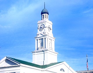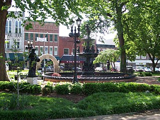
Kentucky, officially the Commonwealth of Kentucky, is a state in the Southeastern region of the United States and one of the states of the Upper South. Kentucky borders Illinois, Indiana, and Ohio to the north; West Virginia and Virginia to the east; Tennessee to the south; and Missouri to the west. The Commonwealth's northern border is defined by the Ohio River. Its capital is Frankfort, and its two largest cities are Louisville and Lexington. The state's population in 2020 was approximately 4.5 million.

Frankfort is the capital city of the Commonwealth of Kentucky and the seat of Franklin County. It is a home rule-class city in Kentucky; the population was 28,602 at the 2020 census. Located along the Kentucky River, Frankfort is the principal city of the Frankfort, Kentucky Micropolitan Statistical Area, which includes all of Franklin and Anderson counties.

Louisville is the largest city in the Commonwealth of Kentucky and the 28th most-populous city in the United States. Louisville is the historical seat and, since 2003, the nominal seat of Jefferson County, on the Indiana border.

Madison County is a county located in the central part of the U.S. state of Kentucky. At the 2020 census, its population was 92,701. Its county seat is Richmond. The county is named for Virginia statesman James Madison, who later became the fourth President of the United States.

Johnson County is a county located in the U.S. state of Kentucky. As of the 2010 census, the population was 23,356. Its county seat is Paintsville. The county was formed in 1843 and named for Richard Mentor Johnson, War of 1812 general, United States Representative, Senator, and Vice President of the United States. Johnson County is classified as a moist county, which is a county in which alcohol sales are not allowed, but containing a "wet" city, in this case Paintsville, where alcoholic beverage sales are allowed.

Owensboro is a home rule-class city in and the county seat of Daviess County, Kentucky, United States. It is the fourth-largest city in the state by population. Owensboro is located on U.S. Route 60 and Interstate 165 about 107 miles (172 km) southwest of Louisville, and is the principal city of the Owensboro metropolitan area. The 2020 census had its population at 60,183. The metropolitan population was estimated at 116,506. The metropolitan area is the sixth largest in the state as of 2018, and the seventh largest population center in the state when including micropolitan areas.

Pineville is a home rule-class city in Bell County, Kentucky, United States. It is the seat of its county. The population was 1,732 as of the 2010 census. It is located on a small strip of land between the Cumberland River and Pine Mountain.

Ashland is a home rule-class city in Boyd County, Kentucky, in the United States. Ashland, the largest city in Boyd County, is located upon a southern bank of the Ohio River. The population was 21,684 at the 2010 census. Ashland is the smaller of two primary cities in the Huntington-Ashland metropolitan area, which is referred to locally as the "Tri-State area" and had a population of 361,487 in 2017, while the Kentucky portion was home to 110,641 in 2017. Ashland serves as an important economic and medical center for northeastern Kentucky and is part of the fifth-largest metropolitan area in Kentucky.

Winchester is a home rule-class city in and the county seat of Clark County, Kentucky, United States. The population was 18,368 at the 2010 census. It is part of the Lexington-Fayette, KY Metropolitan Statistical Area. Winchester is located roughly halfway between Louisville and Ashland.

Covington is a city in Kenton County, Kentucky, United States, located at the confluence of the Ohio and Licking Rivers. Cincinnati, Ohio, lies to its immediate north across the Ohio and Newport, to its east across the Licking and Ludlow to its west. Covington had a population of 40,640 at the time of the 2010 U.S. census, making it the largest city of Northern Kentucky and the fifth-most populous city in the state. It is one of its county's two seats, along with Independence.

Richmond is a home rule-class city in and the county seat of Madison County, Kentucky, United States. It is named after Richmond, Virginia, and is home to Eastern Kentucky University. In 2019, the population was 36,157. Richmond is the third-largest city in the Bluegrass region and the state's sixth-largest city. It is the eighth largest population center in Kentucky, when including metropolitan areas. The city serves as the center for work and shopping for south-central Kentucky. In addition, Richmond is the principal city of the Richmond-Berea, Kentucky Micropolitan Area, which includes all of Madison and Rockcastle counties.

Bowling Green is a home rule-class city and the county seat of Warren County, Kentucky, United States. Founded by pioneers in 1798, Bowling Green was the provisional capital of Confederate Kentucky during the American Civil War. As of the 2020 census, its population of 72,294 made it the third-most-populous city in the state, after Louisville and Lexington; its metropolitan area, which is the fourth largest in the state after Louisville, Lexington, and Northern Kentucky, had an estimated population of 179,240; and the combined statistical area it shares with Glasgow has an estimated population of 233,560.

Northern Kentucky is the third-largest metropolitan area in the U.S. Commonwealth of Kentucky after Louisville and Lexington, and its cities and towns serve as the de facto "south side" communities of Cincinnati, Ohio. The three main counties of this metro area are Boone, Kenton, and Campbell Counties along the Ohio River, with other counties also included. The label "Northern Kentucky" is used to demonstrate the common identity shared across county and city lines by the residents of these northern counties. Arguably, the label seeks to reverse the divisions that occurred to Campbell County, which, in 1794, included the land of Boone, Kenton, Pendleton Counties, and most of Bracken and Grant Counties. The urban and suburban areas of the northern counties are densely populated. Indeed, of Greater Cincinnati's over two million residents, 450,994 of them live in Northern Kentucky, with the three most northern counties contributing 394,163 residents themselves. The largest cities In each of the three most northern counties are Covington, Florence, and Fort Thomas.

UTC−05:00 is an identifier for a time offset from UTC of −05:00. In North America, it is observed in the Eastern Time Zone during standard time, and in the Central Time Zone during the other eight months. The western Caribbean uses it year round.

ABC Television in Western Australia comprises national and local programming on the ABC television network in the Australian state of Western Australia, on a number of channels under the ABC call sign. There is some local programming from the Perth studio.

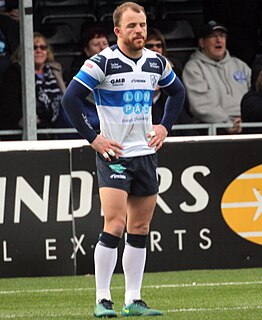
Matty Wildie is a professional rugby league footballer who plays as a hooker, scrum-half and stand-off for Featherstone Rovers in the RFL Championship.

Seal Island is located near Shoalwater, Western Australia in the Perth region.

The Cincinnati metropolitan area is a metropolitan area centered on Cincinnati and including surrounding counties in the U.S. states of Ohio, Kentucky, and Indiana. The area is commonly known as Greater Cincinnati.
Edwin "Ted" Wildie was an Australian rules footballer who played with South Melbourne in the Victorian Football League (VFL).
Hummel is an unincorporated community in Rockcastle County, Kentucky, United States. The community is accessed from Kentucky Route 1786 or U.S. Route 25 via Hummel Road.


