Benham, Kentucky

Last updated

Benham, Kentucky
City Hall Benham KY.png
Benham City Hall
Nickname(s): 
The Little Town That International Harvester, Coal Miners, and Their Families Built
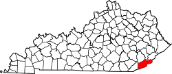
Harlan County Kentucky Incorporated and Unincorporated areas Benham Highlighted 2105662.svg
Location of Benham in Harlan County, Kentucky.
Coordinates: 36°57′53″N82°57′13″W / 36.96472°N 82.95361°W / 36.96472; -82.95361
Country United States
State Kentucky
County Harlan
IncorporatedMarch 7, 1961
Government
  MayorHoward White
Area
[1]
  Total
0.23 sq mi (0.61 km2)
  Land0.23 sq mi (0.61 km2)
  Water0.00 sq mi (0.00 km2)
Elevation
1,591 ft (485 m)
Population
 (2020)
  Total
512
  Density2,188.03/sq mi (843.93/km2)
Time zone UTC-5 (EST)
  Summer (DST) UTC-4 (EDT)
ZIP code
40807
Area code 606
FIPS code 21-05662
GNIS feature ID0486849
Website www.benhamky.org

Benham is a home rule-class city in Harlan County, Kentucky, in the United States. The city was formally incorporated by the General Assembly in 1961. [2] The population was 512 at the 2020 census, [3] up from 500 at the 2010 census.

Contents

History

Benham was originally a company town for International Harvester. The Benham Historic District is on the National Register of Historic Places in recognition of the coal town.

Geography

Benham is located in eastern Harlan County at 36°57′53″N82°57′15″W / 36.96472°N 82.95417°W / 36.96472; -82.95417 (36.964832, -82.954035), [4] in the valley of Looney Creek, between Looney Ridge to the north and Benham Spur to the south. Looney Creek flows west to the Poor Fork of the Cumberland River in neighboring Cumberland.

Kentucky Route 160 is Benham's Main Street, leading west 2.5 miles (4.0 km) to Cumberland and east through Lynch 9 miles (14 km) to the Virginia border at the crest of Black Mountain just north of its summit, the highest point in Kentucky.

According to the United States Census Bureau, Benham has a total area of 0.23 square miles (0.6 km2), all of it land. [5]

Demographics

Historical population
CensusPop.Note
1970 1,000
1980 936−6.4%
1990 717−23.4%
2000 599−16.5%
2010 500−16.5%
2020 5122.4%
U.S. Decennial Census [6]

As of the census [7] of 2000, there were 599 people, 248 households, and 181 families residing in the city. The population density was 1,519.2 inhabitants per square mile (586.6/km2). There were 288 housing units at an average density of 730.4 per square mile (282.0/km2). The racial makeup of the city was 88.81% White, 9.85% African American, 0.33% Native American, 0.17% Asian, 0.33% from other races, and 0.50% from two or more races. Hispanic or Latino of any race were 0.50% of the population.

There were 248 households, out of which 31.0% had children under the age of 18 living with them, 59.3% were married couples living together, 9.7% had a female householder with no husband present, and 27.0% were non-families. 26.6% of all households were made up of individuals, and 19.4% had someone living alone who was 65 years of age or older. The average household size was 2.42 and the average family size was 2.88.

In the city, the population was spread out, with 22.9% under the age of 18, 4.5% from 18 to 24, 24.9% from 25 to 44, 28.2% from 45 to 64, and 19.5% who were 65 years of age or older. The median age was 44 years. For every 100 females, there were 93.9 males. For every 100 females age 18 and over, there were 83.3 males.

The median income for a household in the city was $25,250, and the median income for a family was $33,333. Males had a median income of $35,000 versus $24,844 for females. The per capita income for the city was $16,174. About 18.1% of families and 20.2% of the population were below the poverty line, including 26.8% of those under age 18 and 18.7% of those age 65 or over.

Environmental concerns

In 2010, various city employees and residents expressed concern for the city's relatively high-quality drinking water. While many claimed that the drinking water is cleaner than water anywhere else in the general area, many argued that underground coal mining will contaminate public water supplies for both Benham and the adjacent city of Lynch. [8]

Notable people

See also

Related Research Articles

<span class="mw-page-title-main">Russell County, Kentucky</span> County in Kentucky, United States

Russell County is a county located in the U.S. Commonwealth of Kentucky. As of the 2020 census, the population was 17,991. Its county seat is Jamestown and its largest city is Russell Springs. The county was formed on December 14, 1825, from portions of Adair, Cumberland and Wayne Counties and is named for William Russell.

<span class="mw-page-title-main">Pineville, Kentucky</span> City in Kentucky, United States

Pineville is a home rule-class city in Bell County, Kentucky, United States. It is the seat of its county. The population was 1,732 as of the 2010 census. It is located on a small strip of land between the Cumberland River and Pine Mountain.

<span class="mw-page-title-main">Burkesville, Kentucky</span> City in Kentucky, United States

Burkesville is a home rule-class city in Cumberland County, Kentucky, in the United States. Nestled among the rolling foothills of Appalachia and bordered by the Cumberland River to the south and east, it is the seat of its county. The population was 3,713 at the 2020 census.

<span class="mw-page-title-main">Cumberland, Kentucky</span> City in Kentucky, United States

Cumberland is a home rule-class city in Harlan County, Kentucky, in the United States. The population according to the 2010 Census was 2,237, down from 2,611 at the 2000 census. The city sits at the confluence of Looney Creek and the Poor Fork Cumberland River.

<span class="mw-page-title-main">Evarts, Kentucky</span> City in Kentucky, United States

Evarts is a home rule-class city in Harlan County, Kentucky, in the United States. The post office was opened on February 9, 1855, and named for one of the area's pioneer families. The city was formally incorporated by the state assembly in 1921. The population was 962 at the 2010 census.

<span class="mw-page-title-main">Loyall, Kentucky</span> City in Kentucky, United States

Loyall is a home rule-class city in Harlan County, Kentucky, in the United States. The population was 1,461 as of the 2010 census, up from 766 at the time of the 2000 census.

<span class="mw-page-title-main">Lynch, Kentucky</span> City in Kentucky, United States

Lynch is a home rule-class city in Harlan County, Kentucky, United States. In the 2020 census the city population was 658, down from 747 in 2010.

<span class="mw-page-title-main">Wallins Creek, Kentucky</span> Census-designated place in Kentucky, United States

Wallins Creek is an unincorporated community and census-designated place (CDP) in Harlan County, Kentucky, United States. The population was 156 at the 2010 census, when it was still a city, having dropped from 257 at the 2000 census.

<span class="mw-page-title-main">Old Brownsboro Place, Kentucky</span> City in Jefferson County, Kentucky, United States

Old Brownsboro Place is a home rule-class city in Jefferson County, Kentucky, United States, and a part of the united Metro government. The population was 353 at the 2010 census.

<span class="mw-page-title-main">Spring Valley, Kentucky</span> City in Kentucky, United States

Spring Valley is a home rule-class city in Jefferson County, Kentucky, United States. Spring Valley Estates, begun in 1964, remained an unincorporated area until September, 1983. At that time, the City of Spring Valley was established to provide services. The current mayor is Gerri Willis. The population was 654 at the 2010 census. Population has increased to 837 based on the 2020 census.

<span class="mw-page-title-main">Blackey, Kentucky</span> City in Kentucky, United States

Blackey is an unincorporated community in Letcher County, Kentucky, in the United States. As of the 2010 census, the population was 120. It is located near the early settlement of Indian Bottom. Blackey is thought to have been named after Blackey Brown, one of its citizens.

<span class="mw-page-title-main">Fleming-Neon, Kentucky</span> City in Kentucky, United States

Fleming-Neon also known as Neon, is a home rule-class city in Letcher County, Kentucky, in the United States. The population was 770 at the 2010 census, down from 840 at the 2000 census.

<span class="mw-page-title-main">Jenkins, Kentucky</span> City in Kentucky, United States

Jenkins is a home rule-class city in Letcher County, Kentucky, United States. The population was 2,203 as of the 2010 census.

<span class="mw-page-title-main">Inez, Kentucky</span> City in Kentucky, United States

Inez is a home rule-class city in and the county seat of Martin County, Kentucky, United States. The population was 546 at the 2020 census.

<span class="mw-page-title-main">Stearns, Kentucky</span> Census-designated place in Kentucky, United States

Stearns is an unincorporated community and census-designated place (CDP) in McCreary County, Kentucky, United States. The population was 1,365 at the 2020 census. It was founded by Justus Smith Stearns.

<span class="mw-page-title-main">Edmonton, Kentucky</span> City in Kentucky, United States

Edmonton is a home rule-class city in and the county seat of Metcalfe County, Kentucky, United States. It is part of the Glasgow Micropolitan Statistical Area. The population was 1,671 at the 2020 census.

<span class="mw-page-title-main">Williamsburg, Kentucky</span> City in Kentucky, United States

Williamsburg is a home rule-class city in and the county seat of Whitley County, on the southeastern border of Kentucky, United States. The population was 5,326 at the 2020 census. Developed along the Cumberland River, the city was founded in 1818 and named after William Whitley.

<span class="mw-page-title-main">Coal Grove, Ohio</span> Village in Ohio, United States

Coal Grove is a village in Lawrence County, Ohio, United States, along the Ohio River. The population was 1,889 at the 2020 census. It borders the city of Ironton and lies across the Ohio River from Ashland, Kentucky. It is linked to Ashland by the Ben Williamson Memorial Bridge and Simeon Willis Memorial Bridge.

<span class="mw-page-title-main">Jellico, Tennessee</span> City in Tennessee, United States

Jellico is a city in Campbell County, Tennessee, United States, on the state border with Kentucky, 58 miles (93 km) by road north of Knoxville. The population was 2,355 at the 2010 census.

<span class="mw-page-title-main">Keokee, Virginia</span> Census-designated place in Virginia, United States

Keokee is an unincorporated community and census-designated place (CDP) in Lee County, Virginia, United States. The population was 416 at the 2010 census.

References

  1. "2020 U.S. Gazetteer Files". United States Census Bureau. Retrieved March 18, 2022.
  2. Commonwealth of Kentucky. Office of the Secretary of State. Land Office. "Benham, Kentucky". Accessed 15 July 2013.
  3. "Census.gov". Census.gov. United States Census Bureau. Retrieved April 28, 2023.
  4. "US Gazetteer files: 2010, 2000, and 1990". United States Census Bureau. February 12, 2011. Retrieved April 23, 2011.
  5. "Geographic Identifiers: 2010 Demographic Profile Data (G001): Benham city, Kentucky". American Factfinder. U.S. Census Bureau. Retrieved June 27, 2017.[ dead link ]
  6. "Census of Population and Housing". Census.gov. Retrieved June 4, 2015.
  7. "U.S. Census website". United States Census Bureau . Retrieved January 31, 2008.
  8. "Benham & Lynch Underground Water Reservoirs Threatened". October 4, 2010. Archived from the original on June 15, 2014. Retrieved July 26, 2012.