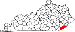
Pine Mountain, Kentucky

Last updated

Pine Mountain, Kentucky
USA Kentucky location map.svg
Red pog.svg
Pine Mountain
Usa edcp location map.svg
Red pog.svg
Pine Mountain
Coordinates: 36°56′55″N83°10′56″W / 36.94861°N 83.18222°W / 36.94861; -83.18222
Country United States
State Kentucky
County Harlan
Elevation
1,745 ft (532 m)
Time zone UTC-5 (Eastern (EST))
  Summer (DST) UTC-4 (EDT)
GNIS feature ID514594 [1]

Pine Mountain is an unincorporated community in Harlan County, Kentucky, United States. It is known as the home of the Pine Mountain Settlement School. A century ago, Pine Mountain was the home of skilled and fluent folk singers, who remembered and sang the songs of their ancestors, handed down through generations. Many of their songs were preserved for posterity by visiting fieldworkers, including Lorraine Wyman and Cecil Sharp, who used the Settlement School as a base.

Pine Mountain once had a post office [2] but it is now closed.

Related Research Articles

<span class="mw-page-title-main">Pineville, Kentucky</span> City in Kentucky, United States

Pineville is a home rule-class city in Bell County, Kentucky, United States. It is the seat of its county. The population was 1,732 as of the 2010 census. It is located on a small strip of land between the Cumberland River and Pine Mountain.

<span class="mw-page-title-main">Elkhorn City, Kentucky</span> City in Kentucky, United States

Elkhorn City is a home rule-class city in Pike County, Kentucky, in the United States. The population was 982 at the 2010 census. The city is located in proximity to the Breaks Interstate Park.

<span class="mw-page-title-main">Munising Township, Michigan</span> Civil township in Michigan, United States

Munising Township is a civil township of Alger County in the U.S. state of Michigan. As of 2020, its population was 2,865.

<span class="mw-page-title-main">Sagola Township, Michigan</span> Civil township in Michigan, United States

Sagola Township is a civil township of Dickinson County in the U.S. state of Michigan. The population was 1,106 at the 2010 census, slightly down from 1,169 at the 2000 census.

<span class="mw-page-title-main">Cumberland River</span> River in Kentucky and Tennessee, United States

The Cumberland River is a major waterway of the Southern United States. The 688-mile-long (1,107 km) river drains almost 18,000 square miles (47,000 km2) of southern Kentucky and north-central Tennessee. The river flows generally west from a source in the Appalachian Mountains to its confluence with the Ohio River near Paducah, Kentucky, and the mouth of the Tennessee River. Major tributaries include the Obey, Caney Fork, Stones, and Red Rivers.

<span class="mw-page-title-main">Tuscarora, Nevada</span> Unincorporated community in the state of Nevada, United States

Tuscarora is an unincorporated community in Elko County, Nevada, United States. The community lies on the east side of the Tuscarora Mountains approximately 40 miles north of Carlin. Tuscarora is part of the Elko Micropolitan Statistical Area. Far from being a ghost town, as several websites proclaim, Tuscarora is home to two schools, a library, a post office and a bar and grill, as well as homes for its very much alive residents.

Stone House is a ghost town in Humboldt County, Nevada, United States.

<span class="mw-page-title-main">Pine Mountain (Appalachian Mountains)</span>

Pine Mountain is a ridge in the Appalachian Mountains running through Kentucky, Virginia and Tennessee. It extends about 125 miles from near Pioneer, Tennessee, to a location near Elkhorn City, Kentucky. Birch Knob, the highest point, is 3,273 feet (998 m) above sea level and is located on the Kentucky-Virginia border. It has long been a barrier to transportation, as the Cumberland River at Pineville, Kentucky is one of only two waterways that pass through the entire ridge. The other is the Clear Fork near Jellico, Tennessee.

<span class="mw-page-title-main">Virgie, Kentucky</span> Census-designated place in Kentucky, United States

Virgie is a Census-designated place (CDP) located along Kentucky Route 1469 in Pike County, Kentucky, United States. Virgie's post office was established as Clintwood on April 3, 1890, with James M. Damron as postmaster. It was later renamed "Virgie" after the daughter of local resident, W.O.B. Ratliff, who was a lawyer and lumber dealer in Pikeville.

<span class="mw-page-title-main">Beveridge, California</span> Unincorporated community in California, United States

Beveridge is an unincorporated community in Inyo County, California. It lies at an elevation of 5587 feet. Beveridge began as a mining town The name honors John Beveridge.

Fairport is a former settlement in Modoc County, California. For 20 years, Fairport was a thriving resort community, and the supply and departure depot for the High Grade Mining District in the Warner Mountains.

Slade is an unincorporated community in Powell County, Kentucky, United States. Their post office closed in 2004.

<span class="mw-page-title-main">Strawberry, Nevada</span> Ghost town in Nevada, United States

Strawberry is a ghost town in White Pine County in the U.S. state of Nevada along Nevada State Route 892. The town was known for its 12,000-tree orchard and huge fields of strawberries. Strawberry is mainly used today as a ranching settlement. The post office was in operation from 1899 until 1938.

Typo is an unincorporated community within Perry County, Kentucky, United States. Its post office has been closed.

<span class="mw-page-title-main">Cromona, Kentucky</span> Unincorporated community in Kentucky, United States

Cromona is a small unincorporated community located in the mountains of Eastern Kentucky in Letcher County, Kentucky, United States. The Cromona post office has operated since 1916. Cromona is actually known as Haymond by the local residents. However, for reasons that are obscure, the post office was given a different name, Cromona. It was built as a coal town in 1916, and was named for the president of the Elk Horn Coal Corporation, Thomas S. Haymond. The population of Haymond was 502 as of the 2010 census.

Smith is an unincorporated community in Harlan County, Kentucky, United States. The community lies along Kentucky State Route 987 and the Martins Fork of the Cumberland River. Smith is also home to Martins Fork Lake. The lake was constructed by the US Army Corps of Engineers as part of several flood control projects along the Cumberland River. The dam was complete and functional in November 1978. Until the early 1970s the community was served by Smith Elementary School. When plans were being made for construction to Martins Fork Lake, the school was closed and students were sent to nearby Cawood Elementary. The community post office was closed in the early 1990s. The community today is served by four churches. Pace Chapel, New Riverside Baptist Church, Full-Gospel Pentecostal Church and Faith-Holiness Church.

Pine Grove is an unincorporated community located in Clark County, Kentucky, United States. Its post office is closed.

Nesco is an unincorporated community and census-designated place (CDP) located in Mullica Township, Atlantic County, in the U.S. state of New Jersey.

Clover Bottom is an unincorporated community located in northern Jackson County, Kentucky, United States. The community is located along US 421 at its intersection with Kentucky Route 1955. It is 3.4 miles northwest of Sandgap and 9.3 miles southeast of Berea. The community is addressed to McKee's ZIP code 40447, despite being past Sandgap, which has its own post office with ZIP code 40481, which partially serves the area around Clover Bottom.

<span class="mw-page-title-main">Dango, Kentucky</span> Unincorporated community in Kentucky, United States

Dango is a ghost town located in southwestern Jackson County, Kentucky, United States. The town was located at the confluence of Racoon Creek and Horse Lick Creek, which flows into the Rockcastle River. It is located southwest of McKee by 8 miles, and 2.7 miles southeast of another ghost town, Loam. Near the confluence of the two creeks is the historical Carpenter School, which may be named after Carpenter Ridge, of which it is two miles south of. Heavy settlement and farming occurred in the area around Horse Lick Creek, where Dango was, until the early 1900s. The area where Dango was is currently occupied by the Daniel Boone National Forest, known as the Horse Lick Creek Biopreserve, with the majority of ownership being private.

References