Darby Coal Mining Camp, Kentucky

Last updated
Darby Coal Mining Camp
Unincorporated community
USA Kentucky location map.svg
Red pog.svg
Darby Coal Mining Camp
Usa edcp location map.svg
Red pog.svg
Darby Coal Mining Camp
Coordinates: 36°51′41″N83°10′18″W / 36.86139°N 83.17167°W / 36.86139; -83.17167 Coordinates: 36°51′41″N83°10′18″W / 36.86139°N 83.17167°W / 36.86139; -83.17167
Country United States
State Kentucky
County Harlan
Elevation 1,499 ft (457 m)
Time zone Eastern (EST) (UTC-5)
  Summer (DST) EDT (UTC-4)
GNIS feature ID 2565594 [1]

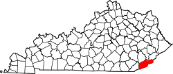
Darby Coal Mining Camp was an unincorporated community and coal town in Harlan County, Kentucky, United States.

Unincorporated area Region of land not governed by own local government

In law, an unincorporated area is a region of land that is not governed by a local municipal corporation; similarly an unincorporated community is a settlement that is not governed by its own local municipal corporation, but rather is administered as part of larger administrative divisions, such as a township, parish, borough, county, city, canton, state, province or country. Occasionally, municipalities dissolve or disincorporate, which may happen if they become fiscally insolvent, and services become the responsibility of a higher administration. Widespread unincorporated communities and areas are a distinguishing feature of the United States and Canada. In most other countries of the world, there are either no unincorporated areas at all, or these are very rare; typically remote, outlying, sparsely populated or uninhabited areas.

A coal town, also known as a coal camp or patch is typically situated in a remote place and provides residences for a population of miners to reside near a coal mine. A coal town is a type of company town or mining community established by the employer, a mining company, which imports workers to work the mineral find. The 'town founding' process is not limited to coal mining, nor mining, but is generally found where mineral wealth is located in a remote or undeveloped area, which is then opened for exploitation, normally first by having some transportation infrastructure brought into being first. Often, such minerals were the result of logging operations by pushing into a wilderness forest, which clear-cutting operations then allowed geologists and cartographers, to chart and plot the lands, allowing efficient discovery of natural resources and their exploitation.

Harlan County, Kentucky County in the United States

Harlan County is a county located in southeastern Kentucky. As of the 2010 census, the population was 29,278. Its county seat is Harlan.

Related Research Articles

McCreary County, Kentucky County in the United States

McCreary County is a county located in the U.S. state of Kentucky. As of the 2010 census, the population was 18,306. Its county seat is Whitley City. The county is named for James B. McCreary, a Confederate war hero and two-time Governor of Kentucky. During his second term as Governor, McCreary County was created by the Legislature and was named in his honor.

Western Coal Field

The West Kentucky Coal Field comprises an area in the west-central and northwestern part of the state, bounded by the Dripping Springs Escarpment and the Pennyroyal Plateau and the Ohio River, but is part of the Illinois Basin that extends into Indiana and Illinois. It is characterized by Pennsylvanian age sandstones, shales and coal. Nearly all of the counties in the area are part of the television market known as the Kentucky–Illinois–Indiana tri-state area.

Black Mountain (Kentucky) mountain peak of the Cumberland Mountains in the Appalachian Mountains of North America

Black Mountain is the highest mountain peak in the Commonwealth of Kentucky, United States, with a summit elevation of 4,145 feet (1,263 m) above mean sea level and a top-to-bottom height of over 2,500 feet (760 m). The summit is located at approximately 36°54′51″N82°53′38″W in Harlan County, Kentucky near the Virginia border, just above the towns of Lynch, Kentucky and Appalachia, Virginia. It is about 500 feet (150 m) taller than any other mountain in Kentucky.

Mountaintop removal mining form of surface mining that involves the mining of the summit or summit ridge of a mountain

Mountaintop removal mining (MTR), also known as mountaintop mining (MTM), is a form of surface mining at the summit or summit ridge of a mountain. Coal seams are extracted from a mountain by removing the land, or overburden, above the seams. This method of coal mining is conducted in the Appalachian Mountains in the eastern United States. Explosives are used to remove up to 400 vertical feet of mountain to expose underlying coal seams. Excess rock and soil is dumped into nearby valleys, in what are called "holler fills" or "valley fills". Less expensive to execute and requiring fewer employees, mountaintop removal mining began in Appalachia in the 1970s as an extension of conventional strip mining techniques. It is primarily occurring in Kentucky, West Virginia, Virginia, and Tennessee.

Surface mining broad category of mining

Surface mining, including strip mining, open-pit mining and mountaintop removal mining, is a broad category of mining in which soil and rock overlying the mineral deposit are removed, in contrast to underground mining, in which the overlying rock is left in place, and the mineral is removed through shafts or tunnels.

Drift mining is either the mining of an ore deposit by underground methods, or the working of coal seams accessed by adits driven into the surface outcrop of the coal bed. A drift mine is an underground mine in which the entry or access is above water level and generally on the slope of a hill, driven horizontally into the ore seam. Random House dictionary says the origin of the term "drift mine" is an Americanism, circa 1885–1890.

The Darby Mine No. 1 disaster in Harlan County, Kentucky, USA, on May 20, 2006 killed five miners and left one survivor.

Kentucky Camp, Arizona human settlement in United States of America

Kentucky Camp is a ghost town and former mining camp along the Arizona Trail in Pima County, Arizona, United States, near the community of Sonoita. The Kentucky Camp Historic District is listed on the National Register of Historic Places and has been since 1995. As it is located within Coronado National Forest, the United States Forest Service is responsible for the upkeep of the remaining buildings within the Kentucky Camp Historic District.

Stone, Kentucky Unincorporated community in Kentucky, United States

Stone is an unincorporated community and coal town in Pike County, Kentucky, United States. It was established in 1912. Stone was a mining community named for Galen Stone, head of the Pond Creek Coal Company which was based in Stone. In 1922 the Pond Creek Coal Company was sold to Fordson Coal Company, which was a subsidiary of Ford Motor Company. In 1936 Fordson sold the mine at Stone to Eastern Coal Company.

Blue Heron, Kentucky Coal town in Kentucky, United States

Blue Heron, also known as Mine 18, is a former coal mining community or coal town on the banks of the Big South Fork of the Cumberland River in McCreary County, Kentucky, United States, that has been recreated and is maintained as an interpretive history area in the Big South Fork National River and Recreation Area.

The Pittsburg-Weir Coalfield, also known as Weir-Pittsburg Coalfield and Cherokee Coalfield, is a coalfield located in Cherokee and Crawford counties in the southeast corner of Kansas.

Packard, Kentucky Ghost town in Kentucky, United States

Packard is a ghost town in Whitley County, Kentucky, United States. Packard was located 7 miles (11 km) southeast of Williamsburg. It was founded as a mining camp by the Thomas B. Mahan family around 1900. Packard's population is thought to have reached at one point nearly 400 residents. The community was a coal town which served the Packard Coal Company; the community and the company were named after Whitley County school teacher Amelia Packard. Packard once had a railway station on the Louisville and Nashville Railroad as well as a post office, which opened on November 27, 1908.

Kentucky Coal Museum Heritage center in Benham, Kentucky

The Kentucky Coal Museum is heritage center located in Benham, Kentucky. Its focus is the history of the coal industry in Eastern Kentucky, featuring specific exhibits on the company towns of Benham and neighboring Lynch. It is housed in a former company store that was built by International Harvester in 1923. In June 1990, the Tri-City Chamber of Commerce purchased the building for the future site of the museum. After receiving additional grants from the state of Kentucky, the museum opened in May 1994.

Coal was discovered in Kentucky in 1750. Since the first commercial coal mine opened in 1820 coal has gained both economic importance and controversy regarding its environmental consequences. As of 2010 there were 442 operating coal mines in the state, and as of 2017 there are less than 4,000 underground coalminers.

Barthell, Kentucky Coal town in Kentucky, United States

Barthell is a former coal town in McCreary County, Kentucky, United States. It was established in 1902 and was the first of 18 mining camps to be built by the Stearns Coal and Lumber Company. It now serves as an open-air history museum, which is open from April through Thanksgiving.

Uz, Kentucky Unincorporated community in Kentucky, United States

Uz was an unincorporated community in Letcher County, Kentucky, United States. Despite the appearance that it would rhyme with "buzz", the area was a mining camp for the U Z Mines, and is pronounced "you-zee". Uz has been noted for its short name.

Dekoven, Kentucky Unincorporated community in Kentucky, United States

Dekoven is an unincorporated community and coal town in Union County, Kentucky, United States.

Closplint, Kentucky Unincorporated community in Kentucky, United States

Closplint is an unincorporated community in Harlan County, Kentucky, United States. The settlement was named Cloversplint after the seam of coal and the mining company that built it as a coal town in 1926 , and operated there between 1928 and 1946 . When the United States Postal Service established a post office, the name was shortened to Closplint.
Black Star Coal Camp, Kentucky Unincorporated community in Kentucky, United States

Black Star Coal Camp is an unincorporated community and coal town in Harlan County, Kentucky, United States.

References