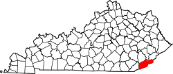
Smith, Kentucky

Last updated
Smith, Kentucky
USA Kentucky location map.svg
Red pog.svg
Smith
Usa edcp location map.svg
Red pog.svg
Smith
Coordinates: 36°44′9″N83°15′34″W / 36.73583°N 83.25944°W / 36.73583; -83.25944 Coordinates: 36°44′9″N83°15′34″W / 36.73583°N 83.25944°W / 36.73583; -83.25944
Country United States
State Kentucky
County Harlan
Elevation
1,355 ft (413 m)
Time zone UTC-5 (Eastern (EST))
  Summer (DST) UTC-4 (EDT)
GNIS feature ID509083 [1]

Smith is an unincorporated community in Harlan County, Kentucky, United States. The community lies along Kentucky State Route 987 and the Martins Fork of the Cumberland River. Smith is also home to Martins Fork Lake. The lake was constructed by the US Army Corps of Engineers as part of several flood control projects along the Cumberland River. The dam was complete and functional in November 1978. Until the early 1970s the community was served by Smith Elementary School. When plans were being made for construction to Martins Fork Lake, the school was closed and students were sent to nearby Cawood Elementary. The community post office was closed in the early 1990s. The community today is served by four churches. Pace Chapel, New Riverside Baptist Church, Full-Gospel Pentecostal Church and Faith-Holiness Church. [2]

Related Research Articles

Annville, Kentucky Census-designated place in Kentucky, United States

Annville is an unincorporated community and census-designated place (CDP) in Jackson County, Kentucky, United States. The population was 1,095 at the 2010 census. The community was named for local resident Nancy Ann Johnson. It is the largest community in Jackson County.

Carthage, Tennessee Town in Tennessee, United States

Carthage is a town in and the county seat of Smith County, Tennessee, United States; it is part of the Nashville Metropolitan Statistical Area. The population was 2,306 at the 2010 census. It is located on the Cumberland River, which was important to its early development. It is likely best known as the hometown of former Vice President and Senator Al Gore of the Democratic Party and his father, Senator Albert Gore, Sr. The younger Gore announced his 1988 and 2000 presidential bids, as well as his 1992 vice-presidential bid, from the steps of the Smith County Courthouse.

Cumberland River River in Kentucky and Tennessee, United States

The Cumberland River is a major waterway of the Southern United States. The 688-mile-long (1,107 km) river drains almost 18,000 square miles (47,000 km2) of southern Kentucky and north-central Tennessee. The river flows generally west from a source in the Appalachian Mountains to its confluence with the Ohio River near Paducah, Kentucky, and the mouth of the Tennessee River. Major tributaries include the Obey, Caney Fork, Stones, and Red rivers.

Levisa Fork Is a tributary of the Big Sandy River in sw Virginia and eastern Kentucky in the US

The Levisa Fork is a tributary of the Big Sandy River, approximately 164 miles (264 km) long, in southwestern Virginia and eastern Kentucky in the United States.

Caney Fork River

The Caney Fork River is a river that flows through central Tennessee in the United States, draining a substantial portion of the southwestern Cumberland Plateau and southeastern Highland Rim regions. It is a major tributary of the Cumberland River, and is part of the Cumberland, Ohio and Mississippi basins. The river is 143 miles (230 km) long, and its watershed covers 1,771 square miles (4,590 km2) in eleven counties. Monterey, Baxter, Sparta, Smithville, McMinnville, Altamont, Spencer and Gordonsville are among the towns that are at least partially drained by the river.

Tomahawk is an unincorporated community that stretches along Kentucky Route 40 in Martin County, Kentucky, United States, in the eastern part of the state near the West Virginia border. It is located on Rockhouse Fork of Rockcastle Creek, approximately six miles (9.6 km) west of Inez, the county seat.

Helmer, Michigan Unincorporated community in Michigan, United States

Helmer is an unincorporated community in Luce County in the U.S. state of Michigan. The community is located within Lakefield Township. As an unincorporated community, Helmer has no legally defined boundaries or population statistics of its own.

Quick, West Virginia Unincorporated community in West Virginia, United States

Quick is a small unincorporated community in Kanawha County, West Virginia, United States. It is located along Indian Creek Road. The community is where Whitoak Fork and Blue Creek come together and meet. It is also where the abandoned railroad that follows Blue Creek joins the road, and follows it all the way to the community of Hitop, along Pond Fork. Its post office is closed.

Blue Heron, Kentucky Coal town in Kentucky, United States

Blue Heron, also known as Mine 18, is a former coal mining community or coal town on the banks of the Big South Fork of the Cumberland River in McCreary County, Kentucky, United States, that has been recreated and is maintained as an interpretive history area in the Big South Fork National River and Recreation Area.

Tuckasegee, North Carolina Unincorporated community in North Carolina, United States

Tuckasegee, named after the historic Cherokee town of that name located near here, is an unincorporated community in Jackson County, North Carolina, United States. It followed the earlier Cherokee town as developing on the upper Tuckaseegee River, at the confluence of its East and West forks.

Cawood, Kentucky Census-designated place in Kentucky, United States

Cawood is a census-designated place (CDP) and coal town in Harlan County, Kentucky, United States. The population was 731 at the 2010 census.

Cromona, Kentucky Unincorporated community in Kentucky, United States

Cromona is a small unincorporated community located in the mountains of Eastern Kentucky in Letcher County, Kentucky, United States. The Cromona post office has operated since 1916. Cromona is actually known as Haymond by the local residents. However, for reasons that are obscure, the post office was given a different name, Cromona. It was built as a coal town in 1916, and was named for the president of the Elk Horn Coal Corporation, Thomas S. Haymond. The population of Haymond was 502 as of the 2010 census.

Oven Fork, Kentucky Unincorporated community in Kentucky, United States

Oven Fork is an unincorporated community in Letcher County, Kentucky. Oven Fork is located on U.S. Route 119 and the Cumberland River 4.2 miles (6.8 km) south of Whitesburg. Oven Fork had a post office from 1948 to 1993.

Coxton, Kentucky Census-designated place in Kentucky, United States

Coxton is an unincorporated coal town and census-designated place (CDP) in Harlan County, Kentucky, United States. Their post office is closed. The community was listed as a CDP in 2014, so no population figures are available from the 2010 census.

Locust, Kentucky Unincorporated community in Kentucky, United States

Locust is an unincorporated community located in Carroll County, Kentucky, United States. Its post office is closed.

Blackmont, Kentucky Unincorporated community in Kentucky, United States

Blackmont is an unincorporated community in Bell County, Kentucky, United States. At one time it was called Hulen. Its post office is closed.

Cropper, Kentucky Unincorporated community in Kentucky, United States

Cropper is an unincorporated community within Shelby County, Kentucky, United States. It was also known as Croppers Depot. Their post office is closed. The town of Cropper is located in northeast Shelby County, Kentucky. The origin of its name comes from the town's founder James Cropper, a blacksmith and store keeper who was the first person to build a house there sometime in the 1790s. He also was the town's first postmaster. The majority of Cropper's original citizens were members of the Low Dutch colony who were in the area as early as 1786. In 1807, a new group of settlers from Virginia increased the town's population. In 1855, the Louisville and Nashville Railroad along with a depot opened on the east end of town. A hotel soon opened afterwards. This railroad line was closed in the early 1970s. Another occurrence, in 1855, was the founding of Union Grove Church. This church had three different denominations that included Christian, Methodist and Baptist. The only cemetery in Cropper is on the church grounds. In June 1900, the Baptist separated from the Union Church, and by 1903 it had its own building. In 1967, the Union Grove Church was renamed Cropper Christian Church. In 1905, a bank was opened by Ben Allen Thomas, but it was closed in 1921. An 1882 map shows the first school in Cropper which was a large two-story building with grades one through twelve. It burned in 1951 and was replaced with a one-story elementary school. The team mascot was the Yellow Jackets.

Speedwell, Kentucky Unincorporated community in Kentucky, United States

Speedwell is an unincorporated community located in Madison County, Kentucky, United States. Its post office is closed.

Martins Fork (Cumberland River tributary)

Martins Fork is a 32-mile (51 km) river in Bell and Harlan Counties in Kentucky in the United States. The river flows east and north from its source in the Cumberland Mountains, a subrange of the Appalachian Mountains, to its confluence with the Clover Fork at Harlan. The confluence marks the official beginning of the Cumberland River.

Collins Creek, also known as Collins Fork, is a tributary of Goose Creek in Clay County in the U.S. state of Kentucky. It is 9 miles (14 km) long; is named for its first settler James Collins, a salt maker and hunter; joins Goose just south of Garrard; and is paralleled by road and railway for most of its course.

References