Coldiron, Kentucky

Last updated

Coldiron, Kentucky
USA Kentucky location map.svg
Red pog.svg
Coldiron
Usa edcp location map.svg
Red pog.svg
Coldiron
Coordinates: 36°49′36″N83°27′13″W / 36.82667°N 83.45361°W / 36.82667; -83.45361
Country United States
State Kentucky
County Harlan
Area
[1]
  Total0.24 sq mi (0.63 km2)
  Land0.22 sq mi (0.57 km2)
  Water0.03 sq mi (0.07 km2)
Elevation
1,132 ft (345 m)
Population
 (2020)
  Total222
  Density1,018.35/sq mi (392.78/km2)
Time zone UTC-5 (Eastern (EST))
  Summer (DST) UTC-4 (EDT)
ZIP code
40819 [2]
Area code 606
GNIS feature ID489796 [3]

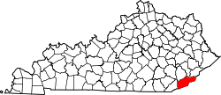
Coldiron is a census-designated place and unincorporated community in Harlan County, Kentucky, United States. Its population was 222 as of the 2020 census. [4]

Demographics

Historical population
CensusPop.Note
2010 223
2020 222−0.4%
U.S. Decennial Census [4]

Related Research Articles

<span class="mw-page-title-main">Webster County, Kentucky</span> County in Kentucky, United States

Webster County is a county located in the U.S. state of Kentucky. As of the 2020 census, the population was 13,017. Its county seat is Dixon and its largest city is Providence. It is the southernmost county in the Evansville, IN–KY Metropolitan Statistical Area. The county was formed in 1860 from parts of Henderson, Hopkins, and Union Counties and named for American statesman Daniel Webster (1782-1852). It was mainly pro-Confederate during the American Civil War and was the site of several skirmishes and some guerrilla warfare. Since 2018 it has been a moist county, with Providence and Sebree voting to allow alcohol sales, and Clay doing so in 2022.

<span class="mw-page-title-main">Marion County, Kentucky</span> County in Kentucky, United States

Marion County is a county in the U.S. state of Kentucky. As of the 2020 census, the total population was 19,581. Its county seat is Lebanon. The county was founded in 1834 and named for Francis Marion, the American Revolutionary War hero known as the "Swamp Fox".

<span class="mw-page-title-main">Madison County, Kentucky</span> County in Kentucky, United States

Madison County is a county located in the central part of the U.S. state of Kentucky. At the 2020 census, its population was 92,701. Its county seat is Richmond. The county is named for Virginia statesman James Madison, who later became the fourth President of the United States.

<span class="mw-page-title-main">Anderson County, Kentucky</span> County in Kentucky, United States

Anderson County, located in the Outer Bluegrass physiographic region, is Kentucky's 48th most populated and ninth fastest-growing county.

<span class="mw-page-title-main">Florence, Kentucky</span> City in Kentucky, United States

Florence is a home rule-class city in Boone County, Kentucky, United States. The population was 31,946 at the 2020 census. It is the second largest city in Northern Kentucky, the eighth-largest city in Kentucky and the state's largest that is not a county seat. Florence is part of the Cincinnati metropolitan area.

<span class="mw-page-title-main">Highland Heights, Kentucky</span> City in Kentucky, United States

Highland Heights is a home rule-class city in Campbell County, Kentucky, in the United States. The population was 6,662 at the 2020 census.

<span class="mw-page-title-main">Manchester, Kentucky</span> City in Kentucky, United States

Manchester is a home rule-class city in Clay County, Kentucky, in the United States. It is the seat of its county and the home of a minimum- and medium-security federal prison. The city's population was 1,255 at the 2010 census.

<span class="mw-page-title-main">Irvine, Kentucky</span> City in Kentucky, United States

Irvine is a home rule-class city in Estill County, Kentucky, in the United States. It is the seat of its county. Its population was 2,715 at the time of the 2010 census.

<span class="mw-page-title-main">Flemingsburg, Kentucky</span> City in Kentucky, United States

Flemingsburg is a home rule-class city in Fleming County, Kentucky, in the United States. The population was 2,658 at the 2010 census, down from 3,010 at the 2000 census. It is the seat of Fleming County.

<span class="mw-page-title-main">Lancaster, Kentucky</span> City in Kentucky, United States

Lancaster is a home rule-class city in Garrard County, Kentucky, in the United States. It is the seat of its county. As of the year 2020 U.S. census, the city population was 3,901.

<span class="mw-page-title-main">Brandenburg, Kentucky</span> City in Kentucky, United States

Brandenburg is a home rule-class city on the Ohio River in Meade County, Kentucky, in the United States. The city is 40 miles (64 km) southwest of Louisville. It is the seat of its county. The population was 2,894 at the 2020 census.

<span class="mw-page-title-main">Harrodsburg, Kentucky</span> City in Kentucky, United States

Harrodsburg is a home rule-class city in Mercer County, Kentucky, United States. It is the seat of its county. The population was 9,064 at the 2020 census.

<span class="mw-page-title-main">Edmonton, Kentucky</span> City in Kentucky, United States

Edmonton is a home rule-class city in and the county seat of Metcalfe County, Kentucky, United States. It is part of the Glasgow Micropolitan Statistical Area. The population was 1,671 at the 2020 census.

<span class="mw-page-title-main">Tompkinsville, Kentucky</span> City in Kentucky, United States

Tompkinsville is a home rule-class city in and the county seat of Monroe County, Kentucky, United States. The population was 2,309 at the 2020 census. The city was named after Vice President Daniel D. Tompkins who served under President James Monroe, for whom the county was named.

<span class="mw-page-title-main">Hazard, Kentucky</span> City in Kentucky, United States

Hazard is a home rule-class city in, and the county seat of, Perry County, Kentucky, United States. The population was 5,263 at the 2020 Census.

<span class="mw-page-title-main">East South Central states</span> Region of the United States

The East South Central states is a region constituting one of the nine U.S. Census Bureau divisions. It is located within the American South. Four states make up the division: Alabama, Kentucky, Mississippi and Tennessee. The division is one of three that together make up the larger region known as the Southern United States.

<span class="mw-page-title-main">Louisville metropolitan area</span> Geographic region surrounding Louisville, KY, USA

The Louisville metropolitan area is the 43rd largest metropolitan statistical area (MSA) in the United States. It had a population of 1,395,855 in 2020 according to the latest official census, and its principal city is Louisville, Kentucky.

<span class="mw-page-title-main">Kentucky's 6th congressional district</span> U.S. House district for Kentucky

Kentucky's 6th congressional district is a congressional district in the U.S. state of Kentucky. Based in Central Kentucky, the district contains the cities of Lexington, Richmond, and Georgetown. The district is currently represented by Republican Andy Barr.

<span class="mw-page-title-main">Pathfork, Kentucky</span> Unincorporated community in Kentucky, United States

Pathfork is an unincorporated community and census-designated place (CDP) in Harlan County, Kentucky, United States, located to the south bank of Wallins Creek. Its population was 379 as of the 2010 census. The community's main roads are East Hwy 72, which connects from US 119, and travels to an end at Old RB Mines, however, 72 runs to Harlan via gravel road, and Ky 2005 an old gravel road that leads to Smith/Brownies Creek, south of Harlan, Kentucky.

References

  1. "2020 U.S. Gazetteer Files". United States Census Bureau. Retrieved March 18, 2022.
  2. "Coldiron KY ZIP Code". zipdatamaps.com. 2023. Retrieved June 16, 2023.
  3. "Coldiron". Geographic Names Information System . United States Geological Survey, United States Department of the Interior.
  4. 1 2 "Coldiron CDP, Kentucky — Census Bureau Profile". Census.gov. Retrieved April 29, 2022.