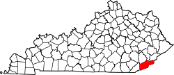
Grays Knob, Kentucky

Last updated

Grays Knob, Kentucky
USA Kentucky location map.svg
Red pog.svg
Grays Knob
Usa edcp location map.svg
Red pog.svg
Grays Knob
Coordinates: 36°48′24″N83°18′36″W / 36.80667°N 83.31000°W / 36.80667; -83.31000
Country United States
State Kentucky
County Harlan
Elevation
1,299 ft (396 m)
Time zone UTC-6 (Central (CST))
  Summer (DST) UTC-5 (CST)
ZIP codes
40829
GNIS feature ID493217 [1]

Grays Knob is an unincorporated community and coal town in Harlan County, Kentucky, United States.

A post office was established in the community in 1916, and named for a local hill. [2] It is located just south of the city of Harlan.

Related Research Articles

<span class="mw-page-title-main">Harlan County, Kentucky</span> County in Kentucky, United States

Harlan County is a county located in southeastern Kentucky. As of the 2020 census, the population was 26,831. Its county seat is Harlan. It is classified as a moist county—a county in which alcohol sales are prohibited, but containing a "wet" city, in this case Cumberland, where package alcohol sales are allowed. In the city of Harlan, restaurants seating 100+ may serve alcoholic beverages.

<span class="mw-page-title-main">Harlan, Kentucky</span> City in Kentucky, United States

Harlan is a home rule-class city in and the county seat of Harlan County, Kentucky, United States. The population was 1,745 at the 2010 census, down from 2,081 at the 2000 census.

<span class="mw-page-title-main">Cumberland River</span> River in Kentucky and Tennessee, United States

The Cumberland River is a major waterway of the Southern United States. The 688-mile-long (1,107 km) river drains almost 18,000 square miles (47,000 km2) of southern Kentucky and north-central Tennessee. The river flows generally west from a source in the Appalachian Mountains to its confluence with the Ohio River near Paducah, Kentucky, and the mouth of the Tennessee River. Major tributaries include the Obey, Caney Fork, Stones, and Red Rivers.

Floyds Knobs is a small unincorporated community in Lafayette Township, Floyd County, Indiana, United States. Historically a farming community on the outskirts of New Albany, it has since become a bedroom community for Louisville, Kentucky. It contains subdivisions, farms, small shopping centers, churches, and transmitters for many of the area's television and radio stations. It is also the location of Floyd Central High School.

Kingdom Come State Park is a part of Kentucky's state park system in Harlan County atop Pine Mountain near the city of Cumberland. It was named after the 1903 best-selling novel The Little Shepherd of Kingdom Come by native Kentuckian John Fox, Jr. Features of the park include Raven Rock, Log Rock, and a 3.5-acre (1.4 ha) mountain lake. The section of the park is also a legally dedicated state nature preserve by the Office of Kentucky Nature Preserves.

Harlan Hubbard was an American artist and writer, known for his simple lifestyle.

<span class="mw-page-title-main">Pathfork, Kentucky</span> Unincorporated community in Kentucky, United States

Pathfork is an unincorporated community and census-designated place (CDP) in Harlan County, Kentucky, United States, located to the south bank of Wallins Creek. Its population was 379 as of the 2010 census. The community's main roads are East Hwy 72, which connects from US 119, and travels to an end at Old RB Mines, however, 72 runs to Harlan via gravel road, and Ky 2005 an old gravel road that leads to Smith/Brownies Creek, south of Harlan, Kentucky.

'Knob Lick' is an unincorporated community in Metcalfe County, Kentucky, United States. Knob Lick is located on Kentucky Route 70, 8 miles (13 km) northwest of Edmonton. Knob Lick has a post office with ZIP code 42154.

Knob Lick is an unincorporated community in Estill County, Kentucky, United States. Knob Lick is 9 miles (14 km) west-southwest of Irvine.

Molus is an unincorporated community in Harlan County, Kentucky, United States. The Molus Post Office is closed.

Baxter is an unincorporated community in Harlan County, Kentucky, United States.

Cawood is a census-designated place (CDP) and coal town in Harlan County, Kentucky, United States. The population was 731 at the 2010 census.

Brookside is an unincorporated community and coal town in Harlan County, Kentucky, United States.

Ages is an unincorporated coal town and census-designated place (CDP) in Harlan County, Kentucky, United States.

Coxton is an unincorporated coal town and census-designated place (CDP) in Harlan County, Kentucky, United States. Their post office is closed. The community was listed as a CDP in 2014, so no population figures are available from the 2010 census.

Kildav is an unincorporated community and coal town in Harlan County, Kentucky, United States. Its post office is closed. The name is a combination of Killebrew and Davis, owners of the King Harlan Coal Company.

Sunshine is an unincorporated community in Harlan County, Kentucky, United States. Its post office is closed.

Ridgeway is an unincorporated community in Harlan County, in the U.S. state of Kentucky.

References

  1. U.S. Geological Survey Geographic Names Information System: Grays Knob, Kentucky
  2. Rennick, Robert M. (1987). Kentucky Place Names. University Press of Kentucky. p. 124. ISBN   0813126312 . Retrieved April 28, 2013.