In 1795, Colonel Thomas Dye Owings was sent from Maryland to Kentucky by his father to operate some of the first iron furnaces in the region. Within 15 years, Owings had amassed a good deal of wealth and land. Along with Colonel Richard H. Menefee, Owings founded the community that took his name, Owingsville.[citation needed]
Owings and Menefee each owned significant parcels of land in what would become Owingsville. To select whose name the community would take, the two men wagered that the man who built the finer home the quickest would be the namesake of the town. For the sum of $60,000, Owings won the contest. Owingsville was then founded in 1811.[citation needed]
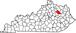
Geography
According to the United States Census Bureau, the city has a total area of 2.4 square miles (6.2km2), of which 0.023 square miles (0.06km2), or 0.93%, is water.[7]
In the census[11] of 2000, there were 1,488 people, 659 households, and 419 families in the city. The population density was 683.7 inhabitants per square mile (264.0/km2). There were 720 housing units at an average density of 330.8 unitsper square mile (127.7 units/km2). The racial makeup of the city was 95.23% White, 3.97% African American, 0.13% Native American, and 0.67% from two or more races. 0.67% of the population were Hispanic or Latino of any race.
There were 659 households, out of which 28.5% had children under the age of 18 living with them, 41.7% were married couples living together, 17.9% had a female householder with no husband present, and 36.4% were non-families. 34.4% of all households were made up of individuals, and 22.5% had someone living alone who was 65 years of age or older. The average household size was 2.17 and the average family size was 2.73.
In the city, the population was spread out, with 21.2% under the age of 18, 9.3% from 18 to 24, 22.7% from 25 to 44, 21.0% from 45 to 64, and 25.7% who were 65 years of age or older. The median age was 43 years. For every 100 females, there were 78.6 males. For every 100 females age 18 and over, there were 71.2 males.
The median income for a household in the city was $21,897, and the median income for a family was $34,167. Males had a median income of $30,893 versus $20,208 for females. The per capita income for the city was $18,156. 26.6% of the population and 23.3% of families were below the poverty line. Out of the total population, 41.1% of those under the age of 18 and 18.7% of those 65 and older were living below the poverty line.
Every year the county celebrates with the May Day Pageant, where high school seniors can compete for the title of "Miss Bath County". The pageant tradition started in 1954 and is a beloved tradition of the community.[citation needed]
This page is based on this Wikipedia article Text is available under the CC BY-SA 4.0 license; additional terms may apply. Images, videos and audio are available under their respective licenses.