Munising Township is a civil township of Alger County in the U.S. state of Michigan. As of the 2010 census, the township population was 2,983.

Hickory is a census-designated place in Graves County, Kentucky, United States., which is located north of Mayfield and 18 miles (29 km) south of Paducah in far western Kentucky.
Gouldsboro is a village and census-designated place (CDP) in Lehigh Township in Wayne County, and Coolbaugh Township, in Monroe County, Pennsylvania, United States. The CDP's population was 750 at time of the 2020 United States Census.
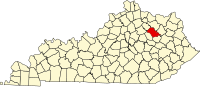
Cannel City is an unincorporated community in Morgan County, Kentucky, United States. It lies along Route 191 south of the city of West Liberty, the county seat of Morgan County. In 1901, the Ohio and Kentucky railway tracks were laid through the region and thrived until the Cannel Coal Company's resources were depleted and forestry resources of the Licking River played out at the same time. On November 1, 1933, the last train trip of the Ohio and Kentucky Junction Railroad-Cannel City Line was made and the track was scrapped. During the golden years, there were several grocery stores, a hardware store, post office, mine, bank, blacksmith and an elegant hotel named The DeLancy. Also standing at over 100 years old is the well used by the trains to put water into their engines. Lost over the years was a train depot at the end of Highway 134, where it currently intersects with Highway 191. At one time, the area had a larger population and count of buildings than the present-day county seat West Liberty. After the mine closed, the area still partially thrived during the times after the Great Depression.

Lake is an unincorporated community in Clare County in the U.S. state of Michigan. The community is located within Garfield Township. As an unincorporated community, Lake has no legal autonomy of its own but does have its own post office with the 48632 ZIP Code.
Howesville is an unincorporated community and coal town in Preston County, West Virginia, United States. It sits at an altitude of 2,218 feet (676 m). The community once possessed a post office, which has since been closed.
Haugan is an unincorporated community in Mineral County, Montana, United States. Haugan is situated 16 miles (26 km) east of the Idaho border and 90 miles (140 km) west of Missoula on Interstate 90 at the Haugan Exit #16. The St. Regis River flows through the community.

The Jones Tract is an island containing Lower Jones Tract and the Upper Jones Tract in the Sacramento-San Joaquin River Delta, fifteen kilometres west of Stockton. The 4,900 ha island is bounded on the north by Empire Cut, on the northeast by Whiskey Slough, on the southeast by Trapper Slough, and on the west, Middle River. The tracts are bifurcated by the parallel running Mokelumne Aqueduct, West Lower Jones Road, and a railroad originally built by the Achison Topeka and Santa Fe Railroad, which now carries freight trains of the BNSF Railway and Amtrak California's San Joaquin. It is in San Joaquin County, and managed by Reclamation District 2039. It appears on 1913 and 1952 United States Geological Survey maps of the area.
Ulvah is an unincorporated community in Letcher County, Kentucky, United States. Its post office has ceased to exist.

Hueysville, also known as Bosco, is an unincorporated community in Floyd County, Kentucky, United States. It has a post office with a ZIP Code of 41640. Hueysville is located on Salt Lick Creek Road west of Kentucky Route 550. CSX Transportation's E&BV Subdivision passes through Hueysville.

Gravel Switch is an unincorporated community within Marion County, Kentucky, United States. It is located along Kentucky Route 243, just south of its intersection with U.S. Route 68, southwest of Perryville and northeast of Bradfordsville.
Buchanan, originally named Mouth of Bear, is an unincorporated community located in Lawrence County, Kentucky, United States at the mouth of Bear Creek where it joins the Big Sandy River, five miles downstream from the mouth of Blaine Creek.
Shelby Gap Railroad Station was an unincorporated community located in Pike County, Kentucky, United States. Its post office closed in 2004.
Valley was a populated place and post office on the South Branch line of the Baltimore and Ohio Railroad in the U.S. state of West Virginia. It was centered near the intersection of West Sioux Lane and Depot Valley Road, now located within the present-day corporate boundaries of Romney. Valley developed in 1884 following the completion of the South Branch line when the rail line's original southern terminus and corresponding Romney Depot were built there. The United States Post Office Department established a post office at Valley on May 19, 1928, remaining in operation until its disestablishment on June 15, 1937. Following the closure of Valley's post office, its mail was routed through the post office in Romney.
Thorne, Nevada is a rail junction and former town located in Mineral County, Nevada.
Norton Furnace is a ghost town in Bristol County, Massachusetts, United States. The settlement was located approximately 2 mi (3.2 km) south of Norton.
Otter is an unincorporated community in Paris Township, Union County, Ohio, United States. It is located at 40°16′33″N83°25′09″W, just northwest of Marysville, on the banks of Otter Run, at the intersection of Dog Leg Road and Westlake-Lee Road.
Broadacre is an unincorporated community in Wayne Township, Jefferson County, Ohio, United States. It is located about 2.5 miles (4.0 km) northeast of Bloomingdale at the intersection of Ohio State Route 152 and Township Route 166, at 40°21′58″N80°46′59″W.
Chandler is an unincorporated community in Wayne Township, Jefferson County, Ohio, United States. It is located south of Bloomingdale at the intersection of Bloomingdale-Smithfield-Chandler Road and County Road 24, at 40°18′28″N80°48′15″W.
Parlett is an unincorporated community in Wayne Township, Jefferson County, Ohio, United States. It is located southeast of Hopedale and just east of Cherry Valley at the intersection of Ohio State Route 151 and Township Road 142A, at 40°18′27″N80°51′46″W.