Russellville, Kentucky

Last updated
Russellville, Kentucky
Logan County courthouse Kentucky.JPG
Logan County courthouse in Russellville, Kentucky
Logan County Kentucky Incorporated and Unincorporated areas Russellville Highlighted 2167512.svg
Location in Logan County, Kentucky
Coordinates: 36°50′33″N86°53′34″W / 36.84250°N 86.89278°W / 36.84250; -86.89278
Country United States
State Kentucky
County Logan
Established1800 [1]
Incorporated1840 [1]
Named for a local landowner
Government
  MayorMark Stratton
Area
[2]
  Total10.87 sq mi (28.14 km2)
  Land10.84 sq mi (28.08 km2)
  Water0.02 sq mi (0.06 km2)
Elevation
594 ft (181 m)
Population
 (2020)
  Total7,164
  Estimate 
(2022) [3]
7,282
  Density660.76/sq mi (255.12/km2)
Time zone UTC-6 (CST)
  Summer (DST) UTC-5 (CDT)
ZIP Code
42276
Area code(s) 270 & 364
FIPS code 21-67512
GNIS feature ID0502534
Website www.russellvilleky.org

Russellville is a home rule-class city [4] in Logan County, Kentucky, in the United States. It is the seat of its county. [5] The population was 6,960 at the time of the 2010 census. [6]

Contents

History

Local historian Alex C. Finley has claimed the area was first settled by Gasper Butcher, as a frontier settlement of the Transylvania Colony of Virginia, around 1780, but others have questioned this claim. [7] Although the area is known to have been called "Big  Boiling Spring", "Gasper Butcher's Spring", and "Butcher's Station", W.R. Jillson was unable to find written records of any habitation before 1790. That year William Cook and his wife erected Cook's Cabin, accompanied by eighteen-year-old William Stewart. [7] [8] Also known as "Cook's Station", the community was located about 1 mile (1.6 km) east of the present city. [7] It was renamed "Logan Court House" when it was chosen as the seat of newly formed Logan County in 1792.[ citation needed ]

General William Russell was given a 2,000-acre (810 ha) grant here for his military service during the American Revolution. He donated part of this property, in 1795, as a platted section for the county seat, known as Logan Court House. The town was renamed in Russell's honor in 1798. [7] It was formally established by the state legislature on January 15, 1810. [1] It was incorporated as a city on February 19, 1840. [1]

In the early 19th century, the community had leaders who were politically prominent in the state. Four homes in the city still stand that were residences of future governors of Kentucky: John Breathitt, James Morehead, John J. Crittenden, and Charles S. Morehead. [8]

During the Civil War, the Kentucky General Assembly declared its neutrality and declined to secede with the rest of the South. Kentucky was a slave state and Confederate sentiment was strong in the Bluegrass region and the west, but the residents of the mountainous eastern section were mainly small farmers and pro-Union. In the summer of 1861, when Confederate troops had occupied the area, 116 prominent pro-Confederate delegates from 68 counties met as the Russellville Convention and created a rival Confederate government for Kentucky. [8] George W. Johnson was elected as the state's Confederate governor and the Confederacy controlled more than half the state early in the war. Despite de facto Union control over the rest of Kentucky after 1862, the government was recognized and Kentucky admitted to the Confederacy. Kentucky was represented by the thirteenth star on the Confederate flag. During the war, there were several minor skirmishes in and around Russellville.[ citation needed ]

After the war, Kentucky struggled for some years with insurgent unrest. A gang made up of the former Confederate guerrillas Cole Younger, George Shepard, and Oliver Shepard, along with Confederate veterans John Jarrett and Arthur McCoy, robbed the Nimrod Long Bank [8] or the Southern Deposit Bank[ citation needed ] in Russellville on March 20, 1868. Brothers Frank and Jesse James, who later had their own outlaw gang based in western Missouri, may have taken part. A Russellville bank on the city square displays a large mural painted depicting the robbery. A reenactment (called a "play on horseback") is performed annually during the city's Tobacco and Heritage Festival.

Several downtown homes have been listed on the National Register of Historic Places including the Victorian Mansion at 224 Cornelius Avenue, a house that boasted the state's first indoor bathroom.[ citation needed ]

Geography

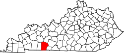
Russellville is located in central Logan County.

According to the United States Census Bureau, Russellville has a total area of 10.8 square miles (28.1 km2), of which 0.02 square miles (0.06 km2), or 0.22%, are water. [9] The city is set among small hills in the valley of the Town Branch, a north-flowing tributary of the Mud River and part of the Green River watershed flowing to the Ohio River.

Russellville is served by U.S. Routes 68, 79 and 431. The nearest limited-access highway is the Natcher Parkway (I-165), 24 miles (39 km) to the northeast.

Climate

The climate in this area is characterized by hot, humid summers and generally mild to cool winters. According to the Köppen Climate Classification system, Russellville has a humid subtropical climate, abbreviated "Cfa" on climate maps. [10]

Demographics

Historical population
CensusPop.Note
1800 117
1810 532354.7%
1830 1,358
1840 1,196−11.9%
1850 1,2726.4%
1860 1,089−14.4%
1870 1,84369.2%
1880 2,05811.7%
1890 2,2539.5%
1900 2,59115.0%
1910 3,11120.1%
1920 3,1240.4%
1930 3,2975.5%
1940 3,98320.8%
1950 4,52913.7%
1960 5,86129.4%
1970 6,45610.2%
1980 7,52016.5%
1990 7,454−0.9%
2000 7,149−4.1%
2010 6,960−2.6%
2020 7,1642.9%
2022 (est.)7,282 [11] 1.6%
U.S. Decennial Census [12]

As of the census [13] of 2000, there were 7,149 people, 3,064 households, and 1,973 families residing in the city. The population density was 672.1 inhabitants per square mile (259.5/km2). There were 3,458 housing units at an average density of 325.1 per square mile (125.5/km2). The racial makeup of the city was 78.64% White, 18.62% African American, 0.39% Native American, 0.36% Asian, 0.03% Pacific Islander, 0.57% from other races, and 1.38% from two or more races. Hispanic or Latino of any race were 1.58% of the population.

There were 3,064 households, out of which 27.4% had children under the age of 18 living with them, 43.4% were married couples living together, 17.4% had a female householder with no husband present, and 35.6% were non-families. 32.6% of all households were made up of individuals, and 15.8% had someone living alone who was 65 years of age or older. The average household size was 2.26 and the average family size was 2.84.

In the city, the population was spread out, with 23.7% under the age of 18, 9.0% from 18 to 24, 25.1% from 25 to 44, 24.3% from 45 to 64, and 18.0% who were 65 years of age or older. The median age was 39 years. For every 100 females, there were 82.6 males. For every 100 females age 18 and over, there were 79.9 males.

The median income for a household in the city was $25,647, and the median income for a family was $31,448. Males had a median income of $27,529 versus $20,032 for females. The per capita income for the city was $15,654. About 17.1% of families and 23.0% of the population were below the poverty line, including 37.0% of those under age 18 and 20.4% of those age 65 or over.

Economy

Amid a largely agricultural area, Russellville is home to manufacturers of a number of products from pet food to plastics. The area's largest employer, Logan Aluminum, employs over 1,300 people. [14]

Education

Russellville has a lending library, a branch of the Logan County Public Library. [15]

Notable people

See also

Related Research Articles

<span class="mw-page-title-main">Warren County, Kentucky</span> County in Kentucky, United States

Warren County is a county located in the south central portion of the U.S. state of Kentucky. As of the 2020 census, the population was 134,554, making it the fifth-most populous county in Kentucky. The county seat is Bowling Green. Warren County is now classified as a wet county after voters approved the measure in 2018. The measure became law in January 2019 that allows alcohol to be sold county wide.

<span class="mw-page-title-main">Simpson County, Kentucky</span> County in Kentucky, United States

Simpson County is a county located in the south central portion of the U.S. state of Kentucky. As of the 2020 census, the total population was 19,594. Its county seat is Franklin.

<span class="mw-page-title-main">Mason County, Kentucky</span> County in Kentucky, United States

Mason County is a county located in the U.S. state of Kentucky. As of the 2020 census, the population was 17,120. Its county seat is Maysville. The county was created from Bourbon County, Virginia in 1788 and named for George Mason, a Virginia delegate to the U.S. Constitutional Convention known as the "Father of the Bill of Rights". Mason County comprises the Maysville, KY Micropolitan Statistical Area, which is included in the Cincinnati-Wilmington-Maysville, OH-KY-IN Combined Statistical Area.

<span class="mw-page-title-main">Lyon County, Kentucky</span> County in Kentucky, United States

Lyon County is a county located in the U.S. state of Kentucky. As of the 2020 census, the population was 8,680. Its county seat is Eddyville. The county was formed from Caldwell County, Kentucky in 1854 and named for former Congressman Chittenden Lyon.

<span class="mw-page-title-main">Logan County, Kentucky</span> County in Kentucky, United States

Logan County is a county in the southwest Pennyroyal Plateau area of the U.S. Commonwealth of Kentucky. As of the 2020 census, the population was 27,432. Its county seat is Russellville.

<span class="mw-page-title-main">Livingston County, Kentucky</span> County in Kentucky, United States

Livingston County is a county located in the U.S. state of Kentucky. As of the 2020 census, the population was 8,888. Its county seat is Smithland and its largest community is Ledbetter. The county was established in 1798 from land taken from Christian County and is named for Robert R. Livingston, a member of the Committee of Five that drafted the U.S. Declaration of Independence. The county was strongly pro-Confederate during the American Civil War and many men volunteered for the Confederate Army. Livingston County is part of the Paducah, KY-IL Micropolitan Statistical Area. It is a prohibition or dry county with the exception of Grand Rivers which voted to allow alcohol sales in 2016.

<span class="mw-page-title-main">Harrison County, Kentucky</span> County in Kentucky, United States

Harrison County is a county located in the U.S. state of Kentucky. As of the 2020 census, the population was 18,692. Its county seat is Cynthiana. The county was founded in 1793 and named for Colonel Benjamin Harrison, an advocate for Kentucky statehood, framer of the Kentucky Constitution, and Kentucky legislator.

<span class="mw-page-title-main">Crittenden County, Kentucky</span> County in Kentucky, United States

Crittenden County is a county in the U.S. state of Kentucky. At the 2020 census, the population was 8,990. Its county seat and only municipality is Marion. The county was formed in 1842 and named for John J. Crittenden, senator and future Governor of Kentucky.

<span class="mw-page-title-main">Caldwell County, Kentucky</span> County in Kentucky, United States

Caldwell County is a county located in the U.S. state of Kentucky. As of the 2020 census, the population was 12,649. Its county seat is Princeton. The county was formed in 1809 from Livingston County, Kentucky and named for John Caldwell, who participated in the George Rogers Clark Indian Campaign of 1786 and was the second lieutenant governor of Kentucky. Caldwell was a prohibition or dry county until 2013, when the citizens voted to lift the ban.

<span class="mw-page-title-main">Hiseville, Kentucky</span> Unincorporated community in Kentucky, United States

Hiseville is an unincorporated community and census-designated place (CDP) in Barren County, Kentucky, United States. The population was 240 at the 2010 census. It is part of the Glasgow Micropolitan Statistical Area. Hiseville was a city until it disincorporated in 2004.

<span class="mw-page-title-main">Morgantown, Kentucky</span> City in Kentucky, United States

Morgantown is a home rule-class city in, and the seat of Butler County, Kentucky, United States. The population was 2,471 at the time of the 2020 Census.

<span class="mw-page-title-main">Marion, Kentucky</span> City in Kentucky, United States

Marion is a home rule-class city in Crittenden County, Kentucky, in the United States. It is the seat of its county. As of the 2010 census, the city population was 3,039.

<span class="mw-page-title-main">Cynthiana, Kentucky</span> City in Kentucky, United States

Cynthiana is a home rule-class city in Harrison County, Kentucky, in the United States. The population was 6,402 at the 2010 census. It is the seat of its county.

<span class="mw-page-title-main">Louisa, Kentucky</span> City in Kentucky, United States

Louisa is an American city located in eastern Kentucky at the merger of the Levisa and Tug Forks into the Big Sandy River, which forms part of the state's border with West Virginia. It is located in Lawrence County the seat of its county. The population was 2,467 at the 2010 census and an estimated 2,375 in 2018.

<span class="mw-page-title-main">Adairville, Kentucky</span> City in Kentucky, United States

Adairville is a home rule-class city in Logan County, Kentucky, in the United States. Established on January 31, 1833, it was named for Governor John Adair and incorporated by the state assembly on February 7, 1871. The population was 852 at the 2010 census.

<span class="mw-page-title-main">Sacramento, Kentucky</span> City in Kentucky, United States

Sacramento is a home rule-class city in McLean County, Kentucky, in the United States. The population was 429 as of the 2020 census. It is included in the Owensboro metropolitan area.

<span class="mw-page-title-main">Tompkinsville, Kentucky</span> City in Kentucky, United States

Tompkinsville is a home rule-class city in and the county seat of Monroe County, Kentucky, United States. The population was 2,309 at the 2020 census. The city was named after Vice President Daniel D. Tompkins who served under President James Monroe, for whom the county was named.

<span class="mw-page-title-main">Mount Sterling, Kentucky</span> City in Kentucky, United States

Mount Sterling, often written as Mt. Sterling, is a home rule-class city in Montgomery County, Kentucky, United States. The population was 7,558 as of the 2020 census, up from 6,895 in 2010. It is the county seat of Montgomery County and the principal city of the Mount Sterling micropolitan area.

<span class="mw-page-title-main">Taylorsville, Kentucky</span> City in Kentucky, United States

Taylorsville is a home rule-class city in Spencer County, Kentucky, United States. It is the county seat of Spencer County. As of the 2010 census, the city had a total population of 763 and was estimated at 1,275 in 2018. It was incorporated in 1829.

<span class="mw-page-title-main">Williamstown, Kentucky</span> City in Kentucky, United States

Williamstown is a home-rule-class city in Grant and Pendleton counties in the U.S. state of Kentucky. The population was 3,925 at the 2010 census, up from 3,227 as of the 2000 census. It is the county seat of Grant County.

References

  1. 1 2 3 4 Commonwealth of Kentucky. Office of the Secretary of State. Land Office. "Russellville, Kentucky". Accessed 16 September 2013.
  2. "2020 U.S. Gazetteer Files". United States Census Bureau. Retrieved March 18, 2022.
  3. "Annual Estimates of the Resident Population for Incorporated Places in Kentucky: April 1, 2020 to July 1, 2022". United States Census Bureau. Retrieved May 26, 2023.
  4. "Summary and Reference Guide to House Bill 331 City Classification Reform" (PDF). Kentucky League of Cities. Retrieved December 30, 2014.
  5. "Find a County". National Association of Counties. Retrieved 2011-06-07.
  6. "Total Population: 2010 Census DEC Summary File 1 (P1), Russellville city, Kentucky". data.census.gov. U.S. Census Bureau. Retrieved February 14, 2020.
  7. 1 2 3 4 Rennick, Robert. Kentucky Place Names, p. 259. University Press of Kentucky (Lexington), 1987. Accessed October 4, 2013.
  8. 1 2 3 4 The Kentucky Encyclopedia, p. 790. "Russellville". University Press of Kentucky (Lexington), 1992. Accessed 4 October 2013.
  9. "U.S. Gazetteer Files: 2019: Places: Kentucky". U.S. Census Bureau Geography Division. Retrieved February 14, 2020.
  10. Climate Summary for Russellville, Kentucky
  11. "Annual Estimates of the Resident Population for Incorporated Places in Kentucky: April 1, 2020 to July 1, 2022". United States Census Bureau. Retrieved May 26, 2023.
  12. "Census of Population and Housing". Census.gov. Retrieved June 4, 2015.
  13. "U.S. Census website". United States Census Bureau . Retrieved 2008-01-31.
  14. "Business & Industry – Logan County, KY – Logan Economic Alliance for Development" . Retrieved 2019-10-12.
  15. "Kentucky Public Library Directory". Kentucky Department for Libraries and Archives. Archived from the original on 11 January 2019. Retrieved 5 June 2019.
  16. Alex C. Finley. 1876, Reprint c. 2000. The History of Russellville and Logan County, Ky. Reprint: Russellville, Ky.: A. B. Willhite. 21–23, 25, 42 (number from reprint).
  17. Hardin, John A. (1995). "Green Pinckney Russell of Kentucky Normal and Industrial Institute for Colored Persons". Journal of Black Studies. 25 (5): 610–621. ISSN   0021-9347.