Richelieu | |
|---|---|
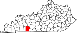
 Richelieu Location within the state of Kentucky | |
| Coordinates: 37°0′16.53″N86°41′30.27″W / 37.0045917°N 86.6917417°W | |
| Country | United States |
| State | Kentucky |
| County | Logan |
| Elevation | 597 ft (182 m) |
| Time zone | UTC-6 (Central (CST)) |
| • Summer (DST) | UTC-5 (CST) |
| ZIP codes | 42271 |
| Area codes | 270 and 364 |
| GNIS feature ID | 508934 [1] |
Richelieu is an unincorporated community in Logan County and Butler County, Kentucky, United States. [1]