Neafus, Kentucky

Last updated

Neafus
USA Kentucky location map.svg
Red pog.svg
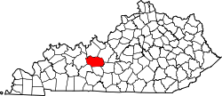
Neafus
Location within the state of Kentucky
Usa edcp location map.svg
Red pog.svg
Neafus
Neafus (the United States)
Coordinates: 37°23′42.18″N86°36′42.95″W / 37.3950500°N 86.6119306°W / 37.3950500; -86.6119306
CountryUnited States
State Kentucky
County Butler
Elevation
630 ft (190 m)
Time zone UTC-6 (Central (CST))
  Summer (DST) UTC-5 (CDT)
Area code(s) 270 and 364
GNIS feature ID508089 [1]

Neafus is an unincorporated community located in northern Butler County in south-central Kentucky, United States. [1]

Contents

Geography

Neafus is located at the tripoint where Butler County's northern boundaries meet with the boundary between Ohio and Grayson Counties. [2] The community also marks the northern terminus of Kentucky Route 340, which previously connected with US 62 west of Do Stop.

Notable residents

Neafus is the birthplace of Medal of Honor recipient, PVT Wesley Phelps, USMC. PVT Phelps received the medal posthumously for actions on Peleliu during World War II.[ citation needed ]

Related Research Articles

<span class="mw-page-title-main">Kentucky Route 70</span> State highway in Kentucky, United States

Kentucky Route 70 (KY 70) is a long east-east state highway that originates at a junction with U.S. Route 60 (US 60) in Smithland in Livingston County, just east of the Ohio River. The route continues through the counties of Crittenden, Caldwell, Hopkins, Muhlenberg, Butler, Edmonson, Barren, Barren, Metcalfe, Green, Taylor, Casey, Pulaski, Lincoln and back into Pulaski again to terminate at a junction with US 150 near Maretburg in Rockcastle.

Pig is an unincorporated community in southern Edmonson County, Kentucky, United States.

Windyville is an unincorporated community located in Edmonson County, Kentucky, United States.

Wax is an unincorporated community in Grayson County, Kentucky, United States.

Welcome is an unincorporated community located in Butler County, Kentucky, United States.

Quality is an unincorporated community located in Butler County, Kentucky, United States.

<span class="mw-page-title-main">Kentucky Route 106</span> State highway in Kentucky, United States

Kentucky Route 106 (KY 106) is a 35-mile-long (56 km) east-west state highway traversing three counties in west-central Kentucky.

<span class="mw-page-title-main">Roundhill, Kentucky</span> Unincorporated community in Kentucky, United States

Roundhill is an unincorporated community in Butler County, Kentucky, United States, situated on Butler County's eastern boundary with Edmonson County.

Jetson is an unincorporated community in Butler County, Kentucky, United States.

<span class="mw-page-title-main">Griderville, Kentucky</span> Unincorporated community in Kentucky, United States

Griderville is a rural unincorporated community in northern Barren County, Kentucky, United States.

Logansport is an unincorporated community in northwestern Butler County in south-central Kentucky, United States. Logansport is part of the Bowling Green Metropolitan Statistical Area.

Glenmore is an unincorporated community located in northern Warren County, Kentucky, United States. Glenmore is part of the Bowling Green Metropolitan Statistical Area.

Gilstrap is an unincorporated community located in northern Butler County in south-central Kentucky, United States.

Huntsville is an unincorporated community located in western Butler County in south-central Kentucky, United States.

Davis Crossroads is an unincorporated community located in southern Butler County in south-central Kentucky, United States.

Silver City is an unincorporated community located in western Butler County in south-central Kentucky, United States.

Richelieu is an unincorporated community in Logan County and Butler County, Kentucky, United States.

Huldeville is an unincorporated community in Butler County, Kentucky, United States.

Needmore is an unincorporated community located in southern Butler County in south-central Kentucky.

Sugar Grove is an unincorporated community located in southern Butler County in south-central Kentucky.

References

  1. 1 2 U.S. Geological Survey Geographic Names Information System: Neafus, Kentucky
  2. DeLorme (2010). Kentucky Atlas and Gazetteer (Map). Yarmouth, Maine: DeLorme. p. 64. § A1. ISBN   0-89933-340-0.