Sadler, Kentucky

Last updated

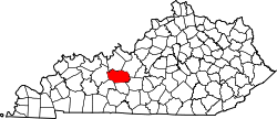
Sadler is an unincorporated community in Grayson County, in the U.S. state of Kentucky. [1]

Grayson County, Kentucky county in Kentucky, United States

Grayson County is a county located in the U.S. state of Kentucky. As of the 2010 census, the population was 25,746. Its county seat is Leitchfield. The county was formed in 1810 and named for William Grayson (1740-1790), a Revolutionary War colonel and a prominent Virginia political figure. Grayson County was formerly a prohibition or dry county, but Leitchfield allowed limited alcohol sales in restaurants in 2010 and voted "wet" in 2016.

U.S. state constituent political entity sharing sovereignty as the United States of America

In the United States, a state is a constituent political entity, of which there are currently 50. Bound together in a political union, each state holds governmental jurisdiction over a separate and defined geographic territory and shares its sovereignty with the federal government. Due to this shared sovereignty, Americans are citizens both of the federal republic and of the state in which they reside. State citizenship and residency are flexible, and no government approval is required to move between states, except for persons restricted by certain types of court orders. Four states use the term commonwealth rather than state in their full official names.

Kentucky State of the United States of America

Kentucky, officially the Commonwealth of Kentucky, is a state located in the east south-central region of the United States. Although styled as the "State of Kentucky" in the law creating it, (because in Kentucky's first constitution, the name state was used) Kentucky is one of four U.S. states constituted as a commonwealth. Originally a part of Virginia, in 1792 Kentucky became the 15th state to join the Union. Kentucky is the 37th most extensive and the 26th most populous of the 50 United States.

History

A post office called Sadler was established in 1892. [2] E. Garner Sadler, the first postmaster, gave the community its name. [3]

Related Research Articles

Edmonson County, Kentucky county in Kentucky, United States

Edmonson County is a county located in the U.S. state of Kentucky. As of the 2010 census, the population was 12,161. Its county seat is Brownsville. The county was formed in 1825 and named for Captain John "Jack" Edmonson (1764–1813), who was killed at the Battle of Frenchtown during the War of 1812. The sale of alcohol is currently prohibited in Edmonson County.

Shrewsbury is a declining rural unincorporated community located within Grayson County, Kentucky, United States. In 1900, it was a settlement in its own right, but today it seems to be less well-defined, and many maps do not show it. It dates to as early as 1833, and was originally called Territory, but later renamed in honor of Judge James W. Shrewsbury. Its first postmaster was Reuben Tingle. He was succeeded by four others, until 1933, when the post office was closed. The town was incorporated as a Kentucky city in 1895, but lost that status in 1901.

Nolin River river in the United States of America

The Nolin River is a 104-mile-long (167 km) tributary of the Green River in central Kentucky in the United States. Via the Green and Ohio rivers, it is a part of the watershed of the Mississippi River.

There are several lakes named Mud Lake within the U.S. state of Kentucky.

Philpot is an unincorporated community in Daviess County, in the U.S. state of Kentucky.

Stegeman, California Unincorporated community in California, United States

Stegeman is an unincorporated community in Colusa County, California. It lies at an elevation of 79 feet.

Cedar Spring is an unincorporated community in Edmonson County, Kentucky, United States.

Creekwood Cove Estates is an unincorporated community in Gloucester County, in the U. S. state of Virginia.

Millerstown is an unincorporated community in Grayson County, Kentucky, in the United States.

Mistaken Creek is a stream in Grayson County, in the U.S. state of Kentucky.

Gus is an unincorporated community in Muhlenberg County, in the U.S. state of Kentucky.

Richardsville is an unincorporated community in Warren County, in the U.S. state of Kentucky.

Rockfield is an unincorporated community in Warren County, in the U.S. state of Kentucky.

Rock Haven is an unincorporated community in Meade County, in the U.S. state of Kentucky.

Rockland is an unincorporated community in Warren County, in the U.S. state of Kentucky.

Leonardsburg is an unincorporated community in Delaware County, in the U.S. state of Ohio.

Rayborn is an unincorporated community in eastern Wright County, in the U.S. state of Missouri. Rayborn is located on Missouri Route 38 between Hartville and Graff. The intersection of Route 38 and Missouri Route 95 is about 2.5 miles to the east of the town.

Ready is an unincorporated community in Grayson County, Kentucky.

Ollie is an unincorporated community in Edmonson County, in the U.S. state of Kentucky.

References

  1. U.S. Geological Survey Geographic Names Information System: Sadler, Kentucky
  2. "Grayson County". Jim Forte Postal History. Retrieved 25 December 2015.
  3. Rennick, Robert M. Kentucky Place Names. University Press of Kentucky. p. 260. ISBN   0-8131-2631-2.
Coordinates: 37°21′28″N86°20′03″W / 37.35778°N 86.33417°W / 37.35778; -86.33417

Geographic coordinate system Coordinate system

A geographic coordinate system is a coordinate system that enables every location on Earth to be specified by a set of numbers, letters or symbols. The coordinates are often chosen such that one of the numbers represents a vertical position and two or three of the numbers represent a horizontal position; alternatively, a geographic position may be expressed in a combined three-dimensional Cartesian vector. A common choice of coordinates is latitude, longitude and elevation. To specify a location on a plane requires a map projection.