Peonia | |
---|---|
Coordinates: 37°31′40.19″N86°28′27.93″W / 37.5278306°N 86.4744250°W | |
Country | United States |
State | Kentucky |
County | Grayson |
Elevation | 781 ft (238 m) |
Time zone | UTC-6 (Central (CST)) |
• Summer (DST) | UTC-5 (CST) |
Area code(s) | 270 and 364 |
GNIS feature ID | 500398 [1] |
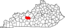
Peonia is an unincorporated community in Grayson County, Kentucky, United States. [1]
Peoria is located about 6 miles (9.7 km) southeast of Leitchfield. The community is situated along Kentucky Route 88 (KY 88) south of Clarkson at its junction with KY 226. [2]
Kentucky Route 90 is a major east–west state highway in southern Kentucky. The route is 134.734 miles (216.833 km) long, and it traverses Barren, Metcalfe, Cumberland, Clinton, Wayne, Pulaski, McCreary and Whitley Counties in southern Kentucky. It runs from the KY 70 junction near Interstate 65 in Cave City to US 25W about 8 miles (13 km) from Interstate 75.
Kentucky Route 70 (KY 70) is a long east-east state highway that originates at a junction with U.S. Route 60 (US 60) in Smithland in Livingston County, just east of the Ohio River. The route continues through the counties of Crittenden, Caldwell, Hopkins, Muhlenberg, Butler, Edmonson, Barren, Barren, Metcalfe, Green, Taylor, Casey, Pulaski, Lincoln and back into Pulaski again to terminate at a junction with US 150 near Maretburg in Rockcastle.
Kentucky Route 185 is a north–south state highway traversing four counties in west-central Kentucky.
Pig is an unincorporated community in southern Edmonson County, Kentucky, United States.
U.S. Route 421 (US 421) in the U.S. state of Kentucky is a 250.536-mile-long (403.199 km) north–south United States highway that traverses twelve counties in the central and eastern parts of the state. It travels in a southeast-to-northwest path from the Virginia state line near Pennington Gap to the Indiana state line, on the Ohio River at Milton, Kentucky and Madison, Indiana.
Straw is an unincorporated community located in Edmonson County, Kentucky, United States.
Temple Hill is an unincorporated community in Barren County, Kentucky, in the United States.
Wax is an unincorporated community in Grayson County, Kentucky, United States.
Snow is an unincorporated community within Clinton County, Kentucky, United States.
Welcome is an unincorporated community located in Butler County, Kentucky, United States.
Kentucky Route 88 is a 56.604-mile-long (91.095 km) state highway in west central Kentucky. It traverses Grayson, Hart, and Green counties in Kentucky. It originates in Clarkson and ends near Greensburg
Kentucky Route 106 (KY 106) is a 35-mile-long (56 km) east-west state highway traversing three counties in west-central Kentucky.
Kentucky Route 218 is a 31.113-mile-long (50.072 km) west-east state highway that traverses three counties in south-central Kentucky. It is locally known as LeGrande Highway from Horse Cave to near Shady Grove.
Kentucky Route 226 is a 1.303-mile-long (2.097 km) rural, secondary state highway located entirely in Grayson County, Kentucky.
Millerstown is an unincorporated community in Grayson County, Kentucky, in the United States.
Kentucky Route 76 is a 36.714-mile-long (59.085 km) state highway in Kentucky that runs from a boat ramp on Lake Cumberland west of Jabez to KY 70 northeast of Elk Horn via Eli, Neatsville, Knifley, and Yuma.
Beech Grove is an unincorporated community and census-designated place in McLean County, Kentucky, United States. Its population was 282 as of the 2020 census. Beech Grove has a post office with ZIP code 42322, which opened on April 29, 1878.
Griderville is a rural unincorporated community in northern Barren County, Kentucky, United States.
Highland Springs is an unincorporated community in northwest Barren County, Kentucky, United States.
Northtown is an unincorporated community in Hart County, Kentucky, United States. The elevation of Northtown is 837 feet. It appears on the Mammoth Cave U.S. Geological Survey Map and is in the Central Time Zone.