Clarkson, Kentucky | |
|---|---|
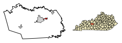 Location of Clarkson in Grayson County, Kentucky. | |
| Coordinates: 37°29′41″N86°13′22″W / 37.49472°N 86.22278°W | |
| Country | United States |
| State | Kentucky |
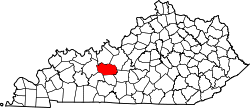
| County | Grayson |
| Incorporated | April 23, 1908 |
| Government | |
| • Mayor | Bonnie Henderson |
| • City Commissioners | Scotty Gore, Keith Higdon, Bob Vincent, Kay Gibson |
| Area | |
• Total | 1.08 sq mi (2.79 km2) |
| • Land | 1.06 sq mi (2.75 km2) |
| • Water | 0.01 sq mi (0.03 km2) |
| Elevation | 728 ft (222 m) |
| Population (2020) | |
• Total | 933 |
| • Density | 876.88/sq mi (338.72/km2) |
| Time zone | UTC-6 (Central (CST)) |
| • Summer (DST) | UTC-5 (CDT) |
| ZIP code | 42726 |
| Area codes | 270 & 364 |
| FIPS code | 21-15148 |
| GNIS feature ID | 0489558 |
| Website | clarkson |
Clarkson is a home rule-class city in Grayson County, Kentucky, United States. The population was 933 at the 2020 census, up from 875 at the 2010 census, [2] Once called "Grayson Springs Depot" after a nearby resort, the name was changed in 1882 to honor the resort's owner, Manoah Clarkson. [3]
Contents
Clarkson is known for its Honeyfest and is home to The Walter T. Kelley Company, a manufacturer of beekeeping equipment.