Schochoh, Kentucky

Last updated

Schochoh, Kentucky
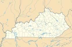
USA Kentucky location map.svg
Red pog.svg
Schochoh
Usa edcp location map.svg
Red pog.svg
Schochoh
Coordinates: 36°43′22″N86°47′28″W / 36.72278°N 86.79111°W / 36.72278; -86.79111
Country United States
State Kentucky
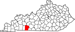
County Logan
Elevation
636 ft (194 m)
Time zone UTC-6 (Central (CST))
 • Summer (DST) UTC-5 (CDT)
GNIS feature ID503046 [1]

Schochoh is an unincorporated community in Logan County, Kentucky, United States.
History

The community, which is named for a location in Judea, was used as a camp meeting site during the Second Great Awakening before its first permanent buildings were built in the 1850s. It grew from its religious origins into a small farming community noted for its corn. [2] The community holds an annual Christmas parade, which began in 1990. [3] [4]

References

  1. ↑ "Schochoh". Geographic Names Information System . United States Geological Survey, United States Department of the Interior.
  2. ↑ "Schochoh". The News-Democrat and Leader. September 18, 1975. pp. 46–47. Retrieved November 19, 2020– via Newspapers.com.
  3. ↑ Griffin, Mark (2006). Logan County. Arcadia Publishing. p. 42. ISBN   9780738543697.
  4. ↑ Cooper, Chris (December 3, 2019). "Schochoh Christmas is a warm and friendly affair". The News-Democrat and Leader. Retrieved November 19, 2020.