Hodgenville, Kentucky

Last updated

Hodgenville, Kentucky
Hodgenville KY Town Square.jpg
Town Square
Larue County Kentucky Incorporated and Unincorporated areas Hodgenville Highlighted 2137396.svg
Location in LaRue County, Kentucky
Coordinates: 37°34′16″N85°44′19″W / 37.57111°N 85.73861°W / 37.57111; -85.73861
Country United States
State Kentucky
County LaRue
Incorporated1839
Named for Robert Hodgen, a local miller
Area
[1]
  Total2.19 sq mi (5.67 km2)
  Land2.18 sq mi (5.65 km2)
  Water0.01 sq mi (0.01 km2)
Elevation
728 ft (222 m)
Population
 (2020)
  Total3,235
  Estimate 
(2022) [2]
3,283
  Density1,481.91/sq mi (572.24/km2)
Time zone UTC-5 (Eastern (EST))
  Summer (DST) UTC-4 (EDT)
ZIP code
42748
Area code(s) 270 & 364
FIPS code 21-37396
GNIS feature ID0494334
Website cityofhodgenvilleky.com

Hodgenville is a home rule-class city [3] in LaRue County, Kentucky, United States. It is the seat of its county. [4] Hodgenville sits along the North Fork of the Nolin River. The population was 3,206 at the 2010 census. [5] It is included in the Elizabethtown metropolitan area.

Contents

History

Hodgenville in 1904 Hodgenville, Kentucky (1904).jpg
Hodgenville in 1904

Robert Hodgen, a Pennsylvania native who moved to Virginia, purchased 10,000 acres (4,000 ha) of land in the vicinity. In 1789, after the Revolutionary War, when settlers started moving west into Kentucky, he built a mill at the site. After his death, the community that developed around it was called "Hodgenville" upon the petition of his widow and children. The United States post office at the site, however, was known as "Hodgensville" from 1826 to 1904. [6]

The city was formally incorporated by the state assembly on February 18, 1836. [7]

Abraham Lincoln birthplace

Abraham Lincoln was born in a small cabin on Sinking Spring Farm near Hodgenville on February 12, 1809. [8] About two years later, the family moved to another farm in the Hodgenville area. [9] Despite claims made later, the cabin Lincoln was born in was likely destroyed by the time of his assassination.

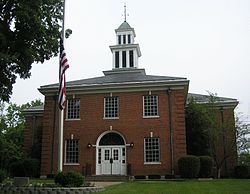
The Abraham Lincoln Birthplace National Historical Park labels the replica cabin, which was built thirty years after his death, the "Traditional Lincoln Birthplace Cabin". The significance of the two Hodgenville sites (birthplace and boyhood home) are found in the setting. Preservation of these two national sites allows visitors to see the landscape of the earliest period of Abraham Lincoln's life. The Lincoln Museum is opened for visitors downtown, and two bronze Abraham Lincoln statues stand at the town square, one of Lincoln as a child, the other as an adult. [10]

Geography

Hodgenville is in central LaRue County, in the valley of the North Fork of the Nolin River, a west- and south-flowing tributary of the Green River. It is 12 miles (19 km) southeast of Elizabethtown via Kentucky Route 61. U.S. Route 31E passes through the center of Hodgenville, leading northeast 24 miles (39 km) to Bardstown and south 43 miles (69 km) to Glasgow.

According to the U.S. Census Bureau, Hodgenville has a total area of 2.1 square miles (5.5 km2), of which 2.15 acres (8,687 m2), or 0.16%, are water. [11]

Climate

The climate in this area is characterized by hot, humid summers and generally mild to cool winters. According to the Köppen Climate Classification system, Hodgenville has a humid subtropical climate, abbreviated "Cfa" on climate maps. [12]

Demographics

Historical population
CensusPop.Note
1870 404
1880 382−5.4%
1890 54241.9%
1900 82552.2%
1910 744−9.8%
1920 1,10047.8%
1930 1,1040.4%
1940 1,34822.1%
1950 1,69525.7%
1960 1,98517.1%
1970 2,56229.1%
1980 2,531−1.2%
1990 2,7217.5%
2000 2,8745.6%
2010 3,20611.6%
2020 3,2350.9%
2022 (est.)3,283 [13] 1.5%
U.S. Decennial Census [14]
LaRue County Courthouse Larue County Kentucky courthouse.jpg
LaRue County Courthouse

As of the census [15] of 2000, there were 2,874 people, 1,235 households, and 781 families living in the city. The population density was 1,667.7 inhabitants per square mile (643.9/km2). There were 1,349 housing units at an average density of 782.8 per square mile (302.2/km2). The racial makeup of the city was 86.64% White, 11.27% African American, 0.24% Native American, 0.07% Asian, 0.35% from other races, and 1.43% from two or more races. Hispanic or Latino of any race were 1.18% of the population.

There were 1,235 households, out of which 29.6% had children under the age of 18 living with them, 42.3% were married couples living together, 18.1% had a female householder with no husband present, and 36.7% were non-families. 34.1% of all households were made up of individuals, and 17.4% had someone living alone who was 65 years of age or older. The average household size was 2.17 and the average family size was 2.76.

The age distribution was 22.8% under the age of 18, 7.9% from 18 to 24, 25.2% from 25 to 44, 22.8% from 45 to 64, and 21.3% who were 65 years of age or older. The median age was 41 years. For every 100 females, there were 82.7 males. For every 100 females age 18 and over, there were 76.8 males.

The median income for a household in the city was $25,132, and the median income for a family was $37,125. Males had a median income of $30,678 versus $18,095 for females. The per capita income for the city was $14,794. About 16.9% of families and 22.3% of the population were below the poverty line, including 27.7% of those under age 18 and 21.5% of those age 65 or over.

Education

Hodgenville has a lending library, the LaRue County Public Library. [16]

Notable people

Related Research Articles

<span class="mw-page-title-main">LaRue County, Kentucky</span> County in Kentucky, United States

LaRue County is a county in the central region of the U.S. state of Kentucky, outside the Bluegrass Region and larger population centers. As of the 2020 census, the population was 14,867. Its county seat is Hodgenville, which is best known as the birthplace of United States President Abraham Lincoln. The county was established on March 4, 1843, from the southeast portion of Hardin County. It was named for John P. LaRue, an early settler. LaRue County is included in the Elizabethtown-Fort Knox, KY Metropolitan Statistical Area, which is also included in the Louisville/Jefferson County-Elizabethtown-Bardstown, KY-IN Combined Statistical Area. It is a dry county.

<span class="mw-page-title-main">Hardin County, Kentucky</span> County in Kentucky, United States

Hardin County is a county located in the central part of the U.S. state of Kentucky. Its county seat is Elizabethtown. The county was formed in 1792. Hardin County is part of the Elizabethtown-Fort Knox, KY Metropolitan Statistical Area, as well as the Louisville/Jefferson County—Elizabethtown-Bardstown, KY-IN Combined Statistical Area. As of the 2020 census, the population was 110,702.

<span class="mw-page-title-main">Maytown, Pennsylvania</span> Census-designated place in Pennsylvania, United States

Maytown is an unincorporated community and census-designated place (CDP) in Lancaster County, Pennsylvania, United States. The population was 4,098 at the 2020 census.

<span class="mw-page-title-main">Tuscola, Illinois</span> City in Illinois, United States

Tuscola is a city and the county seat of Douglas County, Illinois, United States. The population was 4,636 at the 2020 census.

<span class="mw-page-title-main">Harristown, Illinois</span> Village in Illinois, United States

Harristown is a village in Macon County, Illinois, United States. The population was 1,310 at the 2020 census. It is included in the Decatur, Illinois Metropolitan Statistical Area.

<span class="mw-page-title-main">Burkesville, Kentucky</span> City in Kentucky, United States

Burkesville is a home rule-class city in Cumberland County, Kentucky, in the United States. Nestled among the rolling foothills of Appalachia and bordered by the Cumberland River to the south and east, it is the seat of its county. The population was 3,713 at the 2020 census.

<span class="mw-page-title-main">Leitchfield, Kentucky</span> City in Kentucky, United States

Leitchfield is the county seat of Grayson County, Kentucky, United States. Leitchfield is a home rule-class city with a population of 6,404 as of the 2020 census.

<span class="mw-page-title-main">Greensburg, Kentucky</span> City in Kentucky, United States

Greensburg is a home rule-class city in and the county seat of Green County, Kentucky, United States. The population was 2,163 at the 2010 census, down from 2,396 at the 2000 census.

<span class="mw-page-title-main">Elizabethtown, Kentucky</span> City in Kentucky, United States

Elizabethtown is a home rule-class city and the county seat of Hardin County, Kentucky, United States. The population was 28,531 at the 2010 census, and was estimated at 31,394 by the U.S. Census Bureau in 2020, making it the 11th-largest city in the state. It is included in the Elizabethtown–Fort Knox, Kentucky Metropolitan Statistical Area, which is included in the Louisville/Jefferson County–Elizabethtown–Madison, Kentucky-Indiana Combined Statistical Area. The Elizabethtown Metropolitan area had a 2019 estimated population of 153,057, making it the 5th-largest metropolitan area in the state.

<span class="mw-page-title-main">Sonora, Kentucky</span> City in Kentucky, United States

Sonora is a home rule-class city in Hardin County, Kentucky, United States. The population was 565 as of the 2020 Census, up from 513 from the 2010 census,. It is included in the Elizabethtown, Kentucky Metropolitan Statistical Area.

<span class="mw-page-title-main">Vine Grove, Kentucky</span> City in Kentucky, United States

Vine Grove is a home rule-class city in Hardin County, Kentucky, United States. The population was 6,559 as of the 2020 Census, up from 4,520 at the 2010 census. It is part of the Elizabethtown–Fort Knox Metropolitan Statistical Area.

<span class="mw-page-title-main">West Point, Kentucky</span> City in Kentucky, United States

West Point is a home rule-class city in Hardin County, Kentucky, United States, near the edge of Fort Knox military reservation on Dixie Highway. It is located in a former meander bend of the Ohio River. The population was 952 as of the 2020 Census, up from 797 from the 2010 census, but still down from 1,100 at the 2000 census.

<span class="mw-page-title-main">Crab Orchard, Kentucky</span> City in Kentucky, United States

Crab Orchard is a home rule-class city in Lincoln County, Kentucky, United States. The population was 841 at the 2010 census. It is part of the Danville Micropolitan Statistical Area.

<span class="mw-page-title-main">Bardstown, Kentucky</span> City in Kentucky, United States

Bardstown is a home rule-class city in Nelson County, Kentucky, United States. The population was 13,567 in the 2020 census. It is the county seat of Nelson County.

<span class="mw-page-title-main">Springfield, Kentucky</span> City in Kentucky, United States

Springfield is a home rule-class city in and the county seat of Washington County, Kentucky, United States. The population was 2,846 at the 2020 census.

<span class="mw-page-title-main">York, Nebraska</span> City in and county seat of York County, Nebraska, United States

York is a city in and the county seat of York County, Nebraska, United States. At the 2010 census, the city population was 7,766. It is the home of York University and the Nebraska Correctional Center for Women.

<span class="mw-page-title-main">Fairfield, Texas</span> City in Texas, United States

Fairfield is a city and county seat of Freestone County, Texas, United States. The population was 2,850 at the 2020 census, down from 3,094 at the 2000 census. It was founded in 1851.

<span class="mw-page-title-main">Upton, Kentucky</span> City in Kentucky, United States

Upton is a home rule-class city in Hardin and LaRue counties in the U.S. state of Kentucky. The population was 704 as of the 2020 Census, up from 683 from the 2010 census. Its entire area is included in the Elizabethtown–Fort Knox Metropolitan Statistical Area.

<span class="mw-page-title-main">Abraham Lincoln Birthplace National Historical Park</span> National Historical Park in LaRue County, Kentucky, U.S.

Abraham Lincoln Birthplace National Historical Park is a designated U.S. historic park preserving two separate farm sites in LaRue County, Kentucky, where Abraham Lincoln was born and lived early in his childhood. He was born at the Sinking Spring site south of Hodgenville and remained there until the family moved to the Knob Creek Farm northeast of Hodgenville when he was two years old, living there until he was seven years of age. The park's visitor center is located at the Sinking Spring site.

<span class="mw-page-title-main">Elizabethtown metropolitan area</span> Metropolitan Statistical Area in Kentucky, United States

The Elizabethtown–Fort Knox Metropolitan Statistical Area, as defined by the United States Census Bureau, is an area consisting of two counties in Kentucky, anchored by the city of Elizabethtown and the nearby Fort Knox Army post. As of the 2020 census, the MSA had a population of 155,572.

References

  1. "2020 U.S. Gazetteer Files". United States Census Bureau. Retrieved March 18, 2022.
  2. "Annual Estimates of the Resident Population for Incorporated Places in Kentucky: April 1, 2020 to July 1, 2022". United States Census Bureau. Retrieved May 26, 2023.
  3. "Summary and Reference Guide to House Bill 331 City Classification Reform" (PDF). Kentucky League of Cities . Retrieved December 30, 2014.
  4. "Find a County". National Association of Counties. Archived from the original on May 31, 2011. Retrieved June 7, 2011.
  5. "Total Population: 2010 Census DEC Summary File 1 (P1), Hodgenville city, Kentucky". data.census.gov. U.S. Census Bureau. Retrieved February 5, 2020.
  6. Rennick, Robert M. (1987). Kentucky Place Names. University Press of Kentucky. p. 143. ISBN   0813126312 . Retrieved April 28, 2013.
  7. Commonwealth of Kentucky. Office of the Secretary of State. Land Office. "Hodgenville, Kentucky". Accessed 29 July 2013.
  8. "Abraham Lincoln 16th President, 1861-1865". presidentialavenue.com. Archived from the original on September 7, 2012.
  9. "Abraham Lincoln 16th President, 1861-1865". presidentialavenue.com. Archived from the original on January 31, 2013.
  10. Day, Teresa (January 30, 2005). Fun With the Family Kentucky: Hundreds of Ideas for Day Trips with the Kids. Globe Pequot. p. 34. ISBN   9780762734900 . Retrieved May 7, 2013.[ permanent dead link ]
  11. "U.S. Gazetteer Files: 2019: Places: Kentucky". U.S. Census Bureau Geography Division. Retrieved February 5, 2020.
  12. "Hodgenville, Kentucky Köppen Climate Classification (Weatherbase)". Weatherbase.
  13. "Annual Estimates of the Resident Population for Incorporated Places in Kentucky: April 1, 2020 to July 1, 2022". United States Census Bureau. Retrieved May 26, 2023.
  14. "Census of Population and Housing". Census.gov. Retrieved June 4, 2015.
  15. "U.S. Census website". United States Census Bureau . Retrieved January 31, 2008.
  16. "Kentucky Public Library Directory". Kentucky Department for Libraries and Archives. Archived from the original on January 11, 2019. Retrieved June 5, 2019.