
Kentucky, officially the Commonwealth of Kentucky, is a state in the Southeastern region of the United States and one of the states of the Upper South. It borders Illinois, Indiana, and Ohio to the north, West Virginia to the northeast, Virginia to the east, Tennessee to the south, and Missouri to the west. Its northern border is defined by the Ohio River. Its capital is Frankfort, and its two largest cities are Louisville and Lexington. Its population was approximately 4.5 million in 2020.

Lexington is a city in Kentucky, United States that is the county seat of Fayette County. By population, it is the second-largest city in Kentucky and 59th-largest city in the United States. By land area, it is the country's 28th-largest city. The city is also known as "Horse Capital of the World". It is within the state's Bluegrass region. Notable locations in the city include the Kentucky Horse Park, The Red Mile and Keeneland race courses, Rupp Arena, Central Bank Center, Transylvania University, the University of Kentucky, Bluegrass Community and Technical College, and the National Thoroughbred Racing Association (NTRA) Headquarters.

Louisville is the largest city in the Commonwealth of Kentucky, sixth-most populous city in the Southeast, and the 28th most-populous city in the United States. Louisville is the historical seat and, since 2003, the nominal seat of Jefferson County, on the Indiana border.

Morgantown is a home rule-class city in, and the seat of Butler County, Kentucky, United States. The population was 2,471 at the time of the 2020 Census
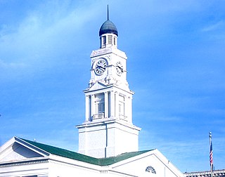
Winchester is a home rule-class city in and the county seat of Clark County, Kentucky, United States. The population was 18,368 at the 2010 census. It is part of the Lexington-Fayette, KY Metropolitan Statistical Area. Winchester is located roughly halfway between Louisville and Ashland.

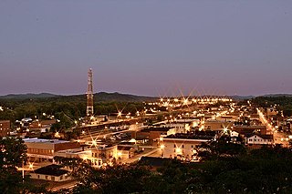
Mayfield is a home rule–class city and the county seat of Graves County, Kentucky, United States. The population was 10,017 as of the 2020 United States Census.

Henderson is a home rule-class city along the Ohio River and is the county seat of Henderson County, Kentucky, United States. The population was 28,757 at the 2010 U.S. census. It is part of the Evansville Metropolitan Area, locally known as the "Tri-State Area". It is considered the southernmost suburb of Evansville, Indiana.

Covington is a home rule-class city in Kenton County, Kentucky, United States. Located at the confluence of the Ohio and Licking rivers, it lies south of Cincinnati, Ohio, across the Ohio and west of Newport, Kentucky, across the Licking. It had a population of 40,691 at the 2020 census, making it the largest city in Northern Kentucky and the fifth-most populous city in the state. A part of the Cincinnati metropolitan area, it is one of Kenton County's two seats, along with Independence.

Independence is a home rule-class city in Kenton County, Kentucky, in the United States. It is one of its county's two seats of government. The population was 24,757 at the time of the 2010 U.S. census, up from 14,982 at the 2000 census. It is the third largest city in Northern Kentucky after Covington and Florence.

Beattyville is a home rule class city in, and the county seat of, Lee County, Kentucky, United States. The city was formally established by the state assembly as "Beatty" in 1851 and incorporated in 1872. It was named for Samuel Beatty, a pioneer settler.

Livermore is a home rule-class city located at the confluence of the Green and Rough rivers in McLean County in the U.S. state of Kentucky. The population was 1,365 at the 2010 census. It is included in the Owensboro metropolitan area.
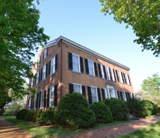
Bardstown is a home rule-class city in Nelson County, Kentucky, United States. The population was 13,567 in the 2020 census. It is the county seat of Nelson County.

Booneville is a home rule-class city in Owsley County, Kentucky, in the United States. The population was 81 at the 2010 census. It is the county seat of Owsley County. It is located at the junction of Kentucky Route 11 and Kentucky Route 30 on the South Fork of the Kentucky River.
Shelbyville is a home rule-class city in and the county seat of Shelby County, Kentucky, United States. The population was 14,045 at the 2010 census.
Versailles is a home rule-class city in Woodford County, Kentucky, United States. It lies 13 miles by road west of Lexington and is part of the Lexington-Fayette Metropolitan Statistical Area. Versailles has a population of 9,316 according to 2017 census estimates. It is the county seat of Woodford County. The city's name is pronounced vər-SAYLZ, an anglicization different from the French pronunciation of the royal city of the same name near Paris.
Corbin is a home rule-class city in Whitley, Knox and Laurel counties in the southeastern portion of the U.S. state of Kentucky. As of the 2010 census, the city population was 7,304. Corbin is on Interstate 75, about halfway between Knoxville, Tennessee, and Lexington.

The Clarksville Metropolitan Statistical Area is defined by the United States Census Bureau as an area consisting of four counties – two in Tennessee and two in Kentucky – anchored by the city of Clarksville, Tennessee. The 2021 estimate placed the population at 329,864. As of 2020, the Clarksville Metropolitan Statistical Area is the 159th largest MSA in the United States.

The history of slavery in Kentucky dates from the earliest permanent European settlements in the state, until the end of the Civil War. Kentucky was classified as the Upper South or a border state, and enslaved African Americans represented 24% by 1830, but declined to 19.5% by 1860 on the eve of the Civil War. The majority of enslaved people in Kentucky were concentrated in the cities of Louisville and Lexington, in the fertile Bluegrass Region as well the Jackson Purchase, both the largest hemp- and tobacco-producing areas in the state. In addition, many enslaved people lived in the Ohio River counties where they were most often used in skilled trades or as house servants. Few people lived in slavery in the mountainous regions of eastern and southeastern Kentucky. Those that did that were held in eastern and southeastern Kentucky served primarily as artisans and service workers in towns.

The Illinois–Indiana–Kentucky tri-state area is a tri-state area where the U.S. states of Illinois, Indiana, and Kentucky intersect. The area is defined mainly by the television viewing area and consists of ten Illinois counties, eleven Indiana counties, and nine Kentucky counties, centered upon the Ohio and Wabash Rivers.


