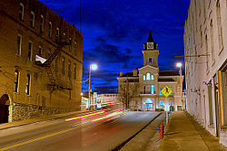
History
The area was settled c. 1802 by Daniel Trabue. The post office was opened on April 1, 1806, by John Field, who also ran the local store.
Camp Boyle, located north of the town square, was an important camp and muster site for the Union Army during the Civil War (1861–1865). [5] [6] The 13th Kentucky Cavalry Regiment (Union) was organized in Columbia. [7]
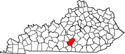
Demographics
Historical population| Census | Pop. | Note | %± |
|---|
| 1810 | 175 | | — |
|---|
| 1830 | 423 | | — |
|---|
| 1840 | 486 | | 14.9% |
|---|
| 1860 | 381 | | — |
|---|
| 1870 | 506 | | 32.8% |
|---|
| 1880 | 549 | | 8.5% |
|---|
| 1900 | 654 | | — |
|---|
| 1910 | 1,022 | | 56.3% |
|---|
| 1920 | 1,076 | | 5.3% |
|---|
| 1930 | 1,195 | | 11.1% |
|---|
| 1940 | 1,372 | | 14.8% |
|---|
| 1950 | 2,167 | | 57.9% |
|---|
| 1960 | 2,255 | | 4.1% |
|---|
| 1970 | 3,234 | | 43.4% |
|---|
| 1980 | 3,710 | | 14.7% |
|---|
| 1990 | 3,845 | | 3.6% |
|---|
| 2000 | 4,014 | | 4.4% |
|---|
| 2010 | 4,452 | | 10.9% |
|---|
| 2020 | 4,845 | | 8.8% |
|---|
| 2024 (est.) | 4,685 | [8] | −3.3% |
|---|
|
As of the census [10] of 2010, there were 4,014 people, 1,554 households, and 893 families residing in the city. The population density was 1,167.9 per square mile (450.9/km2). There were 1,789 housing units at an average density of 520.5 per square mile (201.0/km2). The racial makeup of the city was 88.77% White, 7.68% African American, 0.25% Native American, 0.52% Asian, 0.07% Pacific Islander, 0.20% from other races, and 1.64% from two or more races. Hispanic or Latino of any race were 1.93% of the population. Some other race alone 1.08%
There were 1,554 households, out of which 24.8% had children under the age of 18 living with them, 39.9% were married couples living together, 14.5% had a female householder with no husband present, and 42.5% were non-families. 40.3% of all households were made up of individuals living alone, and 22.1% had someone living alone who was 65 years of age or older. The average household size was 2.12 and the average family size was 2.84.
In the city, the population was spread out, with 18.0% under the age of 18, 19.1% from 20 to 24, 23.1% from 25 to 44, 19.1% from 45 to 64, and 20.6% who were 65 years of age or older. The median age was 36 years. For every 100 females, there were 83.8 males. For every 100 females age 18 and over, there were 78.6 males.
The median income for a household in the city was $22,861, and the median income for a family was $31,344. Males had a median income of $23,906 versus $21,000 for females. The per capita income for the city was $17,836. About 19.9% of families and 26.6% of the population were below the poverty line, including 39.4% of those under age 18 and 17.9% of those age 65 or over.
Infrastructure
The Cumberland Expressway runs through Columbia as it extends from Bowling Green to Somerset. This parkway is a future spur road of Interstate 65. The addition of an interchange with a 2006 reconstruction of Highway 61 South, Columbia now has two exits on the Parkway.
Exit 49, the original exit on the parkway, merges onto Highway 55 South (also known as Jamestown Street) bringing drivers through the middle of Columbia.
Exit 47, the new exit, merges onto Highway 61 South (also known as Burkesville Street/Road) and drivers can choose to go north or go to Burkesville to the south.
The Highway 55 Bypass was officially opened on October 7, 2008, for more information see below.
Columbia Bypass
After years of promises by various governors and other Kentucky officials, construction began early in May 2007, which culminated in an official ground-breaking ceremony by the former Governor himself on May 15, 2007 [14] near the front of the newly constructed Adair County Elementary School, which faces the direction of the bypass.
The Columbia Bypass was opened to the public on October 7, 2008, featuring a traffic light at the intersection of the bypass and North 55 as well as a traffic light at the intersection of South 61. The bypass has relieved a majority of the downtown traffic.
This page is based on this
Wikipedia article Text is available under the
CC BY-SA 4.0 license; additional terms may apply.
Images, videos and audio are available under their respective licenses.

