Brannon Woods, Kentucky

Last updated

Brannon Woods is an unincorporated community in Jessamine County, Kentucky, United States.

Brannon Woods began growing along U.S. Route 68 as Lexington rapidly grew to the southwest and began running out of land. The first developments in the area began in the 1980s when several subdivisions were built along Brannon Road. Southland Christian Church, Lexington's largest church and the second largest church in Kentucky moved to a 20-acre (81,000 m2) site in Brannon Woods in 1981. In 2001 Bellerive Shopping Center was completed in the community. In 2005 US 68 was widened from Brannon Road to Man O War Blvd in Lexington, US 68 is currently being widened southward to Wilmore. Blue Grass Memorial Garden Cemetery is also located in Brannon Woods.
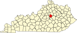
37°58′23″N84°35′35″W / 37.97306°N 84.59306°W / 37.97306; -84.59306


Related Research Articles

<span class="mw-page-title-main">Jessamine County, Kentucky</span> County in Kentucky, United States

Jessamine County is a county located in the U.S. state of Kentucky. As of the 2020 census, the population was 52,991. Its county seat is Nicholasville. The county was founded in December 1798. Jessamine County is part of the Lexington-Fayette, KY Metropolitan Statistical Area. It is within the Inner Blue Grass region, long a center of farming and blooded stock raising, including thoroughbred horses. The legislature established a commercial wine industry here in the late 18th century.

<span class="mw-page-title-main">Fayette County, Kentucky</span> County in Kentucky, United States

Fayette County is located in the central part of the U.S. state of Kentucky. As of the 2020 census, the population was 322,570, making it the second-most populous county in the commonwealth. Its territory, population and government are coextensive with the city of Lexington, which also serves as the county seat. Fayette County is part of the Lexington–Fayette, KY Metropolitan Statistical Area.

<span class="mw-page-title-main">Royal, Illinois</span> Village in Illinois, United States

Royal is a village in Champaign County, Illinois, United States. The population was 293 at the 2020 census.

<span class="mw-page-title-main">U.S. Route 68</span> Highway in the United States

U.S. Route 68 is a United States highway that runs for 560 miles (900 km) from northwest Ohio to Western Kentucky. The highway's western terminus is at US 62 in Reidland, Kentucky. Its present northern terminus is at Interstate 75 in Findlay, Ohio, though the route once extended as far north as Toledo. US 68 intersects with US 62 three times during its route.

<span class="mw-page-title-main">Paris Pike</span>

Paris Pike is the local name for the 14 mile (23 km) stretch of U.S. Routes 27/68 between Paris and Lexington, Kentucky.

<span class="mw-page-title-main">New Circle Road</span> Highway in Lexington, Kentucky

New Circle Road, also known as Kentucky Route 4, is a Kentucky state highway that serves as an inner beltway around Lexington, which is part of the consolidated city-county government with Fayette County.

<span class="mw-page-title-main">Lexington Theological Seminary</span> Graduate theological institution in Lexington, KY

Lexington Theological Seminary is a private Christian seminary in Lexington, Kentucky. Although it is related to the Christian Church, it is intentionally ecumenical with almost 50 percent of its enrollment coming from other denominations. Lexington Theological Seminary is accredited by Association of Theological Schools in the United States and Canada to award Master of Divinity, Master of Theological Studies, Master of Pastoral Studies, and Doctor of Ministry degrees.

<span class="mw-page-title-main">Kentucky Route 29</span>

Kentucky Route 29 is an 11.324-mile-long (18.224 km) state highway located entirely within Jessamine County in the U.S. state of Kentucky. The highway, maintained by the Kentucky Transportation Cabinet, runs north from High Bridge, Kentucky through Wilmore before ending at Nicholasville. Within Wilmore, KY 29 intersects Kentucky Route 1268 and junctions with Kentucky Route 3433. The highway acts as the border between Asbury University and Asbury Theological Seminary. Just north of Wilmore, KY 29 merges with U.S. Route 68 for 0.590 miles (0.950 km) before leaving US 68 and turning east heading towards Nicholasville. KY 29 terminates at Kentucky Route 39 and U.S. Route 27 Business in downtown Nicholasville.

WLTO is a commercial radio station licensed to Nicholasville, Kentucky and serving the Lexington radio market. It is owned by Cumulus Media and broadcasts a Top 40 - CHR radio format. The radio studios and offices are inside Kincaid Towers in downtown Lexington, and its transmitter is just south of the Fayette/Jessamine county line on Brannon Road.

<span class="mw-page-title-main">Man o' War Boulevard</span>

Man o' War Boulevard, named after the racehorse Man o' War, is an almost 17-mile (27 km) urban arterial, circling Lexington, Kentucky to its south. Its western terminus is at US 60 / Keeneland Boulevard at Keeneland Race Course's main entrance, from which the highway heads southeast, intersecting with US 68, US 27, and other roads. It then turns east and northeast, intersecting KY 1974, US 25/US 421, and I-75, before ending at US 60 at Brighton. The majority of the road is a four-lane divided highway with curbs and sidewalks maintained by the Lexington-Fayette Urban County Government, but the 1.429-mile (2.300 km) portion east of I-75 is maintained by the Kentucky Transportation Cabinet as Supplemental Road Kentucky Route 1425, and only carries two lanes.

<span class="mw-page-title-main">Central Bank Center</span> Entertainment, convention and sports complex in Lexington, Kentucky

The Central Bank Center is an entertainment, convention and sports complex located on an 11-acre (45,000 m2) site in downtown Lexington, Kentucky. It features a convention center, the Hyatt Regency Hotel, and Rupp Arena. It opened in 1976.

Parksville is a small unincorporated community on the Chaplin River in south central Boyle County, Kentucky, United States. It is located at the eastern end of Ky Route 300, where it intersects with Ky Route 34, near the US Post Office. The global position of Parksville is 37.597N latitude and -84.891W longitude. Elevation is 1,083 feet (330 m) above sea level. Current population is approximately 900 people. The ZIP Code for Parksville is 40464.

<span class="mw-page-title-main">Southland Christian Church (Lexington, Kentucky)</span>

Southland Christian Church is an evangelical Christian church based in Kentucky, US.

Picadome is a neighborhood in southwestern Lexington, Kentucky, United States. Its boundaries are Waller Avenue to the north, Harrodsburg Road to the west, a combination of Southland Drive and Rosemont Garden to the south, and the Norfolk Southern railroad tracks to the east.

Firebrook is a neighborhood in southwestern Lexington, Kentucky, United States. Its boundaries are Harrodsburg Road to the east, Military Pike to the north, Keene Road to the west, and the Jessamine County line to the south.

Dogwood Trace is a neighborhood in southwestern Lexington, Kentucky, United States. Its boundaries are South Elkhorn Creek to the north and east, Harrodsburg Road to the west, and the Jessamine County line to the south.

Willow Oak is a neighborhood in southwestern Lexington, Kentucky, United States. It is a cul de sac community with only one entrance. Its boundary backs up to properties along Boston Road, Millpond Road, Wyndham Hills Drive, and Everetts Dale. Signs were placed on property this week stating no fishing and residents are enforcing the signs.

Cumberland Hill is a neighborhood in southeastern Lexington, Kentucky, United States. Its boundaries are Hickman Creek to the west, Clearwater Way to the north, Tates Creek Road to the east, and Forest Lake Drive to the south. It is served by the Cumberland Hill Neighborhood Association and also has a private community pool available for residents and nonmembers. The Cumberland Hill Catfish are the neighborhood swim team.