The tornado outbreak of October 17–19, 2007 was a widespread tornado outbreak that took place across much of the eastern half of North America starting on October 17, 2007, and continuing into the early hours of October 19. The outbreak was also responsible for five deaths; three in Michigan and two in Missouri, plus many injuries. At least 64 tornadoes were confirmed including 16 on October 17 across six states including Texas, Oklahoma, Arkansas, Louisiana, Mississippi and Missouri with wind damage reported in Oklahoma, Kansas, Illinois, Iowa, Arkansas and Mississippi. On October 18, at least 48 tornadoes were confirmed across eight states including Florida, Alabama, Mississippi, Tennessee, Kentucky, Illinois, Indiana and Michigan, plus widespread straight line wind damage. Until 2010, this event held the record for largest tornado outbreak ever recorded in the month of October according to NOAA.

An extended period of significant tornado activity affected the Midwest and Southern United States from April 19 to April 24, 2011, with 134 tornadoes being spawned across six days. The outbreak sequence produced an EF4 tornado that tore through the St. Louis metropolitan area on April 22, while other tornadoes caused damage in Illinois, Indiana, Ohio, Kentucky, Texas, Oklahoma, and other parts of Missouri during the period. No fatalities were reported in this outbreak sequence. This event was directly followed by the largest tornado outbreak in the history of the United States.

A significant early season tornadic event affected portions of the Midwestern and Southern United States at the end of January 2013. The first signs of the outbreak came on January 23 as the Storm Prediction Center (SPC) detailed the eastward progression of a shortwave trough into an increasingly unstable air mass across portions of the lower Mississippi Valley; however, considerable uncertainty in the placement of severe thunderstorms caused the SPC to remove their threat outline. Succeeding many changes in the forecast, a Day 1 Moderate risk was issued for January 29, warning of the potential for widespread/significant damaging winds and a few strong tornadoes. The threat shifted eastward on January 30, encompassing a large section of the Southeastern United States. By late that day, the shortwave trough tracked northeastward into New England, ending the severe weather threat.

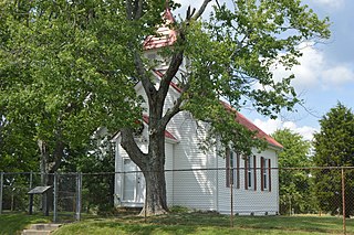
Bernstadt is an unincorporated community located in Laurel County, Kentucky, located about 6 miles (9.7 km) west of London, Kentucky, the county seat. It is on Kentucky Route 1956, which exits the national forest here.

A significant four-day outbreak of tornadoes impacted areas across the High Plains, central Midwest, and parts of the Ohio Valley in early May. The outbreak also produced the first EF4 tornado of the year in Katie, Oklahoma on May 9, where one death occurred. An EF3 tornado near Connerville, Oklahoma also killed a person that day. Other notable tornadoes included two large EF2 tornadoes in Colorado on May 7, a large EF2 tornado near Catherine, Kansas on May 8, and a destructive EF3 tornado that struck Mayfield, Kentucky on May 10. Overall, 57 tornadoes were confirmed.

The March 2019 North American blizzard was a powerful Colorado Low that produced up to two feet of snow in the plains and Midwest. Rapid snowmelt following the storm caused historic flooding, and some areas received hurricane-force wind gusts. Comparable to the 1993 Storm of the Century, the storm was labeled a bomb cyclone after barometric pressure readings dropped in excess of 24 mbar (0.71 inHg) over a 24-hour period. After the storm entered Colorado from its origination in Arizona, the pressure dropped more than 30 mbar (0.89 inHg) and rapidly intensified over the western High Plains. The severe storm set new all-time record low barometric pressure readings in Colorado, Kansas and New Mexico. The storm itself killed only one person in Colorado, but flooding caused by the storm killed at least 3, one in Iowa and at least two in Nebraska and left ~140,000 without power in Texas.

On July 19 and 20, 2018, an unexpected strong tornado outbreak affected Iowa and nearby areas. The event was triggered mostly by three supercells that produced several tornadoes across southeastern Iowa east and southeast of Des Moines. Two of the tornadoes reached EF3 intensity, affecting Pella and Marshalltown. These were the strongest tornadoes to hit Iowa since June 22, 2015, when another EF3 tornado struck near Lovilia. Of the 37 injuries, 13 occurred in Pella, and 23 in Marshalltown, and one the following day in Indiana. The event was also notable due to the Table Rock Lake duck boat accident that killed 17 people and injured 7 others at Table Rock Lake, Missouri.

The April 2022 North American storm complex affected much of the Rocky Mountains and the Midwestern United States with tornadoes, heavy snow, and gusty winds. The system in general first began impacting the Northwest on April 11, before moving eastward into the Rocky Mountains the following day. It was also responsible for producing a large severe weather outbreak of tornadoes and damaging straight-line wind in the Midwest and South while contributing to a powerful blizzard in the upper Midwest states of North and South Dakota.


