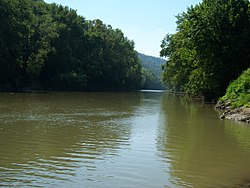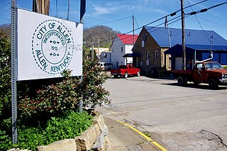
Allen, also known as Allen City, is a home rule-class city in Floyd County, Kentucky, in the United States. The population was 193 at the 2010 census, up from 150 at the 2000 census.

Louisa is a home rule-class city located at the merger of the Levisa and Tug Forks into the Big Sandy River. It is located in Lawrence County, Kentucky, in the United States, and is the seat of its county. The population was 2,467 at the 2010 census and an estimated 2,375 in 2018.
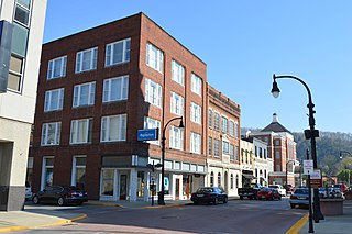
Pikeville is a city in and the county seat of Pike County, Kentucky, United States. During the 2020 U.S. Census, the population within Pikeville's city limits was 7,754. In Kentucky's current city classification system, Pikeville is a home rule-class city, a category that includes all of the state's more than 400 cities except for the two largest, Louisville and Lexington.

The Big Sandy River is a tributary of the Ohio River, approximately 29 miles (47 km) long, in western West Virginia and northeastern Kentucky in the United States. The river forms part of the boundary between the two states along its entire course. Via the Ohio River, it is part of the Mississippi River watershed.

The Cumberland River is a major waterway of the Southern United States. The 688-mile-long (1,107 km) river drains almost 18,000 square miles (47,000 km2) of southern Kentucky and north-central Tennessee. The river flows generally west from a source in the Appalachian Mountains to its confluence with the Ohio River near Paducah, Kentucky, and the mouth of the Tennessee River. Major tributaries include the Obey, Caney Fork, Stones, and Red rivers.

The Kentucky River is a tributary of the Ohio River, 260 miles (418 km) long, in the U.S. Commonwealth of Kentucky. The river and its tributaries drain much of the central region of the state, with its upper course passing through the coal-mining regions of the Cumberland Mountains, and its lower course passing through the Bluegrass region in the north central part of the state. Its watershed encompasses about 7,000 square miles (18,000 km2). It supplies drinking water to about one-sixth of the population of the Commonwealth of Kentucky.
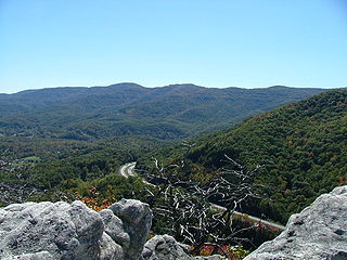
The Cumberland Mountains are a mountain range in the southeastern section of the Appalachian Mountains. They are located in western Virginia, southwestern West Virginia, the eastern edges of Kentucky, and eastern middle Tennessee, including the Crab Orchard Mountains. Their highest peak, with an elevation of 4,223 feet (1,287 m) above mean sea level, is High Knob, which is located near Norton, Virginia.

The Tug Fork is a tributary of the Big Sandy River, 159 miles (256 km) long, in southwestern West Virginia, southwestern Virginia, and eastern Kentucky in the United States. Via the Big Sandy and Ohio rivers, it is part of the watershed of the Mississippi River.

The Big Sandy Expedition was an early campaign of the American Civil War in Kentucky that began in mid-September 1861 when Union Brig. Gen. William "Bull" Nelson received orders to organize a new brigade at Maysville, Kentucky and conduct an expedition into the Big Sandy Valley region of Eastern Kentucky and stop the build-up of Confederate forces under Col. John S. Williams. This was done in three phases. From September 21 to October 20, 1861, Nelson assembled a brigade of 5,500 Union volunteers from Ohio and Kentucky. On October 23, the southern prong secured Hazel Green and the northern prong West Liberty. The two prongs were consolidated at Salyersville and they began the final phase on October 31. This led to the Battle of Ivy Mountain on November 8 and the withdrawal of Confederate forces from Pikeville (Piketon) on November 9, 1861.

Mouthcard is a small unincorporated community in Pike County, Kentucky, United States near the Virginia state line. It lies on the Levisa Fork River of the Big Sandy River in the heart of the Appalachians. U.S. Route 460 runs through Mouthcard to meet U.S. Route 23 in Pikeville, the county seat.
U.S. Route 23 (US 23) is a 157.765-mile-long (253.898 km) United States Numbered Highway in the state of Kentucky. It travels from the Virginia commonwealth line near Jenkins to the Ohio state line west of South Shore via Jenkins, Pikeville, Coal Run Village, Prestonsburg, Paintsville, Louisa, Catlettsburg, Ashland, Russell, Flatwoods, Raceland, Wurtland, Greenup, and South Shore.
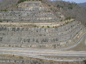
The Pikeville Cut-Through is a rock cut in Pikeville, Kentucky, United States, created by the U.S. Army Corps of Engineers, through which passes a four-lane divided highway, a railroad line, and the Levisa Fork of the Big Sandy River. It is one of the largest civil engineering projects in the western hemisphere, moving nearly 18,000,000 cubic yards (14,000,000 m3) of soil and rock, compared to the Big Dig and the Panama Canal. Dr. William Hambley, who served as mayor of Pikeville for 29 years, Robert H. Holcomb, Chamber of Commerce president, and Henry Stratton, local attorney, spearheaded the project.

The Licking River is a partly navigable, 303-mile-long (488 km) tributary of the Ohio River in northeastern Kentucky in the United States. The river and its tributaries drain much of the region of northeastern Kentucky between the watersheds of the Kentucky River to the west and the Big Sandy River to the east. The North Fork Licking River, in Pendleton County, Kentucky, is one of its tributaries.
The McClure River is a 17.9-mile-long (28.8 km) tributary of the Russell Fork in the U.S. state of Virginia. It is located in Dickenson County in the southwestern part of the state. Via the Russell Fork, the Levisa Fork, the Big Sandy River, and the Ohio River, it is part of the Mississippi River watershed.

Running through Part of Wise County Virginia, and through Dickenson County Virginia, The Pound River is a river in the U.S. state of Virginia. It runs from the North Fork Pound Reservoir to the John W. Flannagan Dam. Via the Russell Fork, the Levisa Fork, the Big Sandy River, and the Ohio River, it is part of the Mississippi River watershed.
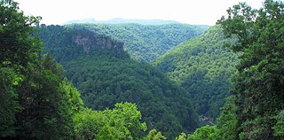
The Russell Fork is a 51.9-mile-long (83.5 km) tributary of the Levisa Fork in southwestern Virginia and southeastern Kentucky in the United States. Known for its whitewater, it rises in the Appalachian Mountains of southwest Virginia, in southern Buchanan County at the base of Big A Mountain, and flows northwest into Dickenson County. The Russell Fork continues to flow through the town of Haysi, Virginia, the Breaks Interstate Park, and the town of Elkhorn City, Kentucky, in Pike County, where it flows into the Levisa Fork which, together with the Tug Fork, form the Big Sandy River.
Dwale is an unincorporated community and census-designated place in Floyd County, Kentucky, United States. The 2010 United States Census reported that Dwale's population was 329, of which 312 persons were white and 9 persons were Asian.
Garden Village is an unincorporated community in Pike County, Kentucky. It is located on the Levisa Fork of the Big Sandy River, below the Peyton Branch and 4 miles (6.4 km) southeast of Pikeville.
The Poor Fork is a 45-mile (72 km) tributary of the Cumberland River in Letcher and Harlan Counties, southeast Kentucky, in the United States. The river flows from its source at Flat Gap in the Appalachian Mountains, on the Kentucky–Virginia border, generally southwest to its confluence about a mile (1.6 km) north of Harlan.
