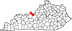
Battletown, Kentucky

Last updated
Battletown, Kentucky
USA Kentucky location map.svg
Red pog.svg
Battletown
Location within the state of Kentucky
Usa edcp location map.svg
Red pog.svg
Battletown
Battletown (the United States)
Coordinates: 38°03′50″N86°17′38″W / 38.06389°N 86.29389°W / 38.06389; -86.29389 Coordinates: 38°03′50″N86°17′38″W / 38.06389°N 86.29389°W / 38.06389; -86.29389
Country United States
State Kentucky
County Meade
Elevation
696 ft (212 m)
Time zone UTC-5 (Eastern (EST))
  Summer (DST) UTC-4 (EST)
ZIP code
40104 [1]
GNIS feature ID486474 [2]

Battletown is an unincorporated rural community in Meade County, Kentucky, United States. It is a small unincorporated community that lies a few miles northwest of Brandenburg on KY 228, at its intersection with Pine Ridge Road.

Notable people

Related Research Articles

English usually refers to:

A census-designated place (CDP) is a concentration of population defined by the United States Census Bureau for statistical purposes only.

Eddie or Eddy may refer to:

Stone is an unincorporated community and coal town in Pike County, Kentucky, United States. It was established in 1912. Stone was a mining community named for Galen Stone, head of the Pond Creek Coal Company which was based in Stone. In 1922 the Pond Creek Coal Company was sold to Fordson Coal Company, which was a subsidiary of Ford Motor Company. In 1936 Fordson sold the mine at Stone to Eastern Coal Company.

West Van Lear is an unincorporated community in Johnson County, Kentucky, United States. Even though it is unincorporated, it has a post office and its own ZIP code (41268). It has a small grocery store, a volunteer fire department, and a community center.

Rineyville is an unincorporated community and census-designated place (CDP) in Hardin County, Kentucky, United States. It is located 7 miles (11 km) northwest of Elizabethtown. The Paducah and Louisville Railway runs north and south through the community.

Guston is a rural unincorporated community in Meade County, Kentucky, United States. It is a small unincorporated community that lies a few miles southwest of Brandenburg on KY 428, near its intersection with KY 710.

Stanville is an unincorporated community in Floyd County, Kentucky, United States.

Tram is an unincorporated community in Floyd County, Kentucky, United States.

Slemp is an unincorporated community located in Perry County, Kentucky, United States.

Avawam is an unincorporated community located in Perry County, Kentucky, United States.

Frakes is an unincorporated community located in Bell County, Kentucky, United States.

Harold is an unincorporated community located in Floyd County, Kentucky, United States.

Grethel is an unincorporated community located in Floyd County, Kentucky, United States.

<span class="mw-page-title-main">Freeburn, Kentucky</span> Unincorporated community & census-designated place in Kentucky, United States

Freeburn is a census-designated place, unincorporated community and coal town in Pike County, Kentucky, United States.

Ages is an unincorporated coal town and census-designated place (CDP) in Harlan County, Kentucky, United States.

Coxton is an unincorporated coal town and census-designated place (CDP) in Harlan County, Kentucky, United States. Their post office is closed. The community was listed as a CDP in 2014, so no population figures are available from the 2010 census.

Putney is an unincorporated community and coal town in Harlan County, Kentucky, United States.

Holmes Mill is an unincorporated community in Harlan County, Kentucky, United States.

<span class="mw-page-title-main">Kentucky Route 228</span>

Kentucky Route 228 (KY 228) is a 23.8-mile-long (38.3 km) state highway in the U.S. state of Kentucky. The highway connects mostly rural areas of Meade County with Brandenburg.

References

  1. "Battletown ZIP Code". zipdatamaps.com. 2022. Retrieved November 18, 2022.
  2. U.S. Geological Survey Geographic Names Information System: Battletown, Kentucky