Doe Valley, Kentucky | |
|---|---|
 Doe Valley  Doe Valley | |
| Coordinates: 37°57′24″N86°07′00″W / 37.95667°N 86.11667°W | |
| Country | United States |
| State | Kentucky |
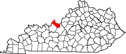
| County | Meade |
| Government | |
| • Type | Homeowners association |
| Area | |
• Total | 4.63 sq mi (12.00 km2) |
| • Land | 4.06 sq mi (10.51 km2) |
| • Water | 0.57 sq mi (1.48 km2) |
| Elevation | 607 ft (185 m) |
| Population | |
• Total | 2,270 |
| • Density | 559.2/sq mi (215.89/km2) |
| Time zone | UTC-5 (Eastern (EST)) |
| • Summer (DST) | UTC-4 (EDT) |
| ZIP Code | 40108 (Brandenburg) |
| Area code | 270 |
| FIPS code | 21-21844 |
| GNIS feature ID | 2631652 [3] |
| Website | doevalley |
Doe Valley is an unincorporated community and census-designated place (CDP) in Meade County, Kentucky, United States. Its population was 2,270 as of the 2020 census. [2]
Contents
Doe Valley was originally conceived as a planned residential community in 1965. [4]