Big Spring, Kentucky | |
|---|---|
 Big Spring  Big Spring | |
| Coordinates: 37°47′57″N86°09′08″W / 37.79917°N 86.15222°W | |
| Country | United States |
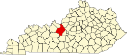
| State | Kentucky |
| Counties | Breckinridge, Hardin, Meade |
| Elevation | 663 ft (202 m) |
| Time zones | UTC-6 (Central (CST)) |
| • Summer (DST) | UTC-5 (CDT) |
| UTC-5 (Eastern (EST)) | |
| • Summer (DST) | UTC-4 (EDT) |
| Area codes | 270 & 364 |
| GNIS feature ID | 512759 [1] |
Big Spring, Kentucky is an unincorporated community in Breckinridge County (west part) in the Central Time Zone, as well as in Meade County (northeast part), and Hardin County (southeast part) in the Eastern Time Zone in the U.S. state of Kentucky. [1] [2]
Big Spring takes its name from a spring which emerges near the town site, then sinks underground. [3] A post office was established for the community in 1826. [4]