Kirk, Kentucky

Last updated

Kirk, Kentucky
USA Kentucky location map.svg
Red pog.svg
Kirk
Usa edcp location map.svg
Red pog.svg
Kirk
Coordinates: 37°43′26.21″N86°28′42.92″W / 37.7239472°N 86.4785889°W / 37.7239472; -86.4785889
Country United States
State Kentucky
County Breckinridge
Elevation
715 ft (218 m)
Time zone UTC-6 (Central (CST))
  Summer (DST) UTC-5 (CDT)
Area code(s) 270 & 364
GNIS feature ID508393 [1]

Kirk is an unincorporated community in Breckinridge County, Kentucky United States. The community was once home to a Methodist church, a post office, a mill, a railroad depot, and was regarded as an important town in the early 20th century.

Contents

Named by Henry McCracken, the president of the Louisville, Hardinsburg and Western Railway, the town began to decline after the railroad's closure.

Geography

The community is located on Kentucky Route 261 [2] just north of the intersection with Kentucky Route 108. [1]

Kirk is 4 miles (6.4 km) from Hardinsburg. [3]

History

The Kirk post office was established in November 1890, with the postmaster being James M. Withers. [4]

In addition to the post office, the community had a store, tobacco warehouses, a stave mill, and a station on the Louisville, Hardinsburg and Western Railway. The railroad was built through the town in 1888 and operated until 1941. The name honors Kirk, a town in Germany, and the place was named by Harvey McCracken, the president of the railroad company. [5] Kirk was on the rail line between Hardinsburg and McQuady. [6]

In the early 20th century, Kirk was an "important town" of Breckinridge County, according to The Handbook of Kentucky, a state publication. [7] The population was 26 in 1900. [8] Around that time, the community was described thusly in The Breckinridge News: "The town of Kirk is situated on the 'Henderson route' branch and its inhabitants are of the most wide-awake and industrious kind." [9] The newspaper went on to describe the community as a small town. [9]

A Methodist Episcopal church opened in Kirk in 1900. The dedication ceremony took place on May 13th of that year; 1,500 people were in attendance. The choir for the opening assembly was from the nearby Hardinsburg Methodist Episcopal Church. [9]

One prominent citizen of Kirk was John E. Monarch, who ran for Kentucky state senator in 1925. [10]

The population of Kirk was 56 in 1940. [3]

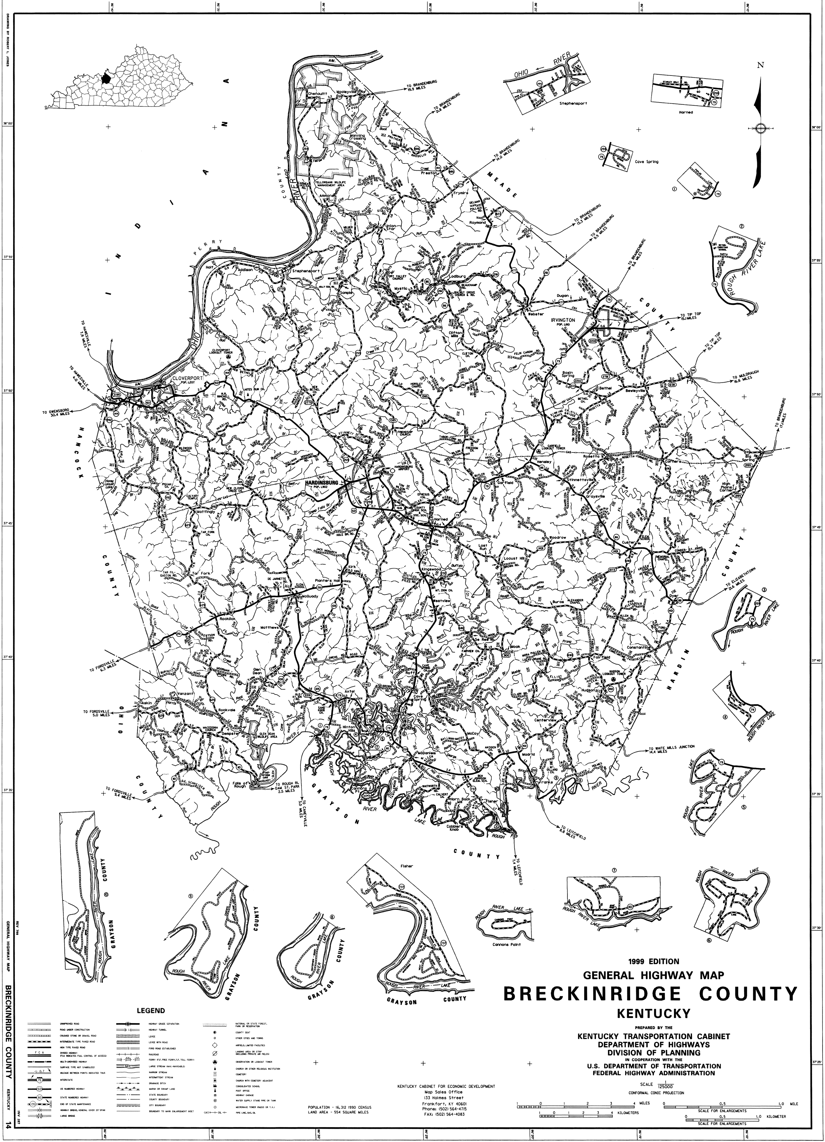
After the railroad closed the population dwindled. The Kirk post office closed in 1965. [5] Despite the population decline, Kirk still appears on county and state maps. [11] [2]

See also

Related Research Articles

<span class="mw-page-title-main">Lexington, Kentucky</span> City in Kentucky, United States

Lexington is the second-most-populous city in the Commonwealth of Kentucky, and the 60th-most populous city in the United States. It is the county seat of Fayette County. By land area, it is the country's 30th-largest city.

<span class="mw-page-title-main">Breckinridge County, Kentucky</span> County in Kentucky, United States

Breckinridge County is a county located in the Commonwealth of Kentucky. As of the 2020 census, the population was 20,432. Its county seat is Hardinsburg, Kentucky. The county was named for John Breckinridge (1760–1806), a Kentucky Attorney General, state legislator, United States Senator, and United States Attorney General. It was the 38th Kentucky county in order of formation. Breckinridge County is now a wet county, following a local-option election on January 29, 2013, but it had been a dry county for the previous 105 years.

<span class="mw-page-title-main">Cloverport, Kentucky</span> City in Kentucky, United States

Cloverport is a home rule-class city in Breckinridge County, Kentucky, United States, on the banks of the Ohio River. The population was 1,152 at the 2010 census.

<span class="mw-page-title-main">Hardinsburg, Kentucky</span> City in Kentucky, United States

Hardinsburg is a home rule-class city in Breckinridge County, Kentucky, in the United States. It is the seat of its county. The population was 2,343 at the 2010 census. Hardinsburg was named after Captain William Hardin.

<span class="mw-page-title-main">Georgetown, Kentucky</span> City in Kentucky, United States

Georgetown is a home rule-class city in Scott County, Kentucky, United States. The population was 37,086 at the 2020 census. It is the 6th-largest city by population in the U.S. state of Kentucky. It is the seat of its county. It was originally called Lebanon when founded by Rev. Elijah Craig and was renamed in 1790 in honor of President George Washington. Historically, settlers were drawn to Georgetown for its Royal Spring.

<span class="mw-page-title-main">Kentucky Route 259</span> State highway in Kentucky, United States

Kentucky Route 259 is a 95.91-mile-long (154.35 km) state highway that traverses five counties in west-central Kentucky.

McDaniels is an unincorporated community in Breckinridge County, Kentucky, United States. McDaniels is located along Kentucky Route 259, 15.5 miles (24.9 km) due south of Hardinsburg. McDaniels is situated on Rough River Lake, which collects the 29.5-mile-long (47.5 km) North Fork Rough River, which flows for its entire length in Breckinridge County. McDaniels has a post office with ZIP code 40152.

<span class="mw-page-title-main">National Register of Historic Places listings in Fayette County, Kentucky</span>

This is a list of the National Register of Historic Places listings in Fayette County, Kentucky.

<span class="mw-page-title-main">National Register of Historic Places listings in Hardin County, Kentucky</span>

This is a list of the National Register of Historic Places listings in Hardin County, Kentucky.

The following is a timeline of the history of Lexington, Kentucky, United States.

McQuady is an unincorporated community in Breckinridge County, Kentucky, United States. McQuady is located at the junction of Kentucky Route 105 and Kentucky Route 261, 5.9 miles (9.5 km) south-southwest of Hardinsburg. McQuady has a post office with ZIP code 40153.

Glen Dean is an unincorporated community in Breckinridge County, Kentucky, United States. Glen Dean is located at the west end of Kentucky Route 108, 9.8 miles (15.8 km) south-southwest of Hardinsburg. Glen Dean had a post office until it closed on June 22, 1991.

Vanzant is an unincorporated community in Breckinridge County, Kentucky, United States. Vanzant is located on Harris Fork in the southwest corner of Breckinridge County, 12.6 miles (20.3 km) southwest of Hardinsburg.

Harned is an unincorporated community in Breckinridge County, Kentucky, United States. Harned is located on U.S. Route 60, 3.2 miles (5.1 km) southeast of Hardinsburg. Harned has a post office with ZIP code 40144.

Stephensport is an unincorporated community in Breckinridge County, Kentucky, United States.

Hudson is an unincorporated community in Breckinridge County, Kentucky, United States. Hudson is located along Kentucky Route 401, 13.4 miles (21.6 km) southeast of Hardinsburg. Hudson has a post office with ZIP code 40145.

Addison is an unincorporated community in Breckinridge County, Kentucky, United States. Addison is located on the Ohio River and Kentucky Route 144, 6.8 miles (10.9 km) north-northeast of Cloverport.

Mattingly is an unincorporated community in Breckinridge County, Kentucky, United States. Mattingly is located around the intersection of Kentucky Route 992 and Kentucky Route 629, 7.9 miles (12.7 km) west of Hardinsburg.

Roff is an unincorporated community in Breckinridge County, Kentucky, United States. Roff is located on Kentucky Route 79, 8.5 miles (13.7 km) south-southeast of Hardinsburg.

<span class="mw-page-title-main">Kentucky Route 261</span> State highway in Kentucky, United States

Kentucky Route 261 (KY 261) is a 42.605-mile-long (68.566 km) state highway in Kentucky that runs from Kentucky Route 54 southeast of Fordsville to Kentucky Route 79 and Sandy Hill Road in rural Meade County southwest of Brandenburg via McQuady, Hardinsburg, and Webster.

References

  1. 1 2 "Kirk". Geographic Names Information System . United States Geological Survey, United States Department of the Interior.
  2. 1 2 "General Highway Map". maps.kytc.ky.gov. Archived from the original on June 6, 2023. Retrieved January 13, 2024.
  3. 1 2 The Attorneys List. United States Fidelity and Guaranty Company, Attorney List Department. 1940. p. 359. Archived from the original on November 3, 2022. Retrieved January 12, 2024.
  4. "Kentucky Postoffices". Lexington Herald-Leader. Lexington, KY. November 18, 1890. p. 3. Archived from the original on January 15, 2024. Retrieved January 13, 2024.
  5. 1 2 "Breckinridge County (Rennick Collection)". Morehead State University. Archived from the original on January 15, 2024. Retrieved January 11, 2024.
  6. Commission, United States Interstate Commerce (1940). Interstate Commerce Commission Reports: Reports and Decisions of the Interstate Commerce Commission of the United States. L.K. Strouse. p. 695. Archived from the original on January 13, 2024. Retrieved January 13, 2024.
  7. Statistics, Kentucky Bureau of Agriculture, Labor and (1908). Handbook of Kentucky. Globe printing Company. p. 371. Archived from the original on January 15, 2024. Retrieved January 12, 2024.{{cite book}}: CS1 maint: multiple names: authors list (link)
  8. Cram's Modern Atlas: The New Unrivaled New Census Edition. J. R. Gray & Company. 1902. p. 143. Archived from the original on December 29, 2023. Retrieved January 12, 2024.
  9. 1 2 3 "It Was A Big Day - People Gather at Kirk Sunday to Attend the Dedication Services". The Breckinridge News. Cloverport, KY. p. 1. Archived from the original on January 15, 2024. Retrieved January 12, 2024.
  10. "Monarch and Wise to Run for State Senator". The Lexington Herald. Lexington, KY. June 28, 1925. p. 5. Archived from the original on January 15, 2024. Retrieved January 13, 2024.
  11. "General Highway Map - Breckinridge County, Kentucky". University of Kentucky. 1999. Archived from the original on January 15, 2024. Retrieved January 13, 2024.

Further reading

Thompson, Bill (1971). The History and Legend of Breckinridge County, Kentucky. Utica, KY: McDowell Publications.