Rock Haven, Kentucky

Last updated

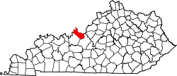
Rock Haven is an unincorporated community in Meade County, in the U.S. state of Kentucky. [1]

History

A post office called Rock Haven was established in 1848, and remained in operation until 1956. [2] The community most likely was named for nearby rock outcroppings. [3]

Related Research Articles

<span class="mw-page-title-main">Meade County, Kentucky</span> County in Kentucky, United States

Meade County is a county located in the U.S. state of Kentucky. As of the 2020 census, the population was 30,003. Its county seat is Brandenburg. The county was founded December 17, 1823, and named for Captain James M. Meade, who was killed in action at the Battle of River Raisin during the War of 1812. Meade County is part of the Elizabethtown-Fort Knox, KY Metropolitan Statistical Area, which is included in the Louisville/Jefferson County-Elizabethtown-Madison, KY-IN Combined Statistical Area.

<span class="mw-page-title-main">Breckinridge County, Kentucky</span> County in Kentucky, United States

Breckinridge County is a county located in the Commonwealth of Kentucky. As of the 2020 census, the population was 20,432. Its county seat is Hardinsburg, Kentucky. The county was named for John Breckinridge (1760–1806), a Kentucky Attorney General, state legislator, United States Senator, and United States Attorney General. It was the 38th Kentucky county in order of formation. Breckinridge County is now a wet county, following a local option election on January 29, 2013, but it had been a dry county for the previous 105 years.

<span class="mw-page-title-main">Brandenburg, Kentucky</span> City in Kentucky, United States

Brandenburg is a home rule-class city on the Ohio River in Meade County, Kentucky, in the United States. The city is 46 miles (74 km) southwest of Louisville. It is the seat of its county. The population was 2,643 at the 2010 census.

<span class="mw-page-title-main">Russell Springs, Kentucky</span> City in Kentucky, United States

Russell Springs is a home rule-class city in Russell County, Kentucky, in the United States. The city is the gateway to Lake Cumberland, one of the largest man-made lakes in the region, created by Wolf Creek Dam. It is the largest city in the county, having a population of 2,441 during the year 2010 U.S. Census.

<span class="mw-page-title-main">Otter Creek Outdoor Recreation Area</span>

Otter Creek Outdoor Recreation Area is a 2,600 acre (11 km²) riverfront park in Meade County, Kentucky. The park is located near Muldraugh and Fort Knox, along State Highway 1638, near U.S. 31W. Although it is located outside Louisville, the park was long operated by the city of Louisville and, after the 2003 merger of the city and Jefferson County, Louisville Metro Government. Both entities attempted to give or sell the park to Meade County and the Commonwealth of Kentucky at various times over the years, most recently in 2004. The park closed in 2009 and reopened in 2011. It is now operated by the Kentucky Department of Fish and Wildlife Resources.

Rosine is an unincorporated community in Ohio County, Kentucky, United States. Bill Monroe, The Father of Bluegrass, is buried in the community and memorialized with a bronze cast disk affixed to the barn where his music remains alive. The community was named for the pen name of Jenny Taylor McHenry, poet and wife of founder Henry D. McHenry. The ZIP Code is 42370 and the area code is 270. The nearest communities are Horse Branch, and Beaver Dam; and the nearest major cities are Owensboro and Bowling Green. The community sits at an elevation of 429 feet. At one time, Rosine was a thriving community with several stores, a school, a pickle factory, and a bat mill that milled bats for the Louisville Slugger bat factory.

The Gasper River is a 38.6-mile-long (62.1 km) river in southwestern Kentucky, United States. It flows northeasterly into the Barren River. It is a rural river; the only community near it is unincorporated Hadley in Warren County. It begins in northeast Logan County, and the river also flows through Warren and Logan counties. Tributaries include Belcher, Salt Lick, Brush, Clear Fork, Westbrook, and Rock House creeks.

Sweeden is an unincorporated community in north-central Edmonson County, Kentucky, United States. The population of Sweeden's ZCTA was 171 at the 2000 census. It is part of the Bowling Green, Kentucky Metropolitan Statistical Area. The ZIP Code for Sweeden is 42285.

Shannondale is an unincorporated community in Montgomery and Boone counties, in the U.S. state of Indiana.


Philpot is an unincorporated community in Daviess County, in the U.S. state of Kentucky.

Guston is a rural unincorporated community in Meade County, Kentucky, United States. It is a small unincorporated community that lies a few miles southwest of Brandenburg on KY 428, near its intersection with KY 710.

Rhoda is an unincorporated community located in Edmonson County, Kentucky, United States.

Concordia is an unincorporated community in Meade County, Kentucky, in the United States.

Gus is an unincorporated community in Muhlenberg County, in the U.S. state of Kentucky.

Richardsville is an unincorporated community in Warren County, in the U.S. state of Kentucky.

Rockland is an unincorporated community in Warren County, in the U.S. state of Kentucky.

Sadler is an unincorporated community in Grayson County, in the U.S. state of Kentucky.

Moxahala Park is an unincorporated community in Muskingum County, in the U.S. state of Ohio.

Hazel Run is an unincorporated community in northeastern St. Francois County, in the U.S. state of Missouri. The community is located one-half mile south of Hazel Run creek and approximately five miles east-northeast of Bonne Terre.

Northtown is an unincorporated community in Hart County, Kentucky, United States. It is a populated place at latitude 37.214 and longitude

References

  1. U.S. Geological Survey Geographic Names Information System: Rock Haven, Kentucky
  2. "Meade County". Jim Forte Postal History. Retrieved 24 December 2015.
  3. Rennick, Robert M. Kentucky Place Names. University Press of Kentucky. p. 254. ISBN   0-8131-2631-2.

Coordinates: 37°56′49″N86°03′17″W / 37.94694°N 86.05472°W / 37.94694; -86.05472