Garrett, Kentucky | |
---|---|
Coordinates: 37°53′52″N86°06′47″W / 37.89778°N 86.11306°W Coordinates: 37°53′52″N86°06′47″W / 37.89778°N 86.11306°W | |
Country | United States |
State | Kentucky |
County | Meade |
Elevation | 686 ft (209 m) |
Time zone | UTC-5 (Eastern (EST)) |
• Summer (DST) | UTC-4 (EDT) |
GNIS feature ID | 492718 [1] |
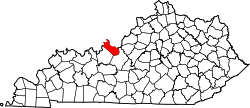
Garrett is an unincorporated community in Meade County, Kentucky, United States. [2] [3]
The Elizabethtown–Fort Knox Metropolitan Statistical Area, as defined by the United States Census Bureau, is an area consisting of two counties in Kentucky, anchored by the city of Elizabethtown and the nearby Fort Knox Army post. As of the 2020 census, the MSA had a population of 155,572.
Flaherty, an unincorporated community in Meade County, Kentucky, United States, is located 13 miles/21 km south of Brandenburg on KY 144, at its intersection with KY 1600 and KY 1816. While predominantly a rural agricultural community; Flaherty has a modest business district consisting of a Dollar General store, car wash, banks, and a gas station. Notable locations also include: Flaherty Elementary & Primary School, Saint Martin of Tours Catholic Church, Flaherty Ball Park, and Flaherty Fire Department. Clarkson House is also in Flaherty.
Rhodelia is a rural unincorporated community in Meade County, Kentucky, United States. It is a small community that lies a few miles west of Brandenburg on KY 144 near its intersection with Rhodes Road and south of KY 144's intersection with KY 259.
Chavies is a residential hamlet with a U.S. Post Office located in Perry County, Kentucky, United States.
This is a list of the National Register of Historic Places listings in Trigg County, Kentucky.
Big Spring, Kentucky is an unincorporated community in Breckinridge County in the Central Time Zone, as well as in Meade County and Hardin County in the Eastern Time Zone in the U.S. state of Kentucky.
Blue Moon is an unincorporated community located in Floyd County, Kentucky, United States.
Beefhide is an unincorporated community spanning across a county line between Letcher County and Pike County, Kentucky, United States.
Printer is an unincorporated community and coal town in Floyd County, Kentucky, United States.
Garrett is an unincorporated community and coal town in Floyd County, Kentucky, United States. It is located at the intersection of Kentucky Route 80 and Kentucky Route 7. CSX E&BV Subdivision also passes through the center of town between Front Street and State Route 7.
Meta is an unincorporated community in Pike County, Kentucky. Meta is located at the junction of Kentucky Route 1426 and Kentucky Route 2169 7.7 miles (12.4 km) northeast of Pikeville. The community had a post office from 1896 to 1959.
Buchanan, originally named Mouth of Bear, is an unincorporated community located in Lawrence County, Kentucky, United States at the mouth of Bear Creek where it joins the Big Sandy River, five miles downstream from the mouth of Blaine Creek.
Piso is an unincorporated community located in Pike County, Kentucky, United States. Their post office has been closed. The community was named by Bud Williamson after viewing an advertisement for medicine in an almanac.
Concordia is an unincorporated community in Meade County, Kentucky, in the United States.
Doe Valley is an unincorporated community and census-designated place in Meade County, Kentucky, United States. Its population was 1,931 as of the 2010 census.
Midway is an unincorporated community in Calloway County, Kentucky, United States.
Midway is an unincorporated community in Meade County, Kentucky, United States.
Hog Wallow is an unincorporated community in Meade County, Kentucky, United States.
Lickskillet is an unincorporated community in Meade County, Kentucky, United States.
Dango is a ghost town located in southwestern Jackson County, Kentucky, United States. The town was located at the confluence of Racoon Creek and Horse Lick Creek, which flows into the Rockcastle River. It is located southwest of McKee by 8 miles, and 2.7 miles southeast of another ghost town, Loam. Near the confluence of the two creeks is the historical Carpenter School, which may be named after Carpenter Ridge, of which it is two miles south of. Heavy settlement and farming occurred in the area around Horse Lick Creek, where Dango was, until the early 1900s. The area where Dango was is currently occupied by the Daniel Boone National Forest, known as the Horse Lick Creek Biopreserve, with the majority of ownership being private.