Limp, Kentucky

Last updated
Limp, Kentucky
Unincorporated community
USA Kentucky location map.svg
Red pog.svg
Limp
Usa edcp location map.svg
Red pog.svg
Limp
Coordinates: 37°35′32″N86°11′51″W / 37.59222°N 86.19750°W / 37.59222; -86.19750 Coordinates: 37°35′32″N86°11′51″W / 37.59222°N 86.19750°W / 37.59222; -86.19750
Country United States
State Kentucky
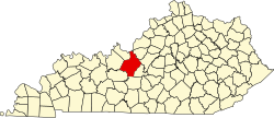
County Hardin
Elevation 722 ft (220 m)
Time zone Eastern (EST) (UTC-5)
  Summer (DST) EDT (UTC-4)
Area code(s) 270 & 364
GNIS feature ID 508465 [1]

Limp is an unincorporated community in Hardin County, Kentucky, United States.

Hardin County, Kentucky County in the United States

Hardin County is a county located in the U.S. state of Kentucky. Its county seat is at Elizabethtown. The county was formed in 1792.

Kentucky State of the United States of America

Kentucky, officially the Commonwealth of Kentucky, is a state located in the east south-central region of the United States. Although styled as the "State of Kentucky" in the law creating it, (because in Kentucky's first constitution, the name state was used) Kentucky is one of four U.S. states constituted as a commonwealth. Originally a part of Virginia, in 1792 Kentucky became the 15th state to join the Union. Kentucky is the 37th most extensive and the 26th most populous of the 50 United States.

A post office called Limp was established in 1884, and remained in operation until it was discontinued in 1934. [2] Limp has been noted for its unusual place name. [3]

Place names considered unusual Wikimedia list article

Unusual place names are names for cities, towns, and other regions which are considered non-ordinary in some manner. This can include place names which are also swear words, inadvertently humorous or highly charged words, as well as place names of unorthodox spelling and pronunciation, including especially short or long names.

Related Research Articles

Breckinridge County, Kentucky County in the United States

Breckinridge County is a county located in the Commonwealth of Kentucky. As of the 2010 census, the population was 20,059. Its county seat is Hardinsburg, Kentucky. The county was named for John Breckinridge (1760–1806), a Kentucky Attorney General, state legislator, United States Senator, and United States Attorney General. It was the 38th Kentucky county in order of formation.

Hardin County, Illinois County in the United States

Hardin County is a county located in the U.S. state of Illinois. According to the 2010 census, it has a population of 4,320, making it the least populous county in Illinois. Its county seat is Elizabethtown. Hardin County is located in the part of the state known as Little Egypt. Hardin County was named for Hardin County, Kentucky, which was named in honor of Colonel John Hardin, an officer in the American Revolutionary War and the Northwest Indian War.

Hardinsburg, Kentucky City in Kentucky, United States

Hardinsburg is a home rule-class city in Breckinridge County, Kentucky, in the United States. It is the seat of its county. The population was 2,343 at the 2010 census. Hardinsburg was named after Captain William Hardin.

Elizabethtown, Kentucky City in Kentucky, United States

Elizabethtown is a home rule-class city and the county seat of Hardin County, Kentucky, United States. The population was 28,531 at the 2010 census, and was estimated at 29,906 by the U.S. Census Bureau in 2016, making it the 11th-largest city in the state. It is included in the Elizabethtown–Fort Knox, Kentucky Metropolitan Statistical Area, which is included in the Louisville/Jefferson County–Elizabethtown–Madison, Kentucky-Indiana Combined Statistical Area.

Radcliff, Kentucky City in Kentucky, United States

Radcliff is a home rule-class city in Hardin County, Kentucky, in the United States. The population was 21,692 at the 2010 census, and in 2016 the estimated population was 22,490. It is included in the Elizabethtown–Fort Knox Metropolitan Area.

Charles Henry Hardin American politician

Charles Henry Hardin was a politician and governor from Missouri, and one of the eight founders of Beta Theta Pi fraternity.

Louisville metropolitan area Geographic region surrounding Louisville, KY, USA

The Louisville metropolitan area or Kentuckiana, also known as the Louisville–Jefferson County, Kentucky–Indiana, metropolitan statistical area, is the 45th largest metropolitan statistical area (MSA) in the United States. The principal city is Louisville, Kentucky.

Colonel John Hardin was a soldier, farmer, rancher, noted marksman and hunter. He was wounded fighting in Lord Dunmore's War; served as a Continental Army officer in the American Revolutionary War and as a Kentucky Co., Virginia militia commander in the Northwest Indian War. He was a member of the Methodist church and one of the first judges in the original Washington County, Virginia. Colonel Hardin was killed in an ambush while acting as a peace emissary to the Shawnee Indian people.

John L. Helm Governor of Kentucky

John LaRue Helm was the 18th and 24th governor of the U.S. Commonwealth of Kentucky, although his service in that office totaled less than fourteen months. He also represented Hardin County in both houses of the Kentucky General Assembly and was chosen to be the Speaker of the Kentucky House of Representatives four times. In 1838 his sole bid for federal office ended in defeat when his opponent, Willis Green, was elected to the U.S. House of Representatives.

Martin D. Hardin American politician

Martin D. Hardin was a politician and lawyer from Kentucky. Born in Pennsylvania, his family immigrated to Kentucky when he was still young. He studied law under George Nicholas and commenced practice at Richmond, Kentucky. His cousin, future U.S. Representative Benjamin Hardin, studied in his law office. He represented Madison County in the Kentucky House of Representatives for a single term.

Area code 502

Area code 502 serves north central Kentucky, primarily Louisville, its suburbs, and the state capital, Frankfort. Its service area encompasses the following Kentucky counties :

Benjamin Hardin American politician

Benjamin Hardin was a United States Representative from Kentucky. Martin Davis Hardin was his cousin. He was born at the Georges Creek settlement on the Monongahela River, Westmoreland County, Pennsylvania and then moved with his parents to Washington County, Kentucky in 1788. Hardin attended the schools of Nelson and Washington Counties, Kentucky before studying law. He was admitted to the bar in 1806 and commenced practice in Elizabethtown and Bardstown, Nelson County, Kentucky and he settled in Bardstown, Kentucky in 1808.

The Elizabethtown–Fort Knox Metropolitan Statistical Area, as defined by the United States Census Bureau, is an area consisting of two counties in Kentucky, anchored by the city of Elizabethtown and the nearby Fort Knox Army post. As of the 2000 census, the MSA had a population of 107,547.

Big Spring, Kentucky Unincorporated community in Kentucky, United States

Big Spring, Kentucky is an unincorporated community in Breckinridge County, Meade County, and Hardin County in the U.S. state of Kentucky.

Saint John, Kentucky Unincorporated community in Kentucky, United States

Saint John is an unincorporated community in Hardin County, Kentucky, United States. Saint John is located on Kentucky Route 1357, 5.6 miles (9.0 km) west of Elizabethtown.

Howe Valley, Kentucky Unincorporated community in Kentucky, United States

Howevalley is an unincorporated community in Hardin County, Kentucky, United States. Howe Valley is located on Kentucky Route 86 12.3 miles (19.8 km) west of Elizabethtown.

Star Mills, Kentucky Unincorporated community in Kentucky, United States

Star Mills is an unincorporated community in Hardin County, Kentucky, United States. Star Mills is located on Kentucky Route 1375, 9.6 miles (15.4 km) southwest of Elizabethtown.

Hardin Springs, Kentucky Unincorporated community in Kentucky, United States

Hardin Springs is an unincorporated community in Hardin County, Kentucky, United States. Hardin Springs is located on Kentucky Route 84, 22.4 miles (36.0 km) west-southwest of Elizabethtown. The Hardin Springs School, which is listed on the National Register of Historic Places, is located in Hardin Springs.

Hardin Township is an inactive township in Clinton County, in the U.S. state of Missouri.

References

  1. U.S. Geological Survey Geographic Names Information System: Limp, Kentucky
  2. "Hardin County". Jim Forte Postal History. Retrieved 14 April 2015.
  3. Strecker, Zoe; Finch, Jackie Sheckler (1 July 2009). Kentucky Off the Beaten Path. Rowman & Littlefield. p. 11. ISBN   978-0-7627-5790-9.