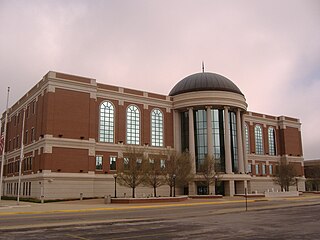
Warren County is a county located in the U.S. state of Kentucky. As of 2018, the population was 131,264, making it the fifth-most populous county in Kentucky. The county seat is Bowling Green. Warren County is now classified as a wet county after voters approved the measure in 2018. The measure became law in January 2019 that allows alcohol to be sold county wide.

McCreary County is a county located in the U.S. state of Kentucky. As of the 2010 census, the population was 18,306. Its county seat is Whitley City. The county is named for James B. McCreary, a Confederate war hero and two-time Governor of Kentucky. During his second term as Governor, McCreary County was created by the Legislature and was named in his honor.

Harlan is a home rule-class city in and the county seat of Harlan County, Kentucky, United States. The population was 1,745 at the 2010 census, down from 2,081 at the 2000 census.

Louisa is a home rule-class city located at the merger of the Levisa and Tug Forks into the Big Sandy River. It is located in Lawrence County, Kentucky, in the United States, and is the seat of its county. The population was 2,467 at the 2010 census and an estimated 2,375 in 2018.

The Cumberland River is a major waterway of the Southern United States. The 688-mile-long (1,107 km) river drains almost 18,000 square miles (47,000 km2) of southern Kentucky and north-central Tennessee. The river flows generally west from a source in the Appalachian Mountains to its confluence with the Ohio River near Paducah, Kentucky, and the mouth of the Tennessee River. Major tributaries include the Obey, Caney Fork, Stones, and Red rivers.

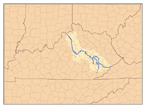
The Kentucky River is a tributary of the Ohio River, 260 miles (418 km) long, in the U.S. Commonwealth of Kentucky. The river and its tributaries drain much of the central region of the state, with its upper course passing through the coal-mining regions of the Cumberland Mountains, and its lower course passing through the Bluegrass region in the north central part of the state. Its watershed encompasses about 7,000 square miles (18,000 km2). It supplies drinking water to about one-sixth of the population of the Commonwealth of Kentucky.
Three Forks may refer to:

Rock Island is an unincorporated community in the northeastern-most portion of Warren County, Tennessee, United States. The town is named after an island on the Caney Fork River just below the confluence of the Rocky River. Rock Island is home to the Great Falls Dam and Rock Island State Park.
Dry Fork or Dryfork may refer to:

The Big South Fork National River and Recreation Area preserves the Big South Fork of the Cumberland River and its tributaries in northeastern Tennessee and southeastern Kentucky. In addition, the former mining community of Blue Heron is preserved and interpreted via signage.
Three Forks, Kentucky, may refer to:
Kentucky Route 101 (KY 101) is a north–south highway traversing three counties in south central Kentucky.

Proctor is an unincorporated community in Lee County, Kentucky, United States. It lies along Route 11 south of the city of Beattyville, the county seat of Lee County. Proctor is also located near the beginning point of the Kentucky River. There are three tributaries which combine near Beattyville and Proctor; the North Fork of the Kentucky River, the Middle Fork of the Kentucky River; and the South Fork of the Kentucky River. For this reason, many local businesses make mention of the "Three Forks".


