Rich Pond, Kentucky

Last updated
Rich Pond
USA Kentucky location map.svg
Red pog.svg
Rich Pond
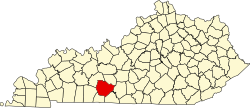
Location within the state of Kentucky
Coordinates: 36°53′39.15″N86°30′33.98″W / 36.8942083°N 86.5094389°W / 36.8942083; -86.5094389
CountryUnited States
State Kentucky
County Warren
Elevation
587 ft (179 m)
Time zone UTC-6 (Central (CST))
  Summer (DST) UTC-5 (CST)
ZIP codes
42104
Area code(s) 270 and 364
GNIS feature ID501793 [1]

Rich Pond is an unincorporated community in Warren County, Kentucky, United States. [1] It is part of the Bowling Green metropolitan statistical area.

Contents

Geography

Rich Pond is located along U.S. Route 31W, known locally as Nashville Road, at its junction with Kentucky Route 242, about 3 miles (4.8 km) south of the Bowling Green city limits. It can be accessed directly from I-165 from Exit 4.

Education

Rich Pond is home to three public schools of the Warren County Public Schools system. Rich Pond Elementary is located on KY 242 on the east side of the community. The South Warren Middle and High School building complex, which houses both the middle and high school institutions, comprises Kentucky's largest school facility.

Related Research Articles

<span class="mw-page-title-main">Warren County, Kentucky</span> County in Kentucky, United States

Warren County is a county located in the south central portion of the U.S. state of Kentucky. As of the 2020 census, the population was 134,554, making it the fifth-most populous county in Kentucky. The county seat is Bowling Green. Warren County is now classified as a wet county after voters approved the measure in 2018. The measure became law in January 2019 that allows alcohol to be sold county wide.

<span class="mw-page-title-main">Edmonson County, Kentucky</span> County in Kentucky, United States

Edmonson County is a county located in the south central portion of the U.S. state of Kentucky. As of the 2020 census, the population was 12,126. Its county seat and only municipality is Brownsville. The county was formed in 1825 and named for Captain John "Jack" Edmonson (1764–1813), who was killed at the Battle of Frenchtown during the War of 1812. This is a dry county where the sale of alcohol is prohibited. Edmonson County is included in the Bowling Green, Kentucky Metropolitan Statistical Area.

Annville is an unincorporated community, a census-designated place (CDP), and the largest community in Jackson County, KY. As of the 2020 census, the population was 1,102. The community was established in 1878 and named for local resident Nancy Ann Johnson. The community offers a few services such as a post office, grocery store, gas station, medical clinic, nursing home, restaurants, and other locally owned businesses.

<span class="mw-page-title-main">Bowling Green, Kentucky</span> City in Kentucky, United States

Bowling Green is a home rule-class city and the county seat of Warren County, Kentucky, United States. Founded by pioneers in 1798, Bowling Green was the provisional capital of Confederate Kentucky during the American Civil War. As of the 2020 census, its population of 72,294 made it the third-most-populous city in the state after Louisville and Lexington; its metropolitan area, which is the fourth largest in the state after Louisville, Lexington, and Northern Kentucky, had an estimated population of 179,240; and the combined statistical area it shares with Glasgow has an estimated population of 233,560.

<span class="mw-page-title-main">Smiths Grove, Kentucky</span> City in Kentucky, United States

Smiths Grove is a home rule-class city in Warren County, Kentucky, United States. The population was 714 at the 2010 census. It is included in the Bowling Green, Kentucky Metropolitan Statistical Area.

Warren Central High School is a 4-year high school in Bowling Green in the U.S. state of Kentucky. It is one of four high schools serving the Warren County Public Schools.

<span class="mw-page-title-main">U.S. Route 31W</span> U.S. Highway in Kentucky and Tennessee

U.S. Route 31W is the westernmost of two parallel routes for U.S. Route 31 from Nashville, Tennessee to Louisville, Kentucky.

<span class="mw-page-title-main">Kentucky Route 880</span>

Kentucky Route 880 is a three miles (4.8 km) east–west state highway that forms a connector between U.S. Route 231 (US 231) and KY 234 in the city of Bowling Green, Kentucky. The western terminus of the route is at US 231 in Bowling Green. The eastern terminus is at KY 234 near the community of Indian Hills east of downtown.

<span class="mw-page-title-main">Kentucky Route 242</span>

Kentucky Route 242 is a 10.275-mile-long (16.536 km) long east–west state highway located south of the city limits of Bowling Green in rural Warren County, Kentucky. The western terminus of the route is at US 68 and KY 80 northwest of Rockfield. The eastern terminus is at KY 622 south of Plano.

<span class="mw-page-title-main">John E. Halsell</span> American politician

John Edward Halsell was a U.S. Representative from Kentucky.

<span class="mw-page-title-main">Kentucky Route 185</span> State highway in Kentucky

Kentucky Route 185 is a north–south state highway traversing four counties in west-central Kentucky.

<span class="mw-page-title-main">Kentucky Route 884</span>

Kentucky Route 884 (KY 884) is a south-north highway in Warren County, Kentucky. Primarily a route serving rural areas southeast of Bowling Green, the route enters the city before its end at U.S. Route 231. The route is known locally as Three Springs Road.

South Warren High School, located in Bowling Green, in the U.S. state of Kentucky, is one of four high schools in the Warren County School System. The school opened on August 3, 2010. It is co-located in the same building complex as South Warren Middle School. Together they comprise the largest school facility in Kentucky. The mascot for South Warren, the Spartans, is inspired by Sparta, an ancient society characterized by a constitutional diarchy form of government and a reverence for martial pursuits.

Bristow is an unincorporated community in Warren County, Kentucky, United States. Bristow is part of the Bowling Green Metropolitan Statistical Area.

Hadley is an unincorporated community in Warren County, Kentucky, United States.

<span class="mw-page-title-main">Kentucky Route 67 (1929–1969)</span> Former highway in Kentucky, United States

The original alignment of Kentucky Route 67 (KY 67) was a north–south primary state highway that traversed Edmonson and Warren counties in south central Kentucky. It was one of the original state routes of the state highway system maintained by the Kentucky Transportation Cabinet. It was established in 1929 and was officially decommissioned in 1969. At the time of its removal from the state route system, it was estimated to be 21.491 miles (34.586 km) long as determined by the KYTC's state route logs and county road logs.

Reedyville is an Unincorporated community in Butler County, Kentucky, United States. The town is supposedly named for the nearby Big Reedy Creek, a tributary of the Green River.

Logansport is an unincorporated community in northwestern Butler County in south-central Kentucky, United States. Logansport is part of the Bowling Green Metropolitan Statistical Area.

Glenmore is an unincorporated community located in northern Warren County, Kentucky, United States. Glenmore is part of the Bowling Green Metropolitan Statistical Area.

Warren County Public Schools is a school division that serves students living in Warren County, Kentucky.

References