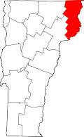
Bloomfield, Vermont

Last updated

Bloomfield, Vermont
Town
Bloomfield, Vermont Old Town Hall.jpg
Essex County Vermont incorporated and unincorporated areas Bloomfield highlighted.svg
Location in Essex County and the state of Vermont.
Map of USA VT.svg
Location of Vermont with the U.S.A.
Coordinates: 44°47′44″N71°38′6″W / 44.79556°N 71.63500°W / 44.79556; -71.63500
Country United States
State Vermont
County Essex
Area
  Total40.5 sq mi (105.0 km2)
  Land40.3 sq mi (104.4 km2)
  Water0.2 sq mi (0.6 km2)
Elevation
1,804 ft (550 m)
Population
 (2020)
  Total217
  Density5/sq mi (2.1/km2)
  Households
101
  Families
75
Time zone UTC-5 (EST)
  Summer (DST) UTC-4 (EDT)
ZIP code
05905
Area code 802
FIPS code 50-009-06325 [1]
GNIS feature ID1462044 [2]

Bloomfield is a town in Essex County, Vermont, United States. The population was 217 at the 2020 census. [3] It is part of the Berlin, New Hampshire-Vermont Micropolitan Statistical Area.

Contents

History

In 1830, an act from the state General Assembly changed the name of the town from "Minehead" to "Bloomfield." [4]

Geography

Bloomfield is in northeastern Essex County, along the Connecticut River, which forms the state line with New Hampshire. The town is bordered to the southwest by Brunswick, to the northwest by Lewis, at its northernmost point by Averill, and to the northeast by Lemington, Vermont, while to the southeast, across the river, it is bordered by the towns of Columbia and Stratford, New Hampshire. The settlement of Bloomfield is in the southern corner of the town, at the mouth of the Nulhegan River in the Connecticut, and connected by bridge to the village of North Stratford, New Hampshire.

Vermont Route 102 follows the Connecticut River along the southeastern edge of the town, leading northeast 13 miles (21 km) to Colebrook, New Hampshire, and south 15 miles (24 km) to Guildhall, Vermont, while Vermont Route 105 leads west up the Nulhegan River 16 miles (26 km) to Island Pond.

According to the United States Census Bureau, the town has a total area of 40.5 square miles (105.0 km2), of which 40.3 square miles (104.4 km2) is land and 0.2 square miles (0.6 km2), or 0.59%, is water. [5] The highest point in the town is 2,470 feet (750 m) along the northeast boundary.

Much of the town's land is at a high elevation, but the population is concentrated along the river where the elevation is much lower.

Climate

A weather station was run in the town from 1906 to 1968. It was located at the southeast edge of town, near Lyman Falls along the Connecticut River. On December 30, 1933, Bloomfield set a record low temperature for New England with −50 °F (−46 °C), a record not tied until 2009 when a small station along the Big Black River, Maine, also recorded −50 °F (−46 °C) on January 16.

Climate data for Bloomfield (1906–1968); elevation 940 feet
MonthJanFebMarAprMayJunJulAugSepOctNovDecYear
Record high °F (°C)62
(17)
68
(20)
78
(26)
87
(31)
96
(36)
99
(37)
98
(37)
97
(36)
98
(37)
88
(31)
75
(24)
62
(17)
99
(37)
Mean daily maximum °F (°C)27
(−3)
29
(−2)
39
(4)
52
(11)
66
(19)
76
(24)
80
(27)
78
(26)
70
(21)
59
(15)
43
(6)
30
(−1)
55
(13)
Mean daily minimum °F (°C)3
(−16)
3
(−16)
14
(−10)
28
(−2)
38
(3)
48
(9)
53
(12)
51
(11)
44
(7)
34
(1)
24
(−4)
10
(−12)
29
(−2)
Record low °F (°C)−44
(−42)
−45
(−43)
−32
(−36)
−12
(−24)
14
(−10)
25
(−4)
30
(−1)
23
(−5)
20
(−7)
6
(−14)
−15
(−26)
−50
(−46)
−50
(−46)
Average precipitation inches (mm)2.3
(58)
2.0
(51)
2.2
(56)
2.9
(74)
3.2
(81)
4.0
(100)
4.1
(100)
3.9
(99)
3.7
(94)
3.5
(89)
3.2
(81)
2.5
(64)
37.8
(960)
Average snowfall inches (cm)23.0
(58)
20.6
(52)
15.0
(38)
5.1
(13)
0.4
(1.0)
0
(0)
0
(0)
0
(0)
0
(0)
1.3
(3.3)
8.7
(22)
18.3
(46)
92.4
(233.3)
Source: Desert Research Institute [6]

Demographics

Historical population
CensusPop.Note
1800 27
1810 144433.3%
1820 132−8.3%
1830 15013.6%
1840 17919.3%
1850 24436.3%
1860 32031.1%
1870 45542.2%
1880 62737.8%
1890 82731.9%
1900 504−39.1%
1910 496−1.6%
1920 382−23.0%
1930 4179.2%
1940 326−21.8%
1950 291−10.7%
1960 212−27.1%
1970 196−7.5%
1980 188−4.1%
1990 25334.6%
2000 2613.2%
2010 221−15.3%
2020 217−1.8%
U.S. Decennial Census [7]

At the 2000 census there were 261 people in 101 households, including 75 families, in the town. The population density was 6.5 inhabitants per square mile (2.5/km2). There were 191 housing units at an average density of 4.7 per square mile (1.8/km2). The racial makeup of the town was 95.40% White, 1.53% Native American, 0.38% Asian, and 2.68% from two or more races. [1] Of the 101 households 34.7% had children under the age of 18 living with them, 61.4% were married couples living together, 6.9% had a female householder with no husband present, and 25.7% were non-families. 23.8% of households were one person and 13.9% were one person aged 65 or older. The average household size was 2.58 and the average family size was 3.03.

The age distribution was 27.2% under the age of 18, 4.2% from 18 to 24, 29.9% from 25 to 44, 23.8% from 45 to 64, and 14.9% 65 or older. The median age was 39 years. For every 100 females, there were 119.3 males. For every 100 females age 18 and over, there were 108.8 males.

The median household income was $33,500 and the median family income was $39,167. Males had a median income of $27,708 versus $20,357 for females. The per capita income for the town was $17,224. About 3.2% of families and 4.0% of the population were below the poverty line, including none of those under the age of eighteen and 7.7% of those sixty-five or over.

Related Research Articles

<span class="mw-page-title-main">Essex County, Vermont</span> County in Vermont, United States

Essex County is a county located in the northeastern part of the U.S. state of Vermont. As of the 2020 census, the population was 5,920, making it the least-populous county in both Vermont and New England. Its shire town is the municipality of Guildhall. The county was created in 1792 and organized in 1800. Bordered by the Connecticut River next to New Hampshire, Essex County is south of the Canadian province of Quebec. It is the county with the lowest household-income in Vermont.

<span class="mw-page-title-main">Clarksville, New Hampshire</span> Town in New Hampshire, United States

Clarksville is a town in northern Coös County, New Hampshire, United States. The population was 294 at the 2020 census. It is part of the Berlin, NH-VT Micropolitan Statistical Area.

<span class="mw-page-title-main">Northumberland, New Hampshire</span> Town in New Hampshire, United States

Northumberland is a town located in western Coös County, New Hampshire, United States, north of Lancaster. It is part of the Berlin, NH–VT micropolitan statistical area. As of the 2020 census, the town population was 2,126, of whom 1,068 lived in the village of Groveton.

<span class="mw-page-title-main">Stewartstown, New Hampshire</span> Town in New Hampshire, United States

Stewartstown is a town in Coös County, New Hampshire, United States. The population was 813 at the 2020 census, down from 1,004 at the 2010 census. It includes the village of West Stewartstown and is part of the Berlin, NH-VT Micropolitan Statistical Area.

<span class="mw-page-title-main">Stratford, New Hampshire</span> Town in New Hampshire, United States

Stratford is a town located on the Connecticut River in Coös County, New Hampshire, United States. The population was 662 at the 2020 census, a decline from the figure of 746 tabulated in 2010. Within the town are the villages of North Stratford, Stratford Hollow, and Beatties. U.S. Route 3 passes through the center of town, as does the St. Lawrence and Atlantic Railroad, formerly a part of the Grand Trunk Railway.

<span class="mw-page-title-main">Woodsville, New Hampshire</span> Census-designated place in New Hampshire, United States

Woodsville is a census-designated place (CDP) and the largest village in the town of Haverhill in Grafton County, New Hampshire, United States, along the Connecticut River at the mouth of the Ammonoosuc River. The population was 1,431 at the 2020 census. Although North Haverhill is now the county seat of Grafton County, the village of Woodsville has traditionally been considered the county seat, as the county courthouse was originally located there. The county buildings are now located halfway between Woodsville and the village of North Haverhill to the south.

<span class="mw-page-title-main">Unity, New Hampshire</span> Place in New Hampshire, United States

Unity is a town in Sullivan County, New Hampshire, United States. The population was 1,518 at the 2020 census, down from 1,671 at the 2010 census. The town includes the villages of Unity, East Unity, Quaker City, and West Unity.

<span class="mw-page-title-main">Waterford, Vermont</span> Town in Vermont, United States

Waterford is a town in Caledonia County, Vermont, United States. The population was 1,268 at the 2020 census.

<span class="mw-page-title-main">Averill, Vermont</span> Town in Vermont, United States

Averill is an unincorporated town in Essex County, Vermont, United States. The town was named for Samuel Averill, a landholder. The town was never formally incorporated, having never gained a large enough permanent population. The population was 21 at the 2020 census. The town's affairs are handled by the Unified Towns & Gores of Essex County. It is part of the Berlin, New Hampshire Vermont Micropolitan Statistical Area.

<span class="mw-page-title-main">Brighton, Vermont</span> Town in Vermont, United States

Brighton is a town in Essex County, Vermont, United States. The population was 1,157 at the 2020 census. The town was named "Gilead" in its original grant in 1780. The town was sold to a group consisting primarily of soldiers commanded by Colonel Joseph Nightingale and subsequently named "Random". The town's name was finally changed by the legislature to "Brighton" in 1832. The Brighton village of Island Pond gets its name from the Abenaki word Menanbawk, which literally means island pond.

<span class="mw-page-title-main">Brunswick, Vermont</span> Town in Vermont, United States

Brunswick is a town in Essex County, Vermont, United States. The town was named after Prince Karl Wilhelm Ferdinand of Brunswick-Lunenburg. The population was 88 at the 2020 census. It is part of the Berlin, NH–VT Micropolitan Statistical Area. Brunswick is home to six mineral springs that made the town a popular resort destination in the 19th century. The land the springs are on is now owned by the Abenaki people.

<span class="mw-page-title-main">Canaan, Vermont</span> Town in Vermont, United States

Canaan is a town in Essex County, Vermont, United States. The population was 896 at the 2020 census. Canaan contains the village of Beecher Falls, located at the confluence of the Connecticut River and Halls Stream. It is part of the Berlin, NH–VT Micropolitan Statistical Area.

<span class="mw-page-title-main">Concord, Vermont</span> Town in Vermont, United States

Concord is a town in Essex County, Vermont, United States. The population was 1,141 at the 2020 census. It is part of the Berlin, NH–VT Micropolitan Statistical Area.

<span class="mw-page-title-main">Ferdinand, Vermont</span> Town in Vermont, United States

Ferdinand is a town in Essex County, Vermont, United States. It was named after German Prince Karl Wilhelm Ferdinand of Brunswick-Lunenburg. Although incorporated, it was never formally organized since it never gained a sufficiently large permanent population. Its population was 16 at the 2020 census and was highest in 1910, with 213. It is managed by the Unified Towns & Gores of Essex County. It is part of the Berlin, NH–VT Micropolitan Statistical Area.

<span class="mw-page-title-main">Guildhall, Vermont</span> Town in Vermont, United States

Guildhall is a town in and the shire town of Essex County, Vermont. As of the 2020 census, the population was 262. According to a large sign in the town center, it is the only town in the world so named. The name derives from a meeting house on the square called the Guildhall.

<span class="mw-page-title-main">Lemington, Vermont</span> Town in Vermont, United States

Lemington is a town in Essex County, Vermont, United States. The population was 87 as of the 2020 census. It is part of the Berlin, NH–VT Micropolitan Statistical Area.

<span class="mw-page-title-main">Lunenburg, Vermont</span> Town in Vermont, United States

Lunenburg is a town in Essex County, Vermont, United States. The population was 1,246 at the 2020 census, the most populous in Essex County. Lunenburg contains the villages of Lunenburg and Gilman and hamlets of West Lunenburg, South Lunenburg, and Mill Village, and is part of the Berlin, NH–VT Micropolitan Statistical Area.

<span class="mw-page-title-main">Maidstone, Vermont</span> Town in Vermont, United States

Maidstone is a town in Essex County, Vermont, United States. As of the 2020 census, the town had a population of 211. It is part of the Berlin, NH–VT Micropolitan Statistical Area. There is no town center or gas station, but there is a town office building in the southern part of the town.

<span class="mw-page-title-main">West Stewartstown, New Hampshire</span> Census-designated place in New Hampshire, United States

West Stewartstown is a census-designated place in the town of Stewartstown in Coös County, New Hampshire, United States. It had a population of 263 at the 2020 census, down from 386 at the 2010 census.

<span class="mw-page-title-main">Colebrook (CDP), New Hampshire</span> Census-designated place in New Hampshire, United States

Colebrook is a census-designated place (CDP) and the main village in the town of Colebrook, Coös County, New Hampshire, United States. The population of the CDP was 1,201 at the 2020 census, out of 2,084 in the entire town. The CDP population had dropped from 1,394 at the 2010 census.

References

  1. 1 2 "U.S. Census website". United States Census Bureau . Retrieved January 31, 2008.
  2. "US Board on Geographic Names". United States Geological Survey. October 25, 2007. Retrieved January 31, 2008.
  3. "Census - Geography Profile: Bloomfield town, Essex County, Vermont". United States Census Bureau . Retrieved December 28, 2021.
  4. Vermont; Thompson, Daniel Pierce (October 29, 2023). "Laws of Vermont, of a Public and Permanent Nature, coming down to, and including the year 1834". p. 177.
  5. "Geographic Identifiers: 2010 Census Summary File 1 (G001): Bloomfield town, Essex County, Vermont". American Factfinder. U.S. Census Bureau. Archived from the original on February 13, 2020. Retrieved March 31, 2016.
  6. "Desert Research Institute".
  7. "U.S. Decennial Census". United States Census Bureau. Retrieved May 16, 2015.