Mount Kelsey is a mountain located in the western portion of Millsfield, New Hampshire. The western slopes of the mountain are contained within the township of Erving's Location, New Hampshire. The summit is occupied by part of the Granite Reliable Wind Farm, with road access from the Phillips Brook watershed to the south.

Crawford Notch is a major pass through the White Mountains of New Hampshire, located almost entirely within the town of Hart's Location. Roughly half of that town is contained in Crawford Notch State Park. The high point of the notch, at approximately 1,900 feet (580 m) above sea level, is at the southern end of the town of Carroll, near the Crawford Depot train station and Saco Lake, the source of the Saco River, which flows southward through the steep-sided notch. North of the high point of the notch, Crawford Brook flows more gently northwest to the Ammonoosuc River, a tributary of the Connecticut River.

South Twin Mountain is a mountain located in Grafton County, New Hampshire. The mountain is part of the Twin Range of the White Mountains. South Twin forms the high point of a north-south ridge, with North Twin Mountain lying approximately one mile to the north and Mount Guyot two miles (3 km) to the southeast. Galehead Mountain, a lower spur of South Twin, is to the west.

The Upper Ammonoosuc River is a tributary of the Connecticut River that flows through Coös County in northern part of the northeastern U.S. state of New Hampshire. Despite its name, the river is not an upstream portion of the Ammonoosuc River, but instead a separate tributary of the Connecticut River flowing from 20 to 60 miles to the north of the Ammonoosuc.

Nash Stream is a 15.3-mile-long (24.6 km) river in northern New Hampshire in the United States. It is a tributary of the Upper Ammonoosuc River and part of the Connecticut River watershed.

The Ammonoosuc River is a 55-mile-long (89 km) river in northwestern New Hampshire in the United States. It is a tributary of the Connecticut River, which flows to Long Island Sound. Ammonoosuc is Abnaki for "small, narrow fishing place".

The Wild Ammonoosuc River is a tributary of the Ammonoosuc River, about 15 miles (24 km) long, in northwestern New Hampshire in the United States. Via the Ammonoosuc River, it is part of the watershed of the Connecticut River, which flows to Long Island Sound.

The Gale River is a 13.1-mile-long (21.1 km) tributary of the Ammonoosuc River in northwestern New Hampshire in the United States. Via the Ammonoosuc, it is part of the watershed of the Connecticut River, which flows to Long Island Sound.
The North Branch of the Upper Ammonoosuc River is an 11.0-mile-long (17.7 km) river in northern New Hampshire in the United States. It is a tributary of the Upper Ammonoosuc River and part of the Connecticut River watershed.

The Ham Branch of the Gale River is a 12.2-mile-long (19.6 km) river in northwestern New Hampshire in the United States. Via the Gale River, it is a tributary of the Ammonoosuc River and part of the Connecticut River watershed.

The Dead River is a 3.5-mile-long (5.6 km) river located entirely within the city limits of Berlin, New Hampshire, in the United States. It is a tributary of the Androscoggin River, which flows south from Berlin before turning east at Gorham and into Maine, eventually joining the Kennebec River at Merrymeeting Bay. The Abenaki people called the Dead River Plumpetoosuc, which means "shallow, narrow river".
The West Branch of the Upper Ammonoosuc River is a 6.1-mile (9.8 km) long river in northern New Hampshire in the United States. It is a tributary of the Upper Ammonoosuc River and part of the Connecticut River watershed. For most of its length, it is within the White Mountain National Forest.
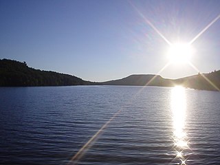
Christine Lake is a 197-acre (0.8 km2) water body located in Coos County in northern New Hampshire, United States, in the town of Stark. The lake lies southeast of the Percy Peaks and north of the Upper Ammonoosuc River. Water from Christine Lake flows via the Upper Ammonoosuc to the Connecticut River at Groveton and thence south to Long Island Sound.
The Bulge is a mountain located in Coos County, New Hampshire. The mountain is part of the Pilot Range of the White Mountains. The Bulge is flanked to the northeast by The Horn, and to the southwest by Mount Cabot.

The Horn is a mountain located in Coos County, New Hampshire. The mountain is part of the Pilot Range of the White Mountains. The Horn is flanked to the southwest by the Bulge.
Mount Weeks, formerly Round Mountain, is a mountain located in Coos County, New Hampshire. Mt. Weeks is the northeasternmost of the Pliny Range of the White Mountains and the highest point within the city limits of Berlin, New Hampshire. Mount Weeks is flanked to the southwest by South Weeks, and faces Terrace Mountain to the northwest across Willard Notch.
South Weeks, or Mount Weeks-South Peak, is a mountain located in Coos County, New Hampshire, within the western part of the city limits of Berlin. The mountain is named for US Senator John W. Weeks (1860–1926) of nearby Lancaster, New Hampshire, the sponsor of the Weeks Act of 1911, under which the White Mountain National Forest was established. South Weeks is part of the Pliny Range of the White Mountains. South Weeks is flanked to the northeast by Mount Weeks, and to the southwest by Mount Waumbek.

Nubble Peak, also known as The Peak Above The Nubble, is a mountain located in Grafton County, New Hampshire. The mountain is part of the Twin Range of the White Mountains. A rock outcrop on its northwestern ridge is known as The Nubble, but topographic maps identify the formation as Haystack Mountain. Nubble Peak is flanked to the south by North Twin Mountain. The mountain is officially trailless and is one of New England's hundred highest summits.

The Dartmouth Range is a mountain range in the White Mountains of New Hampshire in the United States. The range lies in the township of Low and Burbank's Grant and the town of Carroll in Coos County.

