
Chesterfield is a town in Cheshire County, New Hampshire, United States. The population was 3,604 at the 2010 census. It includes the villages of Spofford and West Chesterfield. Chesterfield is home to Spofford Lake, Chesterfield Gorge Natural Area, and parts of Pisgah State Park and Wantastiquet Mountain State Forest.
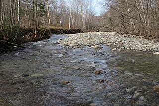
Phillips Brook is a 19.6 mile long (31.6 km) river in northern New Hampshire in the United States. It is a tributary of the Upper Ammonoosuc River and part of the Connecticut River watershed.

Spofford Lake is a 732-acre (2.96 km2) body of water in the town of Chesterfield in southwestern New Hampshire, United States. Water from Spofford Lake flows via Partridge Brook to the Connecticut River. In 2005 the New Hampshire Fish and Game Department named it the cleanest lake in southwestern New Hampshire, despite the amount of motor boating. The village of Spofford is located at the lake's outlet.

The Ham Branch of the Gale River is a 12.2-mile-long (19.6 km) river in northwestern New Hampshire in the United States. Via the Gale River, it is a tributary of the Ammonoosuc River and part of the Connecticut River watershed.
Oliverian Brook is a 13.1-mile-long (21.1 km) river in western New Hampshire in the United States. It is a tributary of the Connecticut River, which flows to Long Island Sound.

Mink Brook is a 9.5-mile-long (15.3 km) stream in western New Hampshire in the United States. It is a tributary of the Connecticut River, which flows to Long Island Sound.

Blow-me-down Brook is a 12.8-mile (20.6 km) long stream located in western New Hampshire in the United States. It is a tributary of the Connecticut River, which flows to Long Island Sound.
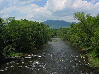
The Sugar River is a 27.0-mile (43.5 km) long river located in western New Hampshire in the United States. It is a tributary of the Connecticut River, which flows to Long Island Sound.

The North Branch of the Sugar River is a 10.1-mile-long (16.3 km) river located in western New Hampshire in the United States. It is a tributary of the Sugar River, which flows to the Connecticut River, which flows to Long Island Sound.
Stocker Brook is a 2.9-mile (4.7 km) long stream located in western New Hampshire in the United States. It is a tributary of the North Branch of the Sugar River, part of the Connecticut River and Long Island Sound drainage basin.
The Cold River is a 22.6-mile-long (36.4 km) river in western New Hampshire in the United States. It is a tributary of the Connecticut River, which flows to Long Island Sound.
Great Brook is a 10.0-mile-long (16.1 km) tributary of the Cold River in western New Hampshire in the United States.

The South Branch of the Ashuelot River is a 17.4-mile (28.0 km) long river located in southwestern New Hampshire in the United States. It is a tributary of the Ashuelot River, itself a tributary of the Connecticut River, which flows to Long Island Sound.

Mirey Brook is a 6.5-mile-long (10.5 km) stream in northern Massachusetts and southwestern New Hampshire in the United States. It is a tributary of the Ashuelot River, itself a tributary of the Connecticut River, which flows to Long Island Sound.

Otter Brook is a 13.2-mile-long (21.2 km) river located in southwestern New Hampshire in the United States. It is a tributary of The Branch of the Ashuelot River, itself a tributary of the Connecticut River, which flows to Long Island Sound.

Tarbell Brook is a 10.1-mile-long (16.3 km) stream located in southwestern New Hampshire and northern Massachusetts in the United States. It is a tributary of the Millers River, itself a tributary of the Connecticut River, which flows to Long Island Sound.

Mount Sunapee is a 5-mile-long (8.0 km) mountain ridge in the towns of Newbury and Goshen in western New Hampshire, United States. Its highest peak, at the north end of the mountain, is 2,726 feet (831 m) above sea level. The mountain has three secondary peaks, White Ledges at 2,716 ft (828 m); North Peak at 2,280 ft (695 m); and South Peak at 2,608 ft (795 m). The north end of the mountain, including the summit, is within Mount Sunapee State Park, which encompasses 3.85 square miles (10.0 km2) and is home to the popular Mount Sunapee Resort. The mountain extends south to Pillsbury State Park in the towns of Goshen and Washington.

The South Branch of the Sugar River is a 6.6-mile-long (10.6 km) river located in western New Hampshire in the United States. It is a tributary of the Sugar River, which flows to the Connecticut River, which flows to Long Island Sound.

Dublin Pond or Dublin Lake is a 236-acre (0.96 km2) water body located in Cheshire County in southwestern New Hampshire, United States, in the town of Dublin. The pond lies at an elevation of 1,480 feet (451 m) above sea level, near the height of land between the Connecticut River/Long Island Sound watershed to the west and the Merrimack River/Gulf of Maine watershed to the east.

