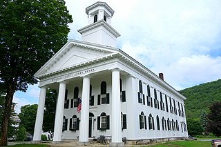
Hartford is a New England town in Windsor County in the U.S. state of Vermont. It is on the New Hampshire border, at the intersection of Interstates 89 and 91. It is the site of the confluence of the White River and the Connecticut River; the Ottauquechee River also flows through the town. The town is composed of five unincorporated villages: Hartford, Quechee, West Hartford, White River Junction and Wilder. The population was 9,952 at the 2010 census.
Deerfield River is a river that runs for 76 miles (122 km) from southern Vermont through northwestern Massachusetts to the Connecticut River. The Deerfield was historically influential in the settlement of western Franklin County, Massachusetts, and its namesake town. The Deerfield River is the Connecticut River's second longest tributary in Massachusetts, 2.1 miles (3.4 km) shorter than the Metropolitan Springfield's Westfield River.

The One Hundred and Two River is a tributary of the Platte River of Missouri that is approximately 80 miles (130 km) long, in northwestern Missouri in the United States, with its source tributaries rising in southwestern Iowa.

The Nishnabotna River is a tributary of the Missouri River in southwestern Iowa, northwestern Missouri and southeastern Nebraska in the United States. It flows for most of its length as two parallel streams in Iowa, the East Nishnabotna River and the West Nishnabotna River. The east and west branches are each about 120 miles (190 km) long; from their confluence the Nishnabotna flows approximately another 16 miles (26 km).

The Rock River is a tributary of the Big Sioux River, about 144 miles (232 km) long, in southwestern Minnesota and northwestern Iowa in the United States. Via the Big Sioux and Missouri rivers, it is part of the watershed of the Mississippi River.
The Little Rock River is a tributary of the Rock River, 74.5 miles (119.9 km) long, in southwestern Minnesota and northwestern Iowa in the United States. Via the Rock, Big Sioux and Missouri rivers, it is part of the watershed of the Mississippi River.
The Plum River is a tributary of the Mississippi River, about 46.6 miles (75.0 km) long, in northwestern Illinois in the United States. It rises in Jo Daviess County and flows generally south-southwestwardly into Carroll County, where it joins the Mississippi at Savanna. Among its several short tributaries are:

The Bark River is a tributary of the Rock River, about 67.5 miles (108.6 km) long, in southeastern Wisconsin in the United States. Via the Rock River, it is part of the watershed of the Mississippi River. According to the Geographic Names Information System, it has also been known historically as the "Peelbark River". The Bark River rises in southern Washington County at Bark Lake In Richfield, WI and flows generally southwestwardly through Waukesha and Jefferson counties, past the communities of Hartland, Delafield and Rome, and through several small lakes. It joins the Rock River in Jefferson County just east of Fort Atkinson. In Jefferson County the Bark River collects the Scuppernong River.
The Scuppernong River is a tributary of the Bark River, 18.9 miles (30.4 km) long, in southeastern Wisconsin in the United States. Via the Bark and Rock rivers, it is part of the watershed of the Mississippi River. It rises in southwestern Waukesha County and flows generally westwardly into Jefferson County, past the village of Palmyra. It joins the Bark River in Jefferson County, 4 miles (6 km) north of Whitewater.

The Big Blue River is an 83.8-mile-long (134.9 km) tributary of the Driftwood River in east-central Indiana in the United States. Via the Driftwood, White, Wabash and Ohio rivers, it is part of the watershed of the Mississippi River.
The Enoree River is a tributary of the Broad River, 85 mi (137 km) long, in northwestern South Carolina in the United States. Via the Broad and Congaree Rivers, it is part of the watershed of the Santee River, which flows to the Atlantic Ocean.
The Rock River is a short tributary of Lake Champlain in northern Vermont in the United States and southern Quebec in Canada. Via Lake Champlain and the Richelieu River, it is part of the watershed of the St. Lawrence River. According to the Geographic Names Information System, it is also known as "River Rocher" and "Riviere de La Roche."

The Ottauquechee River is a 41.4-mile-long (66.6 km) river in eastern Vermont in the United States. It is a tributary of the Connecticut River, which flows to Long Island Sound.
The Ompompanoosuc River is a river, about 25 mi (40 km) long, in eastern Vermont in the United States. It is a tributary of the Connecticut River, which flows to Long Island Sound. According to the Geographic Names Information System, the river has also been known by the names "Om-pom-pa-noos-uc" and "Pompanoosuc."

The Waits River is a 24.5-mile-long (39.4 km) river in eastern Vermont in the United States. It is a tributary of the Connecticut River, which flows to Long Island Sound. According to the Geographic Names Information System, it has also been known historically as "Wait's River" and as "Ma-houn-quam-mas-see."

The Quaboag River is a 25.7-mile-long (41.4 km) river in Massachusetts that heads at Quaboag Pond in Brookfield at an elevation of 594 feet (181 m) above sea level. It flows west to the village of Three Rivers, Massachusetts, at an elevation of 290 feet (88 m).
The White River is a 60.1-mile-long (96.7 km) river in the U.S. state of Vermont. It is a tributary of the Connecticut River.
The Wells River is a tributary of the Connecticut River, approximately 15 miles (24 km) long, in the U.S. state of Vermont.
The Fall River is a 14.1-mile-long (22.7 km) river in southern Vermont and northern Massachusetts, joining the Connecticut River just downstream from Turners Falls, Massachusetts.