Groveton, New Hampshire

Last updated

Groveton, New Hampshire
GrovetonNH.jpg
Covered bridge over the Upper Ammonoosuc River in front of former paper mill in Groveton. The Percy Peaks are in the distance.
USA New Hampshire location map.svg
Red pog.svg
Groveton
Usa edcp location map.svg
Red pog.svg
Groveton
Coordinates: 44°35′56″N71°30′52″W / 44.59889°N 71.51444°W / 44.59889; -71.51444
Country United States
State New Hampshire
County Coos
Town Northumberland
Area
[1]
  Total2.15 sq mi (5.57 km2)
  Land2.06 sq mi (5.33 km2)
  Water0.09 sq mi (0.23 km2)
Elevation
883 ft (269 m)
Population
 (2020)
  Total1,068
  Density518.45/sq mi (200.19/km2)
Time zone UTC-5 (Eastern (EST))
  Summer (DST) UTC-4 (EDT)
ZIP code
03582
Area code 603
FIPS code 33-32260
GNIS feature ID0867268

Groveton is a census-designated place (CDP) and the primary village in the town of Northumberland in Coos County, New Hampshire, United States. The population was 1,068 at the 2020 census. [2] It is located at the intersection of U.S. Route 3 and New Hampshire Route 110.

Contents

History

Fort Wentworth

Fort Wentworth was a colonial fort built in 1755 at the junction of the Upper Ammonoosuc River and Connecticut River, in Northumberland, New Hampshire, just downstream from the present site of Groveton.

Paper mill

Diamond International Papers was originally the hub of Groveton. Diamond International was replaced by James River Paper Company, which was followed by Wausau Paper. In 2008 Wausau ceased production in its Groveton mill, which in turn precluded the trains from stopping in Groveton.

There were plans to turn the mill into a biomass plant, but as of January 2012, plans for buying the mill had fallen through. [3] After an interview with former mill employees, the town of Northumberland decided to demolish the mill for scrap metals. With the price of metals at an all-time high, the town would make more money with the metals than waiting for the mill to sell. Plans for the future site included an LNG plant, which would have brought 80 or so jobs to the North Country. However, the planned development did not materialize.

Hydrogen power plant

Q Hydrogen, [4] in conjunction with state and local political and development officials, is a developer of a hydrogen production system using water.

Electricity production has begun at the site of the old paper mill, which has been scraped clean of most evidence that the 140-acre (57 ha) facility existed there. [5]

Steam locomotive

A coal-powered steam locomotive originally owned by the Odell Manufacturing Company paper mill is publicly displayed as a tourist attraction. Having last seen use in the mid-1960s, it is presently maintained by Wausau Mills and Groveton Paper Board. The community beautification committee "dresses it up" every Christmas and maintains the surrounding area.

Riverside Speedway and Adventure Park

In 1964, Riverside Speedway, a 1/4 mile banked oval track, opened in Groveton. In late 2014 the speedway was purchased and underwent a name change. It was sold again in late 2019 and renamed Riverside Speedway and Adventure Park. In the coming years upgrades are planned for the facility to be a four-season event location, including ATV/UTV and other off-road events as well as snow machine racing. It features weekly racing series and is a popular venue in local auto racing.

The Early Show

Groveton was featured on The Early Show on January 5, 2012. It was a story on the mill and featured Karen Brown of The Early Show and Roger Caron.

Geography

Groveton is located in the northern part of the town of Northumberland in western Coos County at 44°36′3″N71°30′49″W / 44.60083°N 71.51361°W / 44.60083; -71.51361 (44.600868, -71.513525). [6] It lies on the northwestern side of the Upper Ammonoosuc River, approximately one mile east of the river's mouth at the Connecticut River, which forms the New Hampshire/Vermont border.

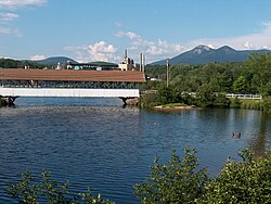
U.S. Route 3 passes through Groveton, leading north 26 miles (42 km) to Colebrook and south 10 miles (16 km) to Lancaster, the Coos County seat. New Hampshire Route 110 branches east from US 3 on the southern edge of Groveton and leads east, then southeast 26 miles (42 km) to Berlin.

According to the United States Census Bureau, the Groveton CDP has a total area of 2.15 square miles (5.57 km2), of which 2.06 square miles (5.33 km2) are land and 0.089 square miles (0.23 km2), or 4.16%, are water. [7]

Demographics

Historical population
CensusPop.Note
1950 1,918
1960 2,0044.5%
1970 1,597−20.3%
1980 1,389−13.0%
1990 1,255−9.6%
2000 1,197−4.6%
2010 1,118−6.6%
2020 1,068−4.5%
U.S. Decennial Census [8]

Groveton is part of the Berlin, NH-VT Micropolitan Statistical Area. As of the 2010 US Census, there were 1,118 people, 491 households, and 300 families residing in the CDP. There were 550 housing units, of which 59, or 10.7%, were vacant. The racial makeup of the CDP was 98.9% white, 0.1% Native American, 0.2% Asian, and 0.8% two or more races. 0.6% of the population were Hispanic or Latino of any race. [9]

Of the 491 households in the CDP, 29.3% had children under the age of 18 living with them, 43.6% were headed by married couples living together, 11.2% had a female householder with no husband present, and 38.9% were non-families. 31.8% of all households were made up of individuals, and 16.5% were someone living alone who was 65 years of age or older. The average household size was 2.28, and the average family size was 2.83. [9]

22.9% of residents in the CDP were under the age of 18, 7.8% were from age 18 to 24, 23.1% were from 25 to 44, 28.2% were from 45 to 64, and 18.4% were 65 years of age or older. The median age was 41.9 years. For every 100 females, there were 93.8 males. For every 100 females age 18 and over, there were 90.3 males. [9]

For the period 2011-15, the estimated median annual income for a household was $36,250, and the median income for a family was $51,563. Male full-time workers had a median income of $36,906 versus $26,083 for females. The per capita income for the CDP was $19,504. 9.3% of the population and 5.2% of families were below the poverty line, along with 12.8% of people under the age of 18 and 6.9% of people 65 or older. [10]

Education

Groveton High School, located on State Street (US 3) at the north end of town, serves Groveton and the towns of Northumberland, Stark, Guildhall and Stratford.

Notable people

Related Research Articles

<span class="mw-page-title-main">Coös County, New Hampshire</span> County in New Hampshire, United States

Coös County or Coos County is a county in the U.S. state of New Hampshire. As of the 2020 census, the population was 31,268, making it the least-populated county in the state. The county seat is Lancaster.

<span class="mw-page-title-main">Berlin, New Hampshire</span> City in New Hampshire, United States

Berlin is a city along the Androscoggin River in Coös County in northern New Hampshire, United States. It is the northernmost city in New Hampshire and the only city in Coös County. The population was 9,425 at the 2020 census, down from 10,051 at the 2010 census.

<span class="mw-page-title-main">Carroll, New Hampshire</span> Town in New Hampshire, United States

Carroll is a town in Coös County, New Hampshire, United States. The population was 820 at the 2020 census. The two largest villages are Twin Mountain and Bretton Woods. Carroll is an important access point for recreational areas in the White Mountains, including many 4,000-footers, the Zealand River area, the Presidential Range, and the Presidential Dry River Wilderness. The town is home to the Mount Washington Hotel at Bretton Woods and to the Highland Center at Crawford Notch, the Appalachian Mountain Club's four-season lodge.

<span class="mw-page-title-main">Dummer, New Hampshire</span> Town in New Hampshire, United States

Dummer is a town in Coös County, New Hampshire, United States. The population was 306 at the 2020 census. It is part of the Berlin, NH–VT micropolitan statistical area. Dummer is home to the Pontook Reservoir, popular with canoeists, kayakers and birdwatchers. In the western part of Dummer lies the village of Paris.

<span class="mw-page-title-main">Northumberland, New Hampshire</span> Town in New Hampshire, United States

Northumberland is a town located in western Coös County, New Hampshire, United States, north of Lancaster. It is part of the Berlin, NH–VT micropolitan statistical area. As of the 2020 census, the town population was 2,126, of whom 1,068 lived in the village of Groveton.

<span class="mw-page-title-main">Stark, New Hampshire</span> Town in New Hampshire, United States

Stark is a town in Coös County, New Hampshire, United States. The population was 478 at the 2020 census, a decline from the figure of 556 tabulated in 2010. It has a famous covered bridge. The town includes the villages of Percy and Crystal as well as the village of Stark, located on the Upper Ammonoosuc River. New Hampshire Route 110 runs through Stark, east from U.S. Highway 3 in Groveton and northwest from Route 16 in Berlin. Much of the town is within the boundaries of the White Mountain National Forest.

<span class="mw-page-title-main">Bath, New Hampshire</span> Town in New Hampshire, United States

Bath is a town in Grafton County, New Hampshire, United States. The population was 1,077 at the 2020 census, unchanged from the 2010 census. Now a tourist destination and commuter town for Littleton, the town is noted for its historic architecture, including the Brick Store and three covered bridges. Bath includes the village of Swiftwater and part of the district known as Mountain Lakes.

<span class="mw-page-title-main">Landaff, New Hampshire</span> Town in New Hampshire, United States

Landaff is a town in Grafton County, New Hampshire, United States. As of the 2020 census, the town population was 446.

<span class="mw-page-title-main">Woodsville, New Hampshire</span> Census-designated place in New Hampshire, United States

Woodsville is a census-designated place (CDP) and the largest village in the town of Haverhill in Grafton County, New Hampshire, United States, along the Connecticut River at the mouth of the Ammonoosuc River. The population was 1,431 at the 2020 census. Although North Haverhill is now the county seat of Grafton County, the village of Woodsville has traditionally been considered the county seat, as the county courthouse was originally located there. The county buildings are now located halfway between Woodsville and the village of North Haverhill to the south.

<span class="mw-page-title-main">Newell, West Virginia</span> Census-designated place in West Virginia, United States

Newell is an unincorporated community and census-designated place in northern Hancock County, West Virginia, United States, along the Ohio River. The population was 1,203 at the 2020 census. It is part of the Weirton–Steubenville metropolitan area and is best known as the home to the Fiesta Tableware Company.

Lancaster is a census-designated place (CDP) and the main village in the town of Lancaster in Coos County, New Hampshire, United States. The population of the CDP was 1,941 at the 2020 census, out of 3,218 in the entire town of Lancaster.

Whitefield is a census-designated place (CDP) and the main village in the town of Whitefield in Coos County, New Hampshire, United States. The population of the CDP was 1,460 at the 2020 census, out of 2,490 people in the entire town of Whitefield.

Lisbon is a census-designated place (CDP) and the main village in the town of Lisbon in Grafton County, New Hampshire, United States. The population of the CDP was 965 at the 2020 census, out of 1,621 in the entire town.

<span class="mw-page-title-main">Lisbon, New Hampshire</span> Town in New Hampshire, United States

Lisbon is a town in Grafton County, New Hampshire, United States. The population was 1,621 at the 2020 census. Lisbon hosts an annual lilac festival on Memorial Day weekend.

Littleton is a census-designated place (CDP) and the main village in the town of Littleton in Grafton County, New Hampshire, United States. The population of the CDP was 4,467 at the 2020 census, out of 6,005 in the entire town.

<span class="mw-page-title-main">Littleton, New Hampshire</span> Town in New Hampshire, United States

Littleton is a town in Grafton County, New Hampshire, United States. The population was 6,005 at the 2020 census. Situated at the northern edge of the White Mountains, Littleton is bounded on the northwest by the Connecticut River.

<span class="mw-page-title-main">Millsfield, New Hampshire</span> Township in Coos County, New Hampshire, United States

Millsfield is a township in Coös County, New Hampshire, United States. It is part of the Berlin, NH-VT Micropolitan Statistical Area. The population was 25 at the 2020 census.

<span class="mw-page-title-main">West Stewartstown, New Hampshire</span> Census-designated place in New Hampshire, United States

West Stewartstown is a census-designated place in the town of Stewartstown in Coös County, New Hampshire, United States. It had a population of 263 at the 2020 census, down from 386 at the 2010 census.

<span class="mw-page-title-main">Colebrook (CDP), New Hampshire</span> Census-designated place in New Hampshire, United States

Colebrook is a census-designated place (CDP) and the main village in the town of Colebrook, Coös County, New Hampshire, United States. The population of the CDP was 1,201 at the 2020 census, out of 2,084 in the entire town. The CDP population had dropped from 1,394 at the 2010 census.

Mountain Lakes is a census-designated place (CDP) in the towns of Haverhill and Bath in Grafton County, New Hampshire, United States. It had a population of 504 at the 2020 census.

References

  1. "ArcGIS REST Services Directory". United States Census Bureau. Retrieved September 20, 2022.
  2. "Groveton CDP, New Hampshire: 2020 DEC Redistricting Data (PL 94-171)". U.S. Census Bureau. Retrieved November 18, 2021.
  3. Chris Jensen (January 17, 2012). "As Purchase Falls Through, Groveton Paper Plant Eyed for Demolition". New Hampshire Public Radio. Retrieved April 3, 2012.
  4. Q Hydrogen (n.d.). "Q Hydrogen's About page". Q Hydrogen. Retrieved February 23, 2021.
  5. David Brooks (January 3, 2020). "North Country plant says it can create hydrogen with a new technology". Concord Monitor. Retrieved February 23, 2021.
  6. "US Gazetteer files: 2010, 2000, and 1990". United States Census Bureau. February 12, 2011. Retrieved April 23, 2011.
  7. "2021 U.S. Gazetteer Files – New Hampshire". United States Census Bureau. Retrieved November 18, 2021.
  8. "Decennial Census Official Publications". Census.gov. Retrieved March 4, 2024.
  9. 1 2 3 "Profile of General Population and Housing Characteristics: 2010 Census Summary File 1 (DP-1): Groveton CDP, New Hampshire". American Factfinder. U.S. Census Bureau. Archived from the original on February 13, 2020. Retrieved October 13, 2017.
  10. "Selected Economic Characteristics: 2011-2015 American Community Survey 5-Year Estimates (DP03): Groveton CDP, New Hampshire". American Factfinder. U.S. Census Bureau. Archived from the original on February 13, 2020. Retrieved October 13, 2017.
  11. CUMMINGS, Fred Nelson, (1864 - 1952)