Rockingham, Vermont

Last updated

Rockingham, Vermont
Pleasant Valley Grange, Rockingham, Vermont.jpg
Pleasant Valley Grange Hall, next to the Rockingham Meeting House
Rockingham vt highlight.png
Rockingham, Vermont
Usa edcp location map.svg
Red pog.svg
Rockingham, Vermont
Location in the United States
Coordinates: 43°9′57″N72°28′54″W / 43.16583°N 72.48167°W / 43.16583; -72.48167
Country United States
State Vermont
County Windham
Chartered1752
Area
  Total42.3 sq mi (109.6 km2)
  Land41.9 sq mi (108.5 km2)
  Water0.4 sq mi (1.1 km2)
Elevation
1,037 ft (316 m)
Population
 (2020)
  Total4,832
  Density123.1/sq mi (48.7/km2)
Time zone UTC-5 (Eastern (EST))
  Summer (DST) UTC-4 (EDT)
ZIP code
05101
Area code 802
FIPS code 50-60250 [1]
GNIS feature ID1462189 [2]

Rockingham is a town along the Connecticut River in Windham County, Vermont, United States. As of the 2020 census, the population was 4,832. Rockingham includes the incorporated villages of Bellows Falls and Saxtons River, as well as a large rural area west of Interstate 91.

Contents

Rockingham has no formal town center; instead, town offices and the Rockingham Public Library are located in the village of Bellows Falls. The approximate center is the Rockingham Meeting House, passed by Route 103, a popular east–west route across the state. The Meeting House was built in Rockingham Village, once the main settlement in the town, but with the increased use of water power for manufacturing, population shifted to other villages located on the two rivers in the town. Most of what was left of Rockingham Village (over a dozen buildings, also called the Old Town) burned in a fire on April 14, 1908; the fire came close to the Meeting House but it was saved. [3] The houses, hotel, and store that burned were not rebuilt. [4]

History

Street scene, Rockingham Village, c. 1910 Street Scene, Rockingham, VT.jpg
Street scene, Rockingham Village, c.1910
Bellows Falls Village, Rockingham, 1915 Rockingham, Vermont (1915).jpg
Bellows Falls Village, Rockingham, 1915

One of the New Hampshire grants, it was chartered by Governor Benning Wentworth on December 28, 1752 and named for Lord Rockingham. The township was granted to Samuel Johnson and 72 others. When the Town was first settled in 1753 by pioneers, its rivers were sites of fishing for salmon and shad, [5] as they had been for the original indigenous inhabitants. By 1771, the population reached 225. In 1785, Colonel Enoch Hale erected the first bridge over the Connecticut River, and until 1796, it remained the only bridge across. [5] The village of Bellows Falls became an important mill town, which reduced the runs of palatable fish.
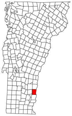
Geography

According to the United States Census Bureau, the town has a total area of 42.3 square miles (109.6 km2), of which 41.9 square miles (108.5 km2) is land and 0.4 square mile (1.1 km2) (0.97%) is water. It is drained by the Williams and the Saxtons rivers, and several brooks that flow directly into the Connecticut River; the latter river forms the eastern boundary of Rockingham.

The highest point in town is Berry Hill at 478 m/1568 ft elevation, near the northwestern corner of the town. [6] The lowest point is on the Connecticut River at the southern boundary of town, at 73 m/240 ft elevation. [7]

The town is crossed by Interstate 91, U.S. Route 5, Vermont Route 103 and Vermont Route 121. The Bellows Falls train station was once served by three rail lines, and today it has Amtrak service on the Vermonter route, with two trains a day, one heading south to Washington, DC and one heading north to St. Albans, VT.

Demographics

The rural community, based on farming, had its peak of population in 1920.

Historical population
CensusPop.Note
1790 1,235
1800 1,68436.4%
1810 1,95416.0%
1820 2,15510.3%
1830 2,2725.4%
1840 2,3302.6%
1850 2,83721.8%
1860 2,9042.4%
1870 2,854−1.7%
1880 3,79733.0%
1890 4,57920.6%
1900 5,80926.9%
1910 6,2076.9%
1920 6,2310.4%
1930 5,302−14.9%
1940 5,7378.2%
1950 5,499−4.1%
1960 5,7043.7%
1970 5,501−3.6%
1980 5,5380.7%
1990 5,484−1.0%
2000 5,309−3.2%
2010 5,282−0.5%
2020 4,832−8.5%
U.S. Decennial Census [8]

As of the census [1] of 2000, there were 5,309 people, 2,202 households, and 1,387 families residing in the town. The population density was 126.7 people per square mile (48.9/km2). There were 2,425 housing units at an average density of 57.9 per square mile (22.3/km2). The racial makeup of the town was 97.38% White, 0.34% African American, 0.09% Native American, 0.55% Asian, 0.06% Pacific Islander, 0.26% from other races, and 1.32% from two or more races. Hispanic or Latino of any race were 1.15% of the population.

There were 2,202 households, out of which 31.1% had children under the age of 18 living with them, 47.2% were couples living together and joined in either marriage or civil union, 12.0% had a female householder with no husband present, and 37.0% were non-families. 30.1% of all households were made up of individuals, and 13.4% had someone living alone who was 65 years of age or older. The average household size was 2.39 and the average family size was 2.96.

In the town, the population was spread out, with 25.1% under the age of 18, 6.8% from 18 to 24, 27.1% from 25 to 44, 25.5% from 45 to 64, and 15.4% who were 65 years of age or older. The median age was 39 years. For every 100 females, there were 93.8 males. For every 100 females age 18 and over, there were 88.6 males.

The median income for a household in the town was $33,423, and the median income for a family was $45,503. Males had a median income of $29,200 versus $22,944 for females. The per capita income for the town was $19,051. About 4.8% of families and 10.0% of the population were below the poverty line, including 13.5% of those under age 18 and 9.6% of those age 65 or over.

Listed on National Register of Historic Places

Rockingham Meeting House Rockingham Meeting House, Rockingham, VT.jpg
Rockingham Meeting House

Locations

The following smaller unincorporated villages are within the town of Rockingham, in addition to its two larger, incorporated villages (Bellows Falls and Saxtons River): [10] [11]

Notable people

Related Research Articles

<span class="mw-page-title-main">Bellows Falls, Vermont</span> Village in Vermont, United States

Bellows Falls is an incorporated village located in the town of Rockingham in Windham County, Vermont, United States. The population was 2,747 at the 2020 census. Bellows Falls is home to the Green Mountain Railroad, a heritage railroad; the annual Roots on the River Festival; and the No Film Film Festival.

<span class="mw-page-title-main">Saxtons River, Vermont</span> Village in Vermont, United States

Saxtons River is an incorporated village in the town of Rockingham in Windham County, Vermont, United States. The population was 479 at the 2020 census. For over a hundred years, Saxtons River has been the home of Vermont Academy, an independent secondary school. Most of the village is a historic district listed on the National Register of Historic Places in 1986 as Saxtons River Village Historic District.

<span class="mw-page-title-main">Saxtons River</span> River in the U.S. state of Vermont

The Saxtons River is a 22.9-mile-long (36.9 km) river in the U.S. state of Vermont, a tributary of the Connecticut River. Its watershed covers 78 square miles (200 km2) and a range in altitude of 1,800 feet (550 m); land use is about 80% forested and 3% agricultural, and the upper river supports wild brook trout and brown trout, while Atlantic salmon occur but are usually limited to the area below Twin Falls on the lower river.

<span class="mw-page-title-main">Vermont Academy</span> Private boarding and day school in Saxtons River, Vermont, United States

Vermont Academy (VA) is a private, co-educational, college preparatory, boarding and day school in Saxtons River, Vermont, serving students from ninth through twelfth grade, as well as postgraduates. Founded in 1876, the campus was listed on the National Register of Historic Places as the Vermont Academy Campus Historic District in 2015.

<span class="mw-page-title-main">Vermont Route 103</span> State highway in southern Vermont, US

Vermont Route 103 is a 42.036-mile-long (67.650 km) north–south state highway in southern Vermont, United States. It runs from U.S. Route 5 in Rockingham in the east to US 7 in Clarendon near Rutland in the west. The Vermont Country Store's second branch is one attraction along the route, as well as the Okemo Ski Resort in Ludlow.

<span class="mw-page-title-main">Bartonsville Covered Bridge</span> United States historic place

The Bartonsville Covered Bridge is a wooden covered bridge in the village of Bartonsville, in Rockingham, Vermont, United States. The bridge is a lattice truss style with a 151-foot span, carrying Lower Bartonsville Road over the Williams River. It was built in 2012, replacing a similar bridge built in 1870 by Sanford Granger. The 1870 bridge, which was listed on the National Register of Historic Places, was destroyed in 2011 in flooding caused by Hurricane Irene.

<span class="mw-page-title-main">Worrall Covered Bridge</span> United States historic place

The Worrall Covered Bridge, also known as the Woralls Bridge or Worral Bridge is a wooden covered bridge carrying Williams Road across the Williams River in Rockingham, Vermont, United States. Built about 1870, it is the only surviving 19th-century covered bridge in the town, after the Hall Covered Bridge collapsed in 1980 and was replaced in 1982, and the Bartonsville Covered Bridge was washed away by Hurricane Irene in 2011 and replaced in 2012-2013. The bridge was listed on the National Register of Historic Places in 1973. The bridge was damaged by the flooding on July 10, 2023, and its fate has not yet been decided.

<span class="mw-page-title-main">Bellows Falls station</span> Railroad station in Bellows Falls, Vermont, US

Bellows Falls station is an Amtrak intercity rail station located in the Bellows Falls village of Rockingham, Vermont, United States. The station is served by the single daily round trip of the Washington, D.C.–St. Albans Vermonter. It has a single side platform adjacent to the single track of the New England Central Railroad mainline.

<span class="mw-page-title-main">Williams River (Vermont)</span>

The Williams River is a 27.0-mile (43.5 km) river in the US state of Vermont. It is a tributary of the Connecticut River. Its watershed covers 117 square miles; land use is about 80% forested and 4% agricultural, and the upper river supports wild brook trout and brown trout.

<span class="mw-page-title-main">Rockingham Meeting House</span> Historic church in Vermont, United States

The Rockingham Meeting House, also known as Old North Meeting House and First Church in Rockingham, is a historic civic and religious building on Meeting House Road in Rockingham, Vermont, United States. The Meeting House was built between 1787 and 1801 and was originally used for both Congregational church meetings as well as civic and governmental meetings. Church services ceased in 1839 but town meetings continued to be held in it until 1869. It was restored in 1906 and has been preserved.

<span class="mw-page-title-main">U.S. Route 5 in Vermont</span> Segment of American highway

U.S. Route 5 (US 5) is a part of the United States Numbered Highway System that runs from New Haven, Connecticut, to the Canada–United States border at Derby Line, Vermont. In Vermont, the road runs south–north from the Massachusetts state line near Guilford to the international border. The 192.317 miles (309.504 km) that lie in Vermont are maintained by the Vermont Agency of Transportation (VTrans) and run largely parallel to Interstate 91 (I-91). US 5 also follows the path of the Connecticut River from the Massachusetts border to St. Johnsbury, where the river turns northeast while US 5 continues north. The highway serves the major towns of Brattleboro, Hartford, and St. Johnsbury, along with the city of Newport near the Canadian border.

<span class="mw-page-title-main">Arch Bridge (Bellows Falls)</span> Bridge in Vermont to North Walpole, New Hampshire

The Bellows Falls Arch Bridge was a three-hinged steel through arch bridge over the Connecticut River between Bellows Falls, Vermont and North Walpole, New Hampshire. It was structurally significant as the longest arch bridge in the United States when it was completed in 1905.

<span class="mw-page-title-main">Vermont Route 121</span> State highway in Windham County, Vermont, US

Vermont Route 121 (VT 121) is a state highway in the U.S. state of Vermont. The highway runs 21.439 miles (34.503 km) from VT 11 in Londonderry east to U.S. Route 5 in the incorporated village of Bellows Falls in the town of Rockingham. VT 121 follows the Saxtons River in northern Windham County. The highway has a pair of gravel sections in the towns of Windham and Grafton.

<span class="mw-page-title-main">Bellows Falls Neighborhood Historic District</span> Historic district in Vermont, United States

The Bellows Falls Neighborhood Historic District encompasses a residential area of the village of Bellows Falls, Vermont. Located south of downtown Bellows Falls, the area has one of the largest concentrations of well-preserved 19th century residences in southern Vermont. It was listed on the National Register of Historic Places in 2002, and enlarged in 2007.

<span class="mw-page-title-main">Hall Covered Bridge</span> United States historic place

The Hall Covered Bridge, located in southern Rockingham, Vermont, carries Hall Bridge Road across the Saxtons River, just north of its junction with Vermont Route 121. It is a Town lattice truss bridge, built in 1982 as a replica of a circa-1867 bridge that was destroyed by an overweight truck in 1980. The bridge was listed on the National Register of Historic Places in 1973.

<span class="mw-page-title-main">Rockingham Village Historic District</span> Historic district in Vermont, United States

The Rockingham Village Historic District encompasses the traditional village center of the town of Rockingham, Vermont. Settled in the 18th century, the district, located mainly on Meeting House Road off Vermont Route 103, includes a variety of 18th and 19th-century houses, and has been little altered since a fire in 1908. It notably includes the 18th-century National Historic Landmark Rockingham Meeting House. The district was listed on the National Register of Historic Places in 2008.

<span class="mw-page-title-main">Bellows Falls Canal</span> Canal in Bellows Falls, Vermont, U.S.

Bellows Falls Canal is a canal constructed to allow boat traffic to bypass Great Falls on the Connecticut River in Bellows Falls, Vermont. It was constructed by the Bellows Falls Canal Company and was one of the first canals in the United States. It was used for transport, to power mills, and later for hydroelectric power. The Bellows Falls Downtown Historic District includes the canal.

<span class="mw-page-title-main">Rockingham Free Public Library</span> Professional association for librarians in STATE

Rockingham Free Public Library is one of four Carnegie Libraries in the state of Vermont. The building, in Bellows Falls, Vermont, a village of Rockingham, Vermont, was designed by Boston architects McLean & Wright in Classical Revival style. The Carnegie grant was offered in 1905. The town took a while to decide on allocating matching funds. The library officially opened on November 23, 1909. A children's annex was added to the building in 1929. In 2003 a new entryway and elevator were added for improved accessibility.

<span class="mw-page-title-main">Great Falls (Connecticut River)</span>

Great Falls is a waterfall along the Connecticut River between Walpole, New Hampshire, and Bellows Falls, Vermont. It has also been called Bellows Falls, and its Abenaki name is Kitchee Pontegu, which means "great falls". Great Falls became its official name, based on local usage, in 2016. It drops 52 feet (16 m), and the village of Bellows Falls was established next to it, to take advantage of its water power. Previously, the main settlement in town, Rockingham Village, was on a high point of land overlooking the Williams River, with no potential for water power.

References

  1. 1 2 "U.S. Census website". United States Census Bureau . Retrieved January 31, 2008.
  2. "US Board on Geographic Names". United States Geological Survey. October 25, 2007. Retrieved January 31, 2008.
  3. Brattleboro Reformer, April 17, 1908, page 2, Image 2. https://chroniclingamerica.loc.gov/lccn/sn97067589/1908-04-17/ed-1/seq-2/
  4. Incorrect year listed for the fire (1909). Lovell, F.S, and L.C. Lovell. 1958. History of the Town of Rockingham, Vermont, including the villages of Bellows Falls, Saxtons River, Rockingham, Cambridgeport, and Bartonsville, 1907-1957, with family genealogies. Published by the town, Bellows Falls, VT.
  5. 1 2 A. J. Coolidge & J. B. Mansfield, A History and Description of New England; Boston, Massachusetts 1859
  6. "Geographic Names Information System".
  7. "Connecticut River topographic map, elevation, relief".
  8. "U.S. Decennial Census". United States Census Bureau. Retrieved May 16, 2015.
  9. Description of Parker Hill from National Register Nomination Information
  10. https://play.google.com/books/reader?id=ULmlDG8KLjYC&pg=GBS.PA4&printsec=frontcover Hayes History of the Town of Rockingham, Vermont
  11. http://www.windhamregional.org/images/maps/roadname/Rockingham_roadmap_town_2017.pdf Town road map with villages labeled
  12. Portrait and Biographical Album of Barry and Eaton Counties, Mich. Chicago, IL: Chapman Bros. 1891. p. 113 via Google Books.
  13. Child, Hamilton (1886). Gazetteer of Grafton County, N. H. 1709-1886. Syracuse, NY: Syracuse Journal Company. p. 100 via Google Books.
  14. "Biographical Statement, Jonathan Blanchard (1811-1892)". Archives of Wheaton College. Wheaton, IL: Wheaton College. Retrieved August 28, 2022.
  15. Vermont Bureau of Publicity (1913). Vermont, the Land of Green Mountains. Montpelier, VT: Vermont Secretary of State. p. 177 via Google Books.
  16. "The Late Hugh H. Henry". Burlington Free Press . Burlington, VT. December 21, 1869. p. 3 via Newspapers.com.
  17. Hiram Carleton, Genealogical and Family History of the State of Vermont, Volume 1, 1903, page 286
  18. Lyman Simpson Hayes, History of the Town of Rockingham, Vermont, 1907, page 691
  19. The National Cyclopaedia of American Biography. Vol. I. James T. White & Company. 1893. p. 271. Retrieved April 12, 2021 via Google Books.
  20. Young, Joseph (1878). History of the Organization of the Seventies. Salt Lake City, UT: Deseret News. p. 8 via Google Books.
  21. History of the Church of Jesus Christ of Latter-Day Saints. Vol. II. Salt Lake City, UT: Deseret News. 1904. p. 298 via Google Books.
  22. "Biography, Henry Franklin Severens". FJC.gov. Washington, DC: Federal Judicial Center. Retrieved August 28, 2022.

Further reading